by Victor A. Walsh
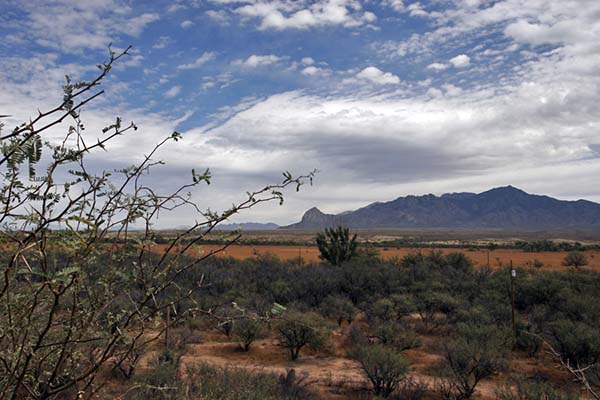
The eight-mile dirt road zigzags through the parched hills like the river of no return. The grasses and thistles, now a golden brown, sparkle in the November sunlight. Not a blade of grass moves in the stillness. Hills and gullies stretch out in all directions like a wrinkled, windblown sheet.
At the parking lot we meet an older maintenance worker with National Parks. His deeply furrowed face is as rough as the terrain. He tells us that the Fort Bowie National Historic Site is about a mile-and-a-half down the trail. I ask him about the jutting mountain peaks on the horizon in front of us. “Those are the Chiricahua Mountains,” he says. “Geronimo use to talk to his gods up there.”
 The trail winds through meadows dotted with mesquite and rimmed by hills. The foot-high grasses, bent and curled by gusting winds, have turned a rich golden yellow. It is warm, quiet — an inviting place of solitude.
But 155 years ago, the last Indian war in the United States erupted here between the native Chiricahua Apache and the U.S. military. The incident that ignited the bloodshed was the kidnapping of a local rancher’s son. Settlers falsely accused Cochise, the chief of the local Chiricahua, of taking the boy. When he was not returned, a brash young officer, Lieutenant George N. Bascom, detained and executed several of Cochise’s relatives. Cochise, in turn, executed his American and Mexican hostages, and a tenuous peace was broken forever.
Markers along the way identify the remnants of a Butterfield Stage station attacked by Cochise’s warriors, the restored post cemetery, a reconstructed Apache wickiup, and the Chiricahua Apache Indian Agency adobe ruin.
A weathered picket fence encloses the cemetery. Long, narrow shadows from the rows of white headstones slice through the sunlit gold-brown grass. In 1895, the army removed the remains of all military personnel for re-internment at the San Francisco National Cemetery. Twenty-three gravesites remain — nearly all civilians employed at the fort.
I stare at the names on the headstones: John Finkle Stone, age 24; John Slater, age 35; John McWilliams, age 26. Below each name are the words, “Killed by Apaches.” They died young, too young, as did Geronimo’s two-year old captured son, Little Robe, buried here after dying in 1885 from dysentery.
 Facing the sun, I look at the brown hills dotted with mesquite and scrub oak. Behind them, invisible in the glaring light, are the Chiricahua Mountains, the spiritual homeland of a people banished by conquest. Today they are part of Chiricahua National Monument.
Beyond the cemetery, the trail follows a dried river gulch shaded by thickets and saplings. Here, tucked below the pass is what drew the Apaches, Spaniards, and Americans: a year-round spring. Today its water is but a trickle, played out by history.
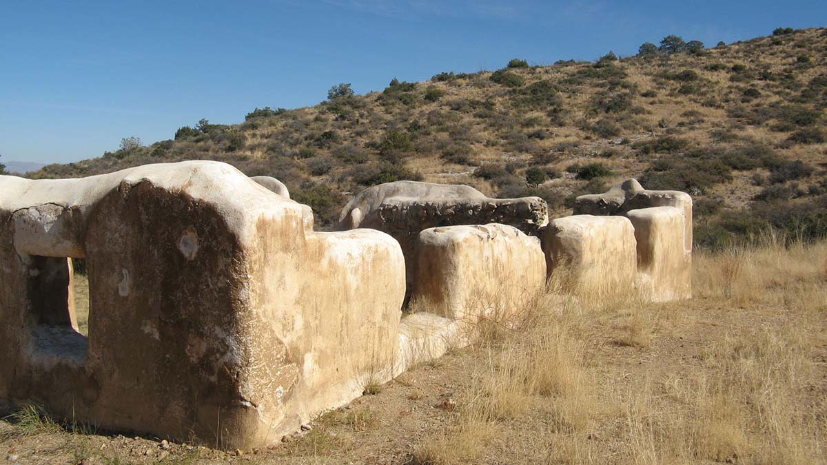
Climbing up an incline, I see a line of crumbling mottled-brown adobe walls in the glinting sunlight sprawled across Apache Pass. An unfurled American flag hangs limply from its post on the parade ground.
 I walk among the ruins — the massive cavalry barracks, the stables, and ordinance building — trying to imagine a world gone: barking dogs, a wagon lumbering up the old stage route; soldiers with their mounts and carbines. The officer’s quarters, a two-story, Victorian-style frame building with a shingled mansard roof, once stood on the far side of the parade ground. Now nothing remains but a marker stranded amidst clumps of dry grass.
I wonder what the men and their families thought or how they coped with the physical isolation of this remote place, and the lurking presence of a determined enemy defending their homeland.
Rebuilt and enlarged in the late 1860s to protect the spring and overland route, Fort Bowie never had walls, but it played a vital role as the base of operations in the last Apache war against the shaman and war chief Geronimo.
After his surrender, Geronimo and thirty-six of his followers were brought to the parade ground and loaded into wagons on September 8, 1886, destined for military prison in Florida. The entire tribe, including those who never resisted, suffered a similar fate until 1913 when 265 survivors — many born in captivity — were at last released from Fort Sill, Oklahoma.
With Geronimo’s final surrender, the fort’s raison d’être ended. In 1894, it was closed, and the small garrison reassigned to a new post in Colorado. The abandoned post quickly fell into disrepair as locals carried off timbers, windows and doors. In 1911, the Chiricahua lands west of the fort, once protected as a military reservation were auctioned off.
In the fleeting light, the adobe walls and stone ruins stand like sentinels to a time when the Chiricahua Apache waged the last major Indian resistance against the United States. They had lost their families, homes, horses, guns, and freedom—everything but their honor.
If You Go:
Getting There:
The Fort Bowie, which became a National Historic Site in 1964, is located 13 miles south of Bowie on Apache Pass Road off I-10 and 20 miles southeast of Willcox off 186. From Tucson it is 166 miles via I-10.
Attractions:
The rural community of Willcox, founded in 1880 as a camp for Southern Pacific Railroad construction crews, has a colorful history that its citizens are striving to preserve. Many of the late 19th-century commercial buildings are still intact, including the restored railroad depot, a National Historic Landmark.
The forest of spires, balanced rocks and pinnacles in nearby Chiricahua National Monument is well worth a visit. To the Chiricahua the mountains were known as the Land of Standing-Up Rocks. The monument’s 12,000 acres encompass two deserts and two mountain ranges, and is home to a wide range of plants and animals.
Accommodations:
Hotels, inns and B&Bs are available at Bowie, 14 miles north of the ruin on I-10 and Willcox, 27 miles west along AZ-186. Bonita Canyon Campground at Chiricahua National Monument is open year-round. Sites are available by online reservations. RV hookups and camp sites are available nearby at Alaskan and Mountain View RV Parks on I-10.
For More Information:
Fort Bowie National Historic Site, 3203 South Old Fort Bowie Rd, (520) 847-2506. There is a visitor center and rear access road for disabled visitors.
Fort Bowie, Arizona, Combat Post of the Southwest 1858-1894 by Douglas C. McChristian, University of Oklahoma Press.
About the author:
Victor A. Walsh’s passion is the trans-Missouri West with a focus on early explorations and their continuing impact on our world today. His historical and travel essays have appeared in American History, True West, Literary Traveler, California History, Journal of the West, Rosebud, Desert Leaf, among other publications.
Photos by Richard Miller and Victor A. Walsh


Leave a Reply
You must be logged in to post a comment.