Travel Thru History

Historical and cultural travel experiences

  • Home
  • Airfare Deals
  • Get Travel Insurance
  • Writers Guidelines

Escape to Nature’s Luxury: The Unforgettable All-Fun Inclusive Experience at Hotel Xcaret México

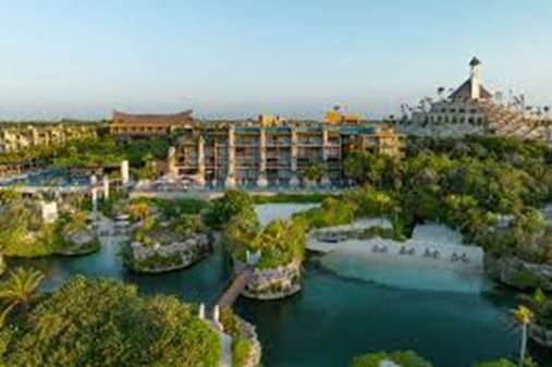
If you’re searching for a vacation that perfectly blends luxury, adventure, and cultural immersion, Hotel Xcaret México is your perfect destination. Nestled in the heart of the Riviera Maya, this eco-luxury resort redefines what an all-inclusive experience can be. From its natural rivers and lush jungle setting to its world-class amenities and unlimited access to adventure parks, every moment at Hotel Xcaret México feels extraordinary.

Start planning your dream getaway today and book your stay at Hotel Xcaret México to experience the world’s first All-Fun Inclusive® concept — where luxury meets nature and every adventure is included.

A New Kind of All-Inclusive

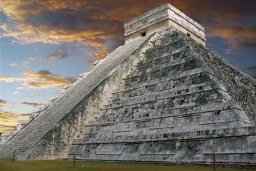
Hotel Xcaret México takes the idea of “all-inclusive” to the next level with its groundbreaking All-Fun Inclusive® program. Unlike traditional resorts, this concept includes unlimited access to all Grupo Xcaret parks and tours — Xcaret, Xel-Há, Xplor, Xplor Fuego, Xavage, Xoximilco, Xenotes, and Xenses.

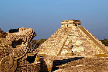
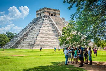
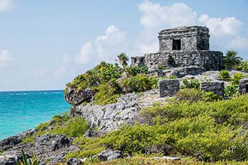
Guests can dive into crystal-clear cenotes, explore ancient caves, zipline over tropical canopies, or float down lazy rivers — all as part of their stay. It’s a seamless way to experience the best of Mexico’s natural beauty and cultural heritage without worrying about extra costs. Whether you’re seeking adventure or relaxation, Hotel Xcaret México ensures every day brings something new and unforgettable.

Harmony Between Nature and Comfort

What makes Hotel Xcaret México truly unique is its eco-integrated design. The resort’s architecture blends effortlessly with the surrounding landscape, preserving the region’s natural rivers, caves, and forests. Paths wind through the jungle and along turquoise waterways, giving guests a sense of discovery at every turn.

The commitment to sustainability runs deep — renewable energy sources, eco-friendly construction, and community support are central to the resort’s philosophy. Staying here means indulging in comfort while contributing to the protection of Mexico’s environment and culture.

Elegant Accommodations and Culinary Excellence

Each suite at Hotel Xcaret México is a sanctuary of style and serenity. With views of the Caribbean Sea, rivers, or gardens, every room connects guests to the surrounding nature. Expect locally inspired décor, luxurious bedding, and open terraces complete with hammocks and soaking tubs.

The resort’s twelve dining venues deliver an unmatched culinary journey. From authentic Mexican dishes crafted by celebrated chefs to international gourmet fare, every meal is a celebration of flavor and artistry. Whether you’re enjoying fresh seafood by the ocean or tasting regional specialties in a fine-dining setting, the resort promises a world-class gastronomic experience.

A Sanctuary for Wellness and Culture

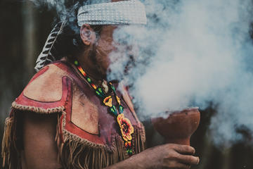
At the Muluk Spa, guests can rejuvenate body and soul with treatments inspired by ancient Mayan rituals. Built within natural rock formations, the spa’s tranquil ambiance and holistic therapies make it a must-visit during your stay.

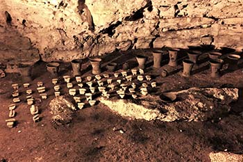
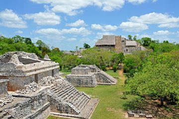
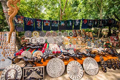
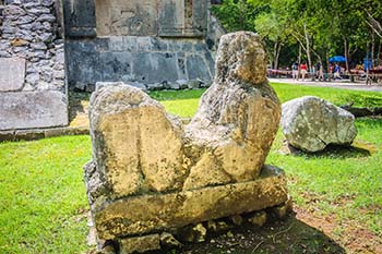
Hotel Xcaret México also celebrates Mexico’s rich cultural traditions through its art, music, and design. Murals, sculptures, and performances scattered throughout the resort connect guests to the country’s heritage, ensuring that every experience feels both luxurious and deeply meaningful.

Adventure Meets Tranquility

Whether you crave adventure or calm, Hotel Xcaret México delivers both in perfect balance. Spend your morning kayaking along serene lagoons, your afternoon relaxing by an infinity pool, and your evening savoring fine cuisine under the stars. Families, couples, and solo travelers alike will find endless ways to unwind, explore, and reconnect.


Your Riviera Maya Escape Awaits

Hotel Xcaret México isn’t just a place to stay — it’s a destination that transforms how you experience travel. With its fusion of sustainability, culture, and indulgence, it reimagines what a luxury vacation should be.


Don’t wait to experience it for yourself. Book your stay at Hotel Xcaret México today and unlock an all-encompassing experience of nature, culture, and luxury in the heart of Mexico’s Riviera Maya.


Tagged With: mexico travel Filed Under: North America Travel

Woven Treasures of Oaxaca Mexico

oaxaca woman weaving

by Deborah Dickerson

She holds up small pieces of bark paper painted with blue-green birds and yellow flowers. “Would you like to buy?” She asks me in broken Spanish. She looks to be not more than 10 or 11. Her eyes are kind and shy. We trade pesos for paintings; then, like an apparition, she is gone.

I sat on the church steps in the middle of the zocalo, looking at my bark paintings, thinking Oaxaca had not changed much from my last visit when I bought a pretty blouse embroidered with red flowers.

Dyed woolThat blouse sparked my passion for Mexican textile art and brought me back here 40 years later

This is the land of the Zapotec, one of 16 indigenous groups inhabiting Oaxaca state. Zapotec translates to “the cloud people.” Living in the mountains of south-central Mexico since pre-Columbian times, their traditions run deep. Their ancestors were warriors, builders, and artists. They are weavers, embroiderers, potters, and woodworkers. Their decor and clothing weave rich stories of the people who create them. It tells their place in their world, their identity, their pride.

Exploring the many shops, markets, and museums in Oaxaca City, Mexico brings to life a heritage of exquisitely crafted tapestries and clothing.

In the nearby villages of Tlacolula, Teotitlan del Valle, and Mitla, the making of traditional weavings and embroideries lives on, where you can enjoy, learn about, and purchase, some of the finest woven symbols of community and living culture.

Oaxaca City – Where everything old is new again

A main thoroughfare in the historic center, Macedonio Alcala, is pedestrian-only, making it easy to crisscross back and forth, browsing the shops, restaurants, and galleries.

Colonial buildings painted in peach, cobalt, and saffron hold windows covered in ornate wrought iron. Baskets of red geranium cascade down the walls.

Massive hard-wood doors are open, inviting you to stop for a visit or a taste. The sweet aroma of cafés and coffee houses waft in and out. Sample a smoky mezcal or a blue corn tostada called a Tlayuda, a Oaxacan specialty.

Inside one of these massive doors is Arte Textil Indigena. Stacks of huipiles (blouses), ponchos, shawls, and skirts, woven on backstrap looms or embroidered with images of crabs, birds, and stars fill the not-for-profit shop. Woven brocade tapestries line the walls. The knowledgeable clerks will tell you where each piece was made, by what process, and sometimes, even the name of the artist.

At the Oaxaca Textile Museum, an artist from an outlying village demonstrates her family’s craft of weaving on a backstrap loom. The beautifully restored eighteenth-century mansion houses current works as well as curated historical exhibits featuring fabric arts from Mexico and around the world, a glimpse of what you may see on your travels outside the city.

Tlacolula Market – Centuries of socializing

Nobel Laureate poet Pablo Neruda once said, “I went from market to market for years, because Mexico is in its markets.”

If the marketplace is the heart of Mexico, the Sunday market in Tlacolula is the heart of Oaxaca.

colorful dressesA sea of green, blue, and orange tarps constructs the open-air stalls – a tapestry in motion. A vendor hawks a taste of orange mamey fruit. The smell of barbeque floats by on the warm breeze past a mile-high stack of fresh tortillas waiting for the tangy pork, grilled onion, and stringy Oaxacan cheese.

Much like 200 years ago, the market is still the weekly gathering place for villagers from around the region to socialize, gossip, and trade goods. Subtle differences in blouses, aprons, and headscarves define the villagers. The intricately machine embroidered, and beribboned aprons worn by Zapotecan women occupy an entire row of vendor stalls.

Teotitlan del Valle -Textiles, tapestries, and tales of a thousand years

Known as the village of 5,000 weavers – Teotitlan del Valle (tayo teet lan del vy a) has been weaving since pre-Columbian times. Their woven cotton fabric was so fine the Aztec rulers required tithes of the cloth.

The Dominicans introduced sheep to the region and brought the first wood pedal loom in the 1500s. The villagers began weaving the stunning wool carpets the village is famous for today.

Past the large shops with the tour buses, is La Cupula Bed and Breakfast.

masterful weaving7th generation master weaver Demetrio Bautista Lazo and his wife, Maribel, are the consummate hosts. Demetrio is world-renowned not only for his weavings, but for his old school, yet innovative dying techniques. Wearing his infectious grin, he shares grinding the cobalt, boiling the yarn in the mixture, and hanging it to dry in the sunshine where it turns a luxurious deep blue. The weaving on his loom is a masterpiece in blue and cream

The many workshops throughout the village welcome visitors and are happy to share their processes and offer their weavings for sale.

Mitla – Legends of blood sacrifice

The intricate mosaic fretwork on the walls of the archeological site at Mitla may be the inspiration for the geometrics woven into carpets and embroidered on cloth. Every stone was meticulously carved and put in place without mortar. A testament to the artistry.)

Once the most important Zapotec religious center in Oaxaca, some say it was a cult center dominated by high priests and was the entrance to the underworld. If you’re not claustrophobic and not superstitious, you can climb down into one of the two underground tombs.

The villagers here weave fine cotton cloth for household goods like bedspreads, tablecloths, and shawls.

Santa Maria del Tule – A small village with a very large tree

On your way back to Oaxaca, stop in Santa Maria del Tule, not for textile art, but for the tree. And for a pistachio nieve (snow) – traditional Oaxacan ice cream.

The large cypress is between 2,000 and 3,000 years old and has a circumference of over 160 feet at its base, dwarfing the nearby church. Imagine, this tree was a sapling when the ancient civilizations of Monte Alban and Mitla were in their heyday.

For the traveler in search of culture and history, journey beyond the mega-resorts and the margaritas to the hazy mountains and brilliant blue skies of the Tlacolula valley of Oaxaca, where every piece of cloth tells a story.

If You Go:

Things to do in Oxaca


Oaxaca Day Trip: San Bartolo Coyotepec, Santo Tomás Jalieza and Ocotlán de Morelos

About the author:

Deb Dickerson is a freelance travel writer who calls the Pacific Northwest home, although you’ll likely find her in a warmer climate when the weather turns gray and cold. Always looking for an adventure and a different outlook, cultural travel is her thing. When going local, she tries to stay off the interstate and enjoys cruising the Scenic Byways and Highways, especially the Oregon Coast. Member of the ITWPA and AWAI, Deb is also a copywriter for the travel and hospitality world. Her work has been published in International Living, Short Weeks Long Weekends, Travel Post Monthly, and various local papers. You can find her here: www.debdickerson.com

Photo credit:

AlejandroLinaresGarcia by Creative Commons Attribution-Share Alike 4.0 International, 3.0 Unported, 2.5 Generic, 2.0 Generic and 1.0 Generic license.

Tagged With: mexico travel, Oaxaca tours, oaxaca weaving Filed Under: North America Travel

Balankanchè, Altar of the Tiger Priest in Yucatan, Mexico

Chichen Itza pyramid

by George Fery

Caves are central to world cultures, used by humans from the dawn of time. They are associated with powerful natural forces believed to be the dwelling places of benevolent and malevolent deities, protectors and disruptors of communities, families and individuals’ lives.

The Balankanchè cave is located 2.5mi/3.9Km southwest of Chichén Itzà’s archaeological site, near the town of Pistè. Its proximity to this major pre-Columbian site underlines the fact that Balankanchè was an integral part of Chichén Itzà for religious rituals and ceremonies.

The cave was called the “Throne of the Tiger Priest” by E. Willis Andrews, in his 1970 archaeological field report. Among known caves in the Maya lowlands, Balankanchè has received less attention than it deserves. Its significance can fully be understood in contrast to the monumental secular site above ground. The interaction between the surface elements and those of the cave, give us an unusual light on the life of the ancient metropolis.

The Itzaes were Maya-Chontales or Putunes that controlled the trade routes around the Yucatán peninsula. They occupied the island of Cozumel and from there, crossed over to the peninsula reaching Chichén Itzá in 918AD. A second group of migrant-soldiers, mixed with nahualtl speaking Toltecs, reached Chichén around 987AD, introducing the cult to Quetzalcoatl from Tula (Hidalgo). They established a military dynasty that ruled the northern peninsula (Thompson (1954, 1966, 1970), R. Piña Chán (1980). The record is in agreement with the book Chilam Balam of Chumayel that refers to two groups of invaders as the “little descent” (918AD) and the “big descent” (987AD).


A recently discovered a cenote (sink hole) 15ft/4.6m below the base of Kukulcán pyramid (aka El Castillo), called the Balamkú cave, will shed new light on beliefs and rituals of the Toltec period. The shrine, like Balankanchè, was dedicated to the Toltec religious figure Quetzalcoatl, the Mayas called Kukulcán.

The Toltec invaders, from the central plateau of Mexico and their history at Chichèn, spans from the Late to the Terminal Classic (987-1250AD). Its large Sacred Cenote, aka Well of Sacrifice, located at the end of the 600ft /180m sacbe or “white road”, the link to the Kukulcán pyramid, was believed to be the main gateway to the underworld and Cha’ak’s home from pre-Toltec times. This cenote was strictly dedicated to religious rituals and ceremonies involving human sacrifice, as remains found testify. The Xtoloc (iguana) in the city, among other cenotes in the vicinity, supplied water to the community. Of note however, is that all cenotes were at times used for religious rituals.

Balankanchè’s importance was first noted in 1958 by Josè Humberto Gómez who had explored the cave over ten years. He eventually discovered what seemed to be a false section of one of the walls. On examination, he realized it was made of crude masonry sealed with mortar covering a small access chamber. Previous archaeological expeditions had come within feet of the wall, probably sealed during the later part of Toltec occupation, not realizing what lay beyond.

Entering the chambers in 1959, researchers found a large number of ceremonial ceramics, beyond two crude stone walls 98.5ft/30m and 361ft/110m respectively from the entrance, and carved limestone effigy censers, as well as mini-metates (grinding stones) set into cavities in the cave’s complex stalagmitic formation, as well as simply laid on the floor. They were among many similar artifacts found in the cave.

Archaeologists believe that Balankanchè’s “first tenant” was probably Cha’ak, a Maya agrarian deity with mythological attributes akin to Tlaloc, the Lord of the Third Sun in Toltec mythology, whose roots go back to Teotihuacàn and, farther in time, to Olmec cosmology.

 The Toltec invasion from central Mexico (987AD), explains the presence of Tlaloc ceramics and Xipe Totec, the enigmatic life-death-rebirth deity carved limestone censers, the only artifacts found in the cave. The total eradication of Cha’ak representations, underline the proscription of the old god by the new one. The Toltec invaders settled in power centers and towns, while traditional Maya-Yucatec’s Cha’ak and deities remained unchanged in the countryside. Balankanchè “second tenant” would be Tlaloc, the Toltec goggle-eye deity of rain, storm, lightning and thunder. The deity that came from Tula on the central plateau of Mexico, is associated with caves, cenotes, springs and mountain tops—all believed to be guardians and holders of rain and maize, in past and present Mesoamerican mythologies.

Balankanche mapTlaloc and Xipe Totec censers found in the cave are made of ceramic and limestone respectively. They represent deities that reached the Yucatán peninsula with the Toltec invaders. While relatively little is known about pre-Toltec deities and fertility gods of the Yucatán, the record indicate that the cave may have been the focus of a folk cult (Edward B. Kurjack, 2006 – personal communication).

Balankanchè’s surface mounds and other structural remains are seen scattered on the site above ground. The cave entrance, in the center of the complex, was surrounded by a 115 ft/35mt circular tulum or defensive wall, 12ft/4m wide at the base and raised 4ft/1.3m above the rock base. It was surmounted by a 6ft/2m enclosure made of perishable material that is now lost to time. The reason for such a strong defensive wall is not known and may pre-date Toltec’s arrival.

The entrance today is located at the center of the circular walled area. It may not have been the location of the original entrance, nor the only access. From ground level, steps take the modern visitor down to a depth of 30ft/9m, then the corridor branches off.

Balankanche entranceThe accessible part of the cave is made up of more than a mile of passageways that vary considerably in shape and size, from broad and flat (as much as 30ft/9m wide and 15ft/5m high), to narrow crawling spaces. Other passageways are no longer passable. The cave is divided into six groups, one of them, now closed may have been the other ancient access to the cave.

The corridors and steps for visitors are well built, lit, maintained, and easily walkable, but there are limitations to admission to the cave. For lack of limited ventilation in the corridors, senior persons, health conditions (pulmonary and coronary in particular), or physical impediment may be prohibited entrance. Sections of the main corridors cannot be visited; some reach the water table at 70ft/22m beneath the surface in at least four places. Water depth vary with seasonal rains and entrance to the cave is sometimes suspended after sudden downpours. There is another corridor under the main one, half submerged and very difficult of access, but for professional cave archaeologists.

balankanche main chamberThe cave’s main chamber is Group.I, a huge and impressive circular room with thousands of stalactites covering the ceiling. The floor, naturally raised as a mound, holds massive twin limestone columns made of both stalactites and stalagmites linked at the center, in the shape of a massive tree trunk.

The cave is a strikingly beautiful work of nature; the high place of a culture that consigned its myths and beliefs in its gods and deities to the mineral world. The central column is a reminder of the trunk of the Ceiba, the mythological Wakah Chan, the “Tree of Life” whose branches reach to the heavens, while its roots are sunk deep into the underworld. The veneration of the “Altar of the Tiger Priest”, can only be understood in the context of the vision of a dual perception of life.

This impressive sanctuary created by nature but conceived by man as an altar for the gods was walled toward the end of the Terminal Classic phase (850-1000AD) The ceramics on the “altar” are representatives of two non-Maya deities from the central plateau of Mexico. Twentynine large Tlaloc-effigy biconical censers and Xipe Totec carved limestone censers were found on the mound of the altar, together with mini-metates (stone grinders) and manos, miniature ceramic plates, bowls and other offerings, dated from the Florescent (625-800AD) to the Modified Florescent (800-950AD) phases. Female Maya deities, Chak’Chel and Ix’Chel, patrons of childbirth, sexuality and fertility, are present in the cave.

Altar of Pristine WatersGroup.II,, is referred to as the “Altar of the Pristine Waters” and, to this day, holds a special place in Maya rituals; it is called the “store room” by archaeologists. At the foot of the limestone columns were placed ceramic urns, set there to collect virgin water or zuhuy’ha in Yucatec. Water drips from the stalactites above and is believed to be the most sacred water in Maya rituals, since it is collected from stalactites, the “nipples of the earth”. It is sanctified because it never touches the ground and, being transferred directly from Nature (the rock) to Culture (the manmade urns), acquire the highest ritual value, and is still practiced in today’s rituals.

The importance of the rain god Cha’ak, and its multiple representations in Mesoamerican cosmology, essentially revolve around a simple word: water. The peninsula lies nineteen degrees north of the equator. Its geographical location and Maya lands further south enjoy only two seasons: dry and wet. If the rains do not come on time, crops are short or fail entirely. Famine may then endure with its retinue of malevolent deities and social disruptions together with hunger, and the fear of tomorrow.

On the underground lakeshore is Group.IIIa with a peculiar arrangement of small ceramic censers, plates and small spindle whorls, as well as stone mini metates, and manos; the largest number of offerings in Group.III. How and why they were displayed is not known, nor the reason for the assemblage and their respective numbers. Their small sizes are particular to Tlaloc offerings; their purpose, point to their use by small children. Of note is the fact that their display today was set by archaeologists, since we do not know of their disposition in ancient times.

Balankanche offeringsEthnographic accounts throughout Mesoamerica document miniature objects as offerings, often associated with rain-making rituals. Young children, particularly girls were favored by Tlaloc, god of rain and thunder. The presence of spindle whorls underlines the symbolic significance of weaving that has been documented to be associated with females and Chak’Chel (great or red rainbow), the aged goddess of curing and childbirth in Classic times. She is also known as Ix Chel (lady rainbow), from her shrines on the islands of Isla Mujeres and Cozumel. To the Maya, rainbows came from the underworld and were dreaded omens of illness and death (Sharer & Traxler, 1994 :735).

Group.IIIb is referred to as the “Waterway” now mostly flooded, because it is located close to the top of the water table. The underground lake extends about 115ft/35m from the shore, then dips below the ceiling of the cave and turns northeast for another 330ft/100m, before rising again above the water table reaching Group.IV, not accessible today. Investigators found ceramics and stone censers in the water and on limestone outcrops. At the end of the elongated lake, is a chamber that seems to be the limit of human penetration in this direction. The average depth is 5ft/1.5mt, with about half that depth in mud (Andrews, 1970:12-13).

On the muddy floor of the waterway were scattered offerings, such as Tlaloc effigy censers, studded censers and a variety of pottery offerings, with a distribution densest near the shore. According to Andrews (1970), at least four passages lead to underground water pools, the main reasons for the cave’s long period of use for this area, where the water table lay 65-76ft/20-23m below the surface.

Long before Tlaloc, the sacred cave was used for the same purposes by its predecessor, the Maya Cha’ak. The cave was “returned” to the Maya deity during a complex and elaborate ritual ceremony, the “Reverent Message to the Lords” that started on the early hours of October 13, 1959, and lasted 3 days and nights. But not before Maya h’men or shamans from the vicinity, through ancient rituals and offerings pacified the deities in the cave, the Yum Balames, to safely allow non-Maya to enter the hallowed precinct (Andrews, 1970:72).

Caves were believed to be the birthplace where humans were born and set forth on earth at the beginning of time, and where they would return at the end of their days. Ancestors dwelling in caves are trusted to interact with the World Above. No less than the sacred earth, caves are believed to be the meeting grounds between humans and the divine.


Private Tour: Chichen Itza Aboard Deluxe Van with Lunch

References:

Balankanche, throne of the tiger priest – E. Willys
Andrews.IV – MARI-Middle American Research Institute at Tulane University, New Orleans, LA, 1970
The Ancient Maya – Sharer & Traxler, Standford U. Press, Stanford, CA, 1994:735.
Chichén Itzá – Román Piña Chan, Fondo de Cultura Econòmica, Mexico,1980
Maya History and Religion – J. Eric Thompson, University of Oklahoma Press, 1970


Private Tour: Chichen Itza, Ek Balam Cenote, and Tequila Factory

About the author:

Freelance writer-photographer, George’s mayaworldimages.com focus on the photography of pre-Columbian archaeological sites in Mexico and the Americas. The other site georgefery.com is concerned with history and travel stories that address a number of topics, from history to day living in various countries and cultures, food, architecture and people.

Long-Form articles in georgefery.com are dedicated to ongoing research papers on Maya and other cultures of the Americas. Fellow member of the Institute of Maya Studies, Miami, FL instituteofmayastudies.org and The Royal Geographical Society, London, U.K. rgs.org . Also a member in good standing with the Maya Exploration Center, Austin, TX mayaexploration.org . the Dallas Museum of Art, Dallas, TX dma.org , and the Archaeological Institute of America, Boston, MA archaeological.org Contact: George Fery – 5200 Keller Springs Road, Apt. 1511, Dallas, Texas 75248 – T. (786) 501 9692 – gfery.43@gmail.com and hello@georgefery.com

All photos by George Fery


Private Tour Chichen Itza, Cenote and Unique Mayan Ritual in Temazcal

Tagged With: Balankanche cave, chichen itza tours, mexico travel, yucatan attractions Filed Under: North America Travel

Palenque and the World of the Maya

Palenque Temple of the Count

by George Fery

Hidden in the verdant hills of the Sierra Chapaneca in the beautiful State of Chiapas, southern Mexico, is the ancient capital of the B’aakal kingdom. The name of the city then was Lakam-ha’ in Maya-Yucatec language. The town is today called by its Spanish name, Palenque.

Remains of impressive Maya temple-pyramids and palaces abound all over Mesoamerica. Many archaeological sites overwhelm the visitor by their monumental architecture. Few are as remarkable as Palenque for its fine palaces, temples and architecture. The layout of this UNESCO World Heritage Site, and its location within a jungle clad mountain range, is replete with springs, streams and falls, overlooking the plains of Tabasco.

The 1998-2000 PMP-Palenque Mapping Project under Mexican INAH-Instituto de Antropologia e Historia management, and FAMSI-Foundation for the Advancement of Mesoamerican Studies (famsi.org), led by Dr. Edwin L. Barnhart, recorded and mapped 1481 structures at Palenque. The PMP covered 0.850Mi2/2.2Km2 of the city jungle shrouded plateau. The area referred to as “Central Palenque” open to visitors, account for less than a hundred buildings and structures. All others are still covered under a dense tropical rain forest. At its height during the Classic, the urban population may have reached 7500-8000 souls.

Central PalenqueEarly morning, when nature awakes and the mist from the jungle slowly lifts, the welcoming calls of howler monkey greet visitors, together with shrieking tropical birds. Palenque’s ancient name probably came from the cluster of small rivers, that come out from the upper slopes of the mountain that overlook the site. The ancient name Lakam-ha’ translate as “Big Waters” for its numerous falls through ravines and over great natural stair-steps. The Yemal K’uk’ Lakam Wiz or “Great Mountain of the Descending Quetzal”, stands over the great city of Classic times (250-950).

A Great Maya Lord

Shrouded in the mist of time one wonders, who lived here? At its height from the end of the 5th to mid-9th century, it was an important metropolis, and a major player in political and trade in the region. Its greatest achievement however, was in architecture and the arts. The 7th century saw the birth and death of one of the greatest Mid-Classic Lord in Maya history, K’inich’ Janahab’ Pakal.II (603-683).

By all accounts Pakal was the greatest Lord of the B’aakal kingdom, as it was then called. His title, like lords before and after him, K’uhul B’aakal Ajaw translate as “Sacred Lord of the B’aakal Kingdom”; it underlines the commanding secular and religious functions of Maya lords. His 68 years reign (615-683), was one of the longest in Maya history. Pakal inherited the kingdom at the young age of 12 but was sacred Lord at 23. During the interregnum, his mother Sak K’uk’ Ajaw governed as regent, not as a Lord of the realm.

Pakal’s wife, Ix Tzak B’u Ajaw was from Ux Te Kuh’, the northwest city where his family took refuge, when Palenque was burned by the Kan Kingdom proxies, twice, in 519 and 611. She is buried next to her husband mausoleum, The Temple of the Inscriptions. Her resting place is Temple XIII, referred to as the Temple of the Red Queen, for the large amount of hematite, a red pigment iron oxide, found in her sarcophagus.

Temple of the SkullTemple.XIII and Temple.XII, known by its enigmatic name, Temple of the Skull, are adjacent to each other on an east-west line. They are separated by Temple.XIIA not yet fully excavated. The Temple of the Skull is named after the skull shown at the base of its west pier. It is the skull of a rabbit, whose shape is seen on the full moon. The rabbit representation on the moon is common in the New World and Asia. The skull on Temple.XII is that of Goddess.O, the Aged Goddess of the Falling Moon, to whom the temple was probably dedicated.

The PalaceThe Palace, open to visitors, is built on a massive irregular quadrangle; it was a ceremonial and administrative building. Large stairways on three sides allowed access to the vaulted halls that ringed the quadrangle. The south side stairway was ceremonial, while the north side was utilitarian. The complex is made of a complicated system of vaulted buildings, lengthy halls and three courtyards.

The PMP project discovered a palace complex west of central Palenque, that is still under the jungle canopy, and is significantly larger than the Palace. Of note are the names assigned to buildings by archaeologists, that do not always reflect their true function at the time; “temple” and “palace” on the record are but terms of convenience.

In the middle of the Palace complex, the Tower’s third floor holds an altar built of limestone mixed with a large quantity of seashells from the Pacific. The altar may have been dedicated to ceremonies linked to the legendary Primordial Seas. The belief may have been supported by numerous marine fossils found in the limestone of the mountain range.

The Tower at PalenqueOn the Palace east side runs the Otolum River, its banks walled up as a canal, a key part of the important and elaborate, water management system of the city. Bathrooms were found below the plaza level. The Palace was mainly used for administrative and ceremonial purposes, for the ruler, members of the nobility with bureaucratic functions, scribes, high priests and formal state receptions of ambassadors or important visitors.

People did not reside in the Palace; the tropical humidity and thick stone walls were not conducive to ventilation. They lived outside in fine traditional wattle and daub structures set on stones with a short vertical wall. Thanks to their semi-open construction, it allowed for ventilation to pass through, a plus for comfort in a tropical environment, especially in rainy season. The residential area was located close by, east of the Palace, beyond the Otolum river canal.

The Rise and Fall of History

The history of the city is tumultuous with frequent wars, as well as great and not so great Lords at its head. At the death of her father, Ix Yohl Ik’nal Ajaw (reigned 583-604), was the only woman elevated to K’uhul B’aakal Ajaw or Sacred Lord of the B’aakal kingdom. Her reign was plagued by hostility from within and without. Regional antagonism was fueled by two enemies for different but complementary reasons. The first was Tortuguero, a city located in the northern plains of Tabasco. Leaders of that city claimed the title of K’uhul B’aakal Ajaw that Palenque rightly demanded as its historical right. A deep-seated enmity endured that fed their antagonism for years.

The second is that of Calakmul, the powerful K’an kingdom to the northeast in Yucatan that fueled both cities’ antagonism for its own benefit: control of trade routes and that of the Usumacinta river, a major waterway. Its other proxy Tonina was only 41Mi/80Km distant from Palenque, in today’s Ocosingo valley. This enmity will remain a thorn in Palenque’s side through murderous wars, up to its collapse in 850-900.

There may have been another reason for this lasting enmity with the powerful K’an kingdom. Palenque traded and probably had political contacts, with the powerful metropolis of central Mexico, Teotihuacan. Calakmul then may have perceived Palenque as a Mexican proxy in the Maya heartland, which would explain such a long-lasting and violent antagonism.

Faces of defeatIn 659 Pakal got his revenge against the K’an kingdom, as shown in the West Court of the Palace. The carved limestone slabs show six sahals (state officials) of Santa Elena and Pomona, other proxies of the Great Jaguar militaristic totem, Calakmul. They are shown bound and ready for execution, facing the carved steps across the courtyard that recount Palenque’s defeats and burning in 599 and 611.

The antagonism with Tonina in particular, will last to the end of Palenque’s dynasties. K’inich K’an Joy Chitam, Pakal 66 years old second son was captured in battle in 711 and held prisoner for seven years. Unlikely, he was freed by Tonina, but the reason for his release and the terms attached to his freedom, are unknown. After his release, he remained Lord of Palenque for another ten years, before his death.

Palenke Temple of InscriptionsThe Temple of the Inscriptions, is Pakal’s last resting place; truly the most important and renowned sanctuary ever built in the Americas. Its name comes from the three large hieroglyphic panels found on the walls of the sanctuary, in the temple. In the past, it was known as the “Temple of the Laws” because of the glyphs covered limestone panels. They narrate Pakal’s achievements and his place in the context of eternity. The temple-pyramid also had an exceptional “roof crest”, now lost to time. The building, like all major buildings in the city, was covered with stucco and painted red, from its base to the roof. For visitors it must have been an impressive sight to behold.

The eight-steps funerary pyramid, the B’olon Eht Naah as it was called then, was planned by Pakal. Its foundations were built and the sarcophagus and its slab set, about five years before Pakal’s death (683). It was completed by his elder son and heir K’inich K’an Bahlam’ (635-702). The temple at the top of the pyramid complete the mythological nine levels of Xibalba, the underworld.

Crypt of PakalThe grandeur of the crypt, 82 feet down in the pyramid, with its 20 tons massive sarcophagus and 5 tons slab, both with remarkable engravings, are truly unique. The crypt is located a mere six feet below the level of the main plaza. They were built and set before the pyramid was erected. On the sarcophagus’ four sides are engraved Pakal ancestors sprouting from fruiting trees, acknowledgement to ancestor worship. The renowned finely carved sarcophagus’ slab relates Pakal mythical journey after death through the underworld, and his rebirth as Hunal Ye’ the maize god.

Nine life size stucco figures are on the walls surrounding the sarcophagus; eight men and one woman, Lady Ol Nal. They are assumed to have been Pakal’s guardians, warding off malevolent forces when his body was carried down the steps of the pyramid. The “Nine Lords of the Night” are now standing guard for eternity.

Five persons, the so called “companions”, were sacrificed to attend and serve the Lord in the afterlife, a customary practice of ancient cultures for significant ranking individuals. They were identified as two males and a female in their late teens or early twenties (the two others could not be sexed, due to the remains deterioration). They were buried in a shallow stone cavity behind the now open massive triangular door, that sealed the entrance to the crypt in 690.

Cross group complexThe Cross Group complex, is at the heart of the ancient city, and its temple-pyramids: the Temple of the Cross, Temple of the Foliated Cross and Temple of the Sun are accessible, but one cannot get into their sanctuaries. The view of central Palenque from atop the Temple of the Cross is spectacular. They are collectively referred to as Palenque’s Divine Triad; and represent the tri-partite conception of the world space and royal power.

Each temple is the home of a god named by Henrich Berlin in 1963 as God.I, God.II and God.III. They were born in Matwill, the Maya mythical world a few days apart; Berlin assumed that they may have been triplets. In each temple is a large finely carved limestone panel, that relate the story of Pakal’s eldest son and heir, K’inich’ K’an Bahlam’ accession to the throne in 684. He is shown with his father, in the act transferring lordship powers to himself, together with dedications to the gods of the Divine Triad.

At the entrance of the Cross Group complex, but not a part of it, one may climb up the steps to Temple.XIV to see its remarkable limestone carved panel on the back wall of the sanctuary. K’inich’ K’an Bahlam’ is shown receiving the K’awiil’ scepter of lordship from his mother Lady Tz’ak-b’u Ajaw, dressed in the garments of the Moon Goddess.

Standing by itself a few steps away from the North Group and the Ball Court, the Temple of the Count (pictured at top) is named for an exceptional character, the French archeologist Jean-Frédérick de Waldeck. For two years in 1872, while researching and writing about Palenque, he camped in the temple on top of the pyramid. He recorded important carvings on stone and stucco now eroded or mostly unreadable. His drawings of carved panels and their interpretations may be questionable, but he did record the ancient art of the city that may otherwise have been lost forever.

Palenke North GroupThe North Group, so called because it is located north of the Palace, is of interest for Palenque’s interaction with Teotihuacan. Evidence found at the base of Temple.V of a stucco frieze in the sub-structure shows the figure of a man whose dress and adornment leave no doubt as to an Early Period contact with the great metropolis of central Mexico. The goggled eye warrior, armed with a spear thrower or atlatl in his left hand, is clearly Mexican and relates to Tlaloc, Aztec god of rain, thunder and war.

The numerous streams and falls that cascade from the Great Mountain of the Descending Quetzal, create numerous quiet pools. The widest are the ones near the bottom of the mountain; they are referred as the Queen’s Baths.

The tropical environment provided an abundance of water and forest products, from fruit trees to soft and hard wood. Wildlife, from jaguar, wild turkeys, and forest deer to scarlet macaws, was a bounty. This exceptionally luxurious environment enhances the elegance of the multiple falls and pools, a beautiful experience at the end of a day’s visit of this great Maya metropolis.

 If You Go:

How to Get There – Recommended

Direct flights Mexico City Palenque are available. Air service also available to Villahermosa, 83miles/134Kms northeast of Palenque.
Bus service are available between cities and their airports.
On GPS it is: 17d 29’ 52”N, 92d 03’ 02”W.
For those driving, from Villahermosa or Ciudad del Carmen, use Highway MX186 to the small town of Catazaja, then to a turnoff on Highway MX199 to Palenque (toll road); transit time may be 2.5 hours.


Palenque Mayan Ruins, Misol-Ha and Agua Azul Waterfalls Full Day Tour from Palenque

Excellent international class hotels are available downtown, as well as on the road to the archaeological zone, together with fine restaurants, serving both international foods and Mexican recipes from Chiapas.
The archaeological site is 4miles/8Kms from downtown Palenque.
The site opens from 8am to 4:30pm; the entrance fee is currently $4.50/65Pesos; parking is $1.75/35Pesos.
At the entrance to the site are guides, available for a fee, speaking English and other language. There are also small stalls selling bottled water and snacks.

Recommended: hat, sunscreen, bug spray, comfortable walking shoes, bottled water, pocket poncho, Imodium.
Where access on structures is permitted, it is strongly recommended to use great caution while climbing up and, especially, going down the stairs.
For safety and conservation purposes, access to the following structures is either limited or prohibited:  Temple of the Inscriptions, the Tower in the Palace, Temple of the Count, and the North Group. In the Cross Group complex, where one can climb the stairs to the temples, but access into the sanctuaries is prohibited; as are areas under archaeological investigation or maintenance.


Palenque Archaelogical Site, Agua Azul and Misolha Waterfalls Combo Tour

Recommended: not to leave the site without a visit to the museum and its remarkable collection of artifacts, especially the ceramic censers. It is located at the bottom of the hill before the entrance. Follow the trail and steps down to the Queen’s Baths area. At the bottom turn right at the main road, the museum will be a couple of hundred feet at left.

Details on the history, art and architecture of Palenque, are available in “Long-Form Articles” at georgefery.com.

Notes

Mesoamerica is a geographical and cultural area that extends from southern Mexico to Belize, Guatemala, Honduras, El Salvador, Nicaragua and northern Costa Rica.
Years in text above are AD/CE.
Recommended reading: Palenque: Eternal City of the Maya by David and George Stuart.About the author:

Freelance writer, researcher, and photographer, Georges Fery (georgefery.com) addresses topics, from history, culture, and beliefs to daily living of ancient and today’s indigenous communities of the Americas. His articles are published online in the U.S. at travelthruhistory.com, popular-archaeology.com, and ancient-origins.net, as well as in the quarterly magazine Ancient American (ancientamerican.com). In the U.K. his articles are found in mexicolore.co.uk.

The author is a fellow of the Institute of Maya Studies instituteofmayastudies.org  Miami, FL, and The Royal Geographical Society, London, U.K. rgs.org. As well as a member in good standing of the   Maya Exploration Center, Austin, TX mayaexploration.org, the Archaeological Institute of America, Boston, MA archaeological.org, NFAA-Non Fiction Authors Association nonfictionauthrosassociation.com, and the National Museum of the American Indian, Washington, DC. americanindian.si.edu.

Photographs:

All photos are ©georgefery.com

  1. Temple of the Count
  2. Central Palenque
  3. Temple of the Skull
  4. The Palace
  5. The Tower
  6. Faces of Defeat
  7. Temple of the Inscriptions
  8. The Crypt
  9. Temple of the Cross
  10. The North Group

Tagged With: maya pyramids, mexico travel, palenque ruins, yucatan travel Filed Under: North America Travel

Three Ways to Visit the Maya Ruins

welcome to Chichen Itza sign

by Jett & Kathryn Britnell

Riviera Maya, Mexico

Riviera Maya is a fanciful 20th century tourist slogan given to a rather scenic stretch of Caribbean coastline on Mexico’s northeastern Yucatán Peninsula. Famous for its beautiful sun-drenched beaches and all-inclusive resorts and hotels, Riviera Maya’s tourism district lies approximately 17-kilometres (10-miles) south of Cancun, Mexico beginning at the quiet fishing village of Puerto Morelos and stretching south to Playa del Carmen, Puerto Aventuras and Akumal before coming to an end at the Maya town of Felipe Carrillo Puerto. Two thousand years ago, long before they were conquered by Spanish Conquistadors in the 16th century, the Yucatán Peninsula was the ancestral home of the indigenous Maya civilization.

Pyramids, Plazas and Temples

Mexico souvenirsWhile many people flock to Riviera Maya solely to drink cold Coronas while sun worshipping on white sand beaches splashed by a crystal-clear turquoise ocean, there are many who choose to ruin their Mexican vacation by stepping back in history by visiting some ancient archeological masterpieces. Today, the Maya’s past is revealed in the impressive crumbling ruins of their elaborate pyramids, plazas and temples which are scattered throughout the Yucatán Peninsula. Many archeological structures still remain undiscovered as they are hidden from view by thick vegetation and cloaked by dense jungle. While there are a seemingly endless number of ancient sites to explore, Chichén Itzá, Tulum and Cobá are three of the Riviera Maya’s finest and most diverse collection of archaeological sites that are easy to visit, and yet, they still possess some unique mysteries to entice modern day explorers.

“Nosotros los Maya”

They called themselves “Nosotros los Maya,” a Spanish phrase which means “We the Maya.” The Maya civilization developed one of the most advanced civilizations in the Americas. Despite worshiping many different Gods related to nature, the Maya are known to have practiced human sacrifice. With their knowledge in astronomy and mathematics, the Maya developed an accurate calendar system. OK, so let’s acknowledge that cataclysmic “the world is going to end” prophecy that was supposed to happen when the Maya calendar ended in 2012. Well, it didn’t happen because the Maya calendar did not end on Dec. 21, 2012, and there never were any Mayan prophecies foretelling the end of days on this date. This date simply signified the end of the Mayan long-count period. Just as a modern calendar begins again on January 1st, so too does the Mayan calendar begin a new long-count period. But, I digress.

Maya also invented the mathematical concept of zero and developed a complex system of hieroglyphic writing. Of course, they also constructed lavishly large cities with pyramids, temples, palaces, ball courts, and grand plazas. Which begs the question, why did this seemingly advanced culture for its time disappear? Scholars have put forward numerous theories, one being the Maya were wiped out by a severe drought and the other being deforestation negatively impacted the environment making their advanced farming techniques and way of life unsustainable. To this day, nobody knows for sure what caused their demise.

Chichén Itzá: “Mouth of the Well of The Itzá”

Chhichen Itza pyramidSpanish Conquistadors discovered Chichén Itzá in the early 1500’s, but by then the city had long been abandoned and all the Spanish conquerors found were crumbling buildings overgrown by dense jungle. Strategically located in the heart of the northern Yucatán peninsula roughly half-way between Merida and Cancun, Chichén Itzá is one of Mexico’s most visited tourist destinations with more than two million visitors annually. A ceremonial and sacred center for the ancient Maya civilization, Chichén Itzá, which translates as “Mouth of the Well of the Itzá”, was so named for the large cenote and fresh water source by the first settlers of the city. Tracing its roots to the fifth century AD, Chichén Itzá’s massive archaeological site was declared a UNESCO World Heritage Site in 1988 and its iconic Temple of Kukulkan (locals generally use the pyramid’s Spanish name, El Castillo) was designated one of the New Seven Wonders of the World in 2006.

El Castillo (the Castle) is a 23-metre (75- feet) high multi-tiered pyramid and is the most iconic monument in the city. Back when I made my first visit here in 1987, you could carefully climb to the top of the pyramid. Unfortunately, climbing is no longer allowed due to some tourists who defaced the interior of the six-metre-tall throne room on top of the pyramid. This monument is an astrological wonder with 91 steps per side and the final 365th step on top representing the solar year. Each of the pyramid’s corners faces one of the cardinal directions so that people could use the edifice to navigate. Some people specifically plan to make a visit here during the spring or fall equinoxes (March and September) at about 3PM, when the sun casts triangular shadows down the north side of the pyramid’s terraces to show how the stones have been laid to look like snakes slithering down the staircase. If you prefer to avoid the inevitable huge crowds for this bi-annual event, the shadowy serpent effect is recreated each evening during a spectacular light and sound show which is projected on the pyramid. As if the Maya mysteries are piled on top of one another, in recent years it was discovered that El Castillo was built upon another much older temple.

Maya sculptureOther notable structures of Chichén Itzá include the astronomical Observatory, the Grand Ball Court the Group of the Thousand Columns, Temple of the Jaguars, the Temple of the Warriors, the Temple of the Wall Panels, and the Sacred Cenoté to name a few. Once a source of water for agriculture, the escape-proof Sacred Cenoté was later used for large scale ceremonial human sacrifices honoring the God of Rain. Many of Chichén Itzá’s stone buildings are also famous for their unusual acoustics. For example, if you stand in just the right spot at the bottom of the El Castillo pyramid and either hand clap, or whistle, you can hear the distinctive echo of a “chirp”. Additionally, if you clap your hands once at one end of the Grand Ball Court, it produces nine echoes in the middle of the court.

Tulum: A Name Given By Explorers

TulumPerched majestically atop a jagged seaside cliff, overlooking a white sand beach and facing east toward the Caribbean Sea, Tulum boasts one of the most attractive settings of all Mexico’s archeological sites. As one of the very few walled cities build by the Maya, it is truly quite stunning in comparison to other Mayan ruins on the Yucatán Peninsula which seems to support that oft heard real estate agents’ mantra, “location, location, location.” Tulum lies just 129- kilometres (80-miles) south of Cancun and receives thousands of visitors every day making it one of the most frequently visited Maya ruins on the entire Riviera Maya. Built as a sea port for Cobá, this ancient walled city formerly may have been called, Zamá, which means “Place of the Dawning Sun.” It’s believed Tulum’s first inhabitants named their city Zama because it faces the sunrise. Tulum, a Mayan word which translates as “trench” or “wall,” is the name given to this city by explorers Stephens and Catherwood in 1841. Interestingly, Tulum’s fortress walls are located on only three sides as the ocean and the sea cliff protects its eastern border.

Built atop a 12-metre (40-feet) limestone cliff rising abruptly from a turquoise sea, the “El Castillo” pyramid is the tallest building within the city and served as a lighthouse that guided ships toward this major port by aligning two torches to help the vessels safely navigate through the surrounding reef. Visible at sea from miles away, this great walled city must have been a sight to behold with its red, white and blue painted buildings and flickering flames emanating from atop the lighthouse. During its heyday, Tulum was a major trading hub for both inland and seafaring goods from as far away as Guatemala and modern-day Honduras and was in effect a trade distribution center for goods going between other settlements along the Yucatán Peninsula, including Cobá and Chichén Itzá.

Known to be the last city built and inhabited by the Maya, it is thought to have morphed into a religious center for priests that remained active during the Spanish invasion. By the end of the 16th century, Old World diseases and epidemics brought by the Spanish had decimated the Maya population and Tulum was abandoned. After entering the ruins through one of five doorways in the ruin’s 5-metre (16-feet) high fortress walls, visitors enter a sun-baked compound with gently rolling hills and more than 60 principal and secondary Mayan buildings or structures. Although we have walked these grounds many times, we always learn something new about Tulum’s noble past with each visit.

Cobá: “Waters Stirred by The Wind”

climbing CobMany moons ago a good friend told me Cobá was his favorite Mayan archeological site. I wholeheartedly agree as these Cobá’s ruins are definitely a “must see” and provides a fertile landscape for channeling your inner Indiana Jones. Less crowded and with fewer visitors than at Chichén Itza or Tulum, Cobá comes closest to being a lost city in the jungle. Cobá, is a Yucatec Maya name which translates as “waters stirred by the wind”, which seems appropriate given the location of its expansive ancient ruins surrounded by two large crocodile-infested lagoons. Centrally and conveniently located just 48-kilometres (30-miles) northwest of Tulum and 60-kilometres (37-miles) southeast of Valladolid, archeologists estimate Cobá was abandoned when the Spanish conquered the Peninsula around 1550. Cobá’s history remained unknown for centuries as the site was not visited by modern day explorers until the 1920’s because the site was inaccessible due to its impenetrable dense jungle and the Caste War of Yucatán (1847–1901).

Archaeologists believe Cobá was one of the most important Mayan settlements as their design and purpose was very different from other Maya cities. Cobá is not a single site, but a large group of man-made ruins spread over more than 80-square kilometres (30-square miles). Over 16 “white limestone roads” called sacbes that originate at the main pyramid and stretch out through the jungle in the four cardinal directions; north, south, east and west. These highways, ranging in width from 3.5 to nine metres (10 to 30-feet), were constructed for commerce. Goods were transported along the sacbes at night when temperatures were cooler than during daylight. Under the moonlight, the white limestone would be illuminated and light the causeway for travellers. Evidently, the ingenuity required to construct these wide and long roadways exceeded that needed to construct Maya stone buildings and temples.

Cobá’s rugged ruins are fascinating to explore. Many structures remain unexcavated and are hidden by lush vegetation and trees growing on and around them. It’s estimated more than 6,000 structures are scattered throughout the jungle, but only three partially-restored settlements are open for public viewing. Cobá’s star attraction is climbing the 120 steps of the Nohoch Mul (which means “great mound”) pyramid. Standing at 42-metres tall (137-feet), this is the tallest pyramid on Riviera Maya and the view from the top of this pyramid provides a stunning panorama of the Yucatan jungle, including both the Macanxoc Lagoon to the east and Cobá Lagoon to the southwest. Every year there seems to be official talk about shutting down climbing to the top of the pyramid, but a climbing ban has yet to be passed. So, the time to visit Cobá is now, Nohoch Mul is closed to pyramid climbers.


Private Tour: Chichen Itza, Ek Balam Cenote, and Tequila Factory

If You Go:

How Not to Visit the Ruins?

Whether you rent a car, join a tour group or take public transportation, Chichén Itzá, Tulum and Cobá require partial to full day trips from Riviera Maya resorts and hotels. If you prefer to enjoy the ruins without being surrounded by crowds of tourists, plan to arrive first thing in the morning or later in the afternoon to avoid crowds bused in from Riviera Maya resorts and hotels. The most optimal time of year to visit Riviera Maya’s archeological ruins is during the dry season which begins in late November and ends in February. Generally, there is less rainfall and daytime temperatures are more tolerable and are certainly not as hot as during the summer months. Extreme heat and humidity during the summer months make the interior sites in the jungle oppressive and mosquitoes are also more prevalent that time of year. Of course, wear some durable walking shoes, put on a sun hat, wipe on some sunscreen and carry some drinking water. If there is an opportunity to do so, don’t pass up a chance to cool yourself down by going for a swim in a Cenoté. Formed by the collapse of porous limestone bedrock, Cenotés are natural groundwater pools that are found throughout the Yucatán Peninsula. The Maya thought these turquoise pools were “Portals to the Underworld.”


Luxury Bus Tour to Chichen Itza from Cancun or Riviera Maya

 About the authors:

Jett & Kathryn Britnell are professional underwater, wildlife & expedition photographers, internationally published writers, scuba divers, explorers, shark advocates, guest speakers, book reviewers, wine connoisseurs, single-malt scotch swillers, marine conservationists and devil may care adventurers. Both are Fellows of Canada’s prestigious Royal Canadian Geographical Society, Fellows of the famed Royal Geographical Society in London, members of the British Columbia Association of Travel Writers, Matador Network Ambassadors and authors of a monthly adventure column called Third Age Expeditions for Luxe Beat Magazine. Jett is also a Fellow of the world renowned and exclusive Explorers Club, a member of the Ocean Artists Society, a featured photographer of The Ocean Agency and a consultant to Elephanatics, an elephant advocacy organization residing in Vancouver, British Columbia, Canada.

Photos by Jett and Kathryn Britnell.

Tagged With: chichen itza, maya pyramids, mexico travel, riviera maya Filed Under: North America Travel

  • 1
  • 2
  • 3
  • …
  • 5
  • Next Page »

MORE TRAVEL STORIES:

The Ultimate Guide to the Best Places to Eat in Bisbee, AZ

Hadrian’s Wall: A Walk Through History

Starry Nights: A Traveler’s Memoir

A Confederate Memorial Without Controversy

Mystery of Ancient Ruins and Petroglyphs on Hawaii’s Big Island

Little Town With Rich Heritage

Italy Visa Checklist for Indians Traveling for Leisure or Business

Travel to Morocco from USA: Everything You Need to Know


SEARCH

DESTINATIONS

  • Africa Travel
  • Antarctica travel
  • Asia Travel
  • Australia travel
  • Caribbean Travel
  • Central America Travel
  • Europe Travel
  • Middle East Travel
  • North America Travel
  • Oceania Travel
  • South America Travel
  • Travel History
  • Travel News
  • UK Travel
  • Uncategorized
  • World Travel
facebook
Best Travel Blogs - OnToplist.com

Copyright © 2026 Cedar Cottage Marketing | About Us | Contact | Privacy Policy | Terms & Conditions | Copyright Notice | Log in