Travel Thru History

Historical and cultural travel experiences

  • Home
  • Airfare Deals
  • Get Travel Insurance
  • Writers Guidelines

Pioneer History Comes Alive at 5 Heritage Sites in Champoeg, Oregon

Pioneer Garden hop arch

by June Russell-Chamberlin

Willamette RiverIn 1861 Champoeg, Ore., was a bustling pioneer town. It enjoyed a prime location on the banks of the Willamette River, midway between the end of the Oregon Trail at Oregon City and Salem, capital of the newly minted state. Steam-powered sternwheelers plied the river; a ferry and stagecoach connected the town to nearby settlements and beyond. Like most pioneer towns, Champoeg (pronounced sham-POO-ee) boasted a livery stable, blacksmith and saloon, as well as three stores, a hotel, an Episcopal church and a bowling alley. The prosperous riverside town had a bright future — until it vanished in a single night.

On December 6, 1861, floodwaters rose nearly 47 feet, sweeping the buildings away and leaving little trace of Champoeg. Today the open meadows and shady groves of this peaceful riverside park give few hints to where the pioneer town once stood. Just 30 miles south of Portland, the townsite and nearby historic buildings are among five sites in the Champoeg State Heritage Area that play host to living history events and bring pioneer history to life.


Ghosts of Champoeg

The Pioneer Monument

Pioneer Monument
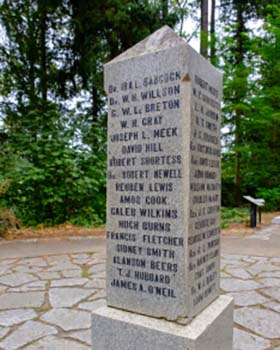
I like to start my visit at the Pioneer Monument, where it all began. Long before Champoeg became a town it was a meeting place where trails used by the Kalapuya people and fur trappers crossed the Willamette River. It was also where the Hudson’s Bay Company built their warehouse and granary and where, on May 2, 1843, roughly half the white male population of the Willamette Valley — 102 men — gathered to vote on whether to establish a provisional government. Both Britain and America laid claim to the Oregon Country, but neither had established a local governing body. With a margin of just two votes, the former fur trappers and settlers voted in favor of establishing a provisional government, setting Oregon on the road to U.S. statehood.

In 1901 a monument was erected in a shady riverside plaza on the spot where the vote took place. Many of the 52 names on the monument belong to the movers and shakers of their day. Their names grace counties, streets, parks and schools across the state. Among the names are those of legendary mountain man Joe Meek and his friend Robert Newell, who would sell lots in the town of Champoeg a year later.

This is also where living history reenactors host Founders Day in May and set up fur trapper encampments in spring and summer. On various visits, I’ve watched a black powder rifle salute, talked with a tinsmith and admired a wooden canoe beside the river. Special events bring the state’s pioneer history to life with demonstrations of pioneer craftsmanship and skills.

I often follow the path down the slope of the bank to the river. The trail hugs the riverbank, and though the river itself is mostly hidden behind the trees and brush, you can smell it — an earthy scent I always associate with willows and river mud. After about a quarter mile the trail rises, taking you to the top of the bank near the townsite of Champoeg.

The Champoeg Townsite

street name on wooden postNewell, an American, and French-Canadian André Longtain platted the town of Champoeg in 72 blocks across their respective land claims. Each named the streets after his country’s heroes. The streets on Newell’s side of town have names such as Washington, Jefferson and Monroe. On Longtain’s side the streets are named after Lasalle, Orleans, Lafayette and other Frenchmen. Today, five-foot-high wooden posts engraved with street names mark the corner of each block.

Simple line-drawn maps of the lost town are available at the park visitor’s center. Towering black walnut and oak trees shelter Napoleon Street, the imprint of which is still visible beneath the grass. It leads down to the river, where a roughly cleared, 40-foot dirt slope shows where the ferry docked and sternwheelers came calling, bringing mail, travelers and goods to Champoeg.

If you stand in the clearing, back to river and map in hand, you can visualize the layout of the town. There, on your left, would have been Edward Dupois’ stagecoach office and store; on the right, Robert Newell’s store. A block or so further along Napoleon Street on the left, beneath the trees, was the Masonic Hall. At the edge of the meadow near the corner of Jefferson Street and Degrasse Street stood the bowling alley and the hotel.

Today the former townsite is home to a variety of birds and plump, grey California ground squirrels, often spied bounding across the grass to their burrows. Families ride their bikes along the shady paved path that winds through the grassy streets. More than four miles of walking trails and bike paths connect the townsite to the park’s campground, the Pioneer Monument, Robert Newell’s house and other historic sites in the Heritage Area.

The Robert Newell House Museum

Robert Newell House MuseumOn a hill above the Champoeg townsite stands the white, two-story frame house that fur-trapper-turned-businessman Robert Newell built in 1852. It’s the centerpiece of the Newell Pioneer Village, which also includes the Pioneer Mothers Memorial Cabin, built in 1929; the Butteville Academy, a one-room schoolhouse and teacherage erected in 1859; and the Butteville Jail, which dates from 1848. The Newell Pioneer Village is owned by the Daughters of the American Revolution, which purchased the Newell house in 1952, restored it, and opened it to the public seven years later.

When the Willamette River’s floodwaters destroyed Champoeg, some of the townspeople found refuge with the Newell family, safe in their house on the hill. Today the house is preserved as a museum that showcases life in the mid-1800s with period furnishings throughout the house. The upstairs rooms hold a collection of evening gowns and accessories belonging to Oregon’s First Ladies (don’t miss the bullfrog purse), vintage quilts, spinning wheels and Native American artifacts. Costumed interpreters will guide you through the house, sharing the Newell family’s story and answering questions. They also provide programs for school groups from March through October. Newell Pioneer Village hosts dinners, teas, festivals and other special events throughout the year.

 The Manson Barn and Pioneer Garden

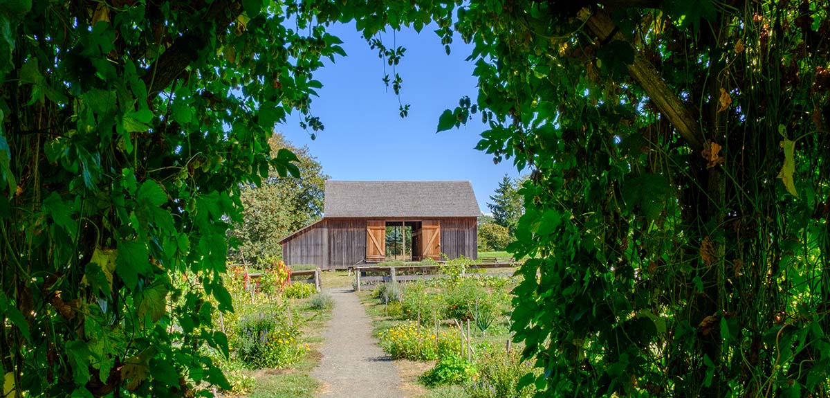
In 1862, Donald Manson salvaged timbers from the flood and built a barn for his homestead on the bluff near the Newell house. Today the homestead is gone, but the barn still stands. Located behind the visitor center, the barn and garden are used for education and living history programs. You’ll want to check the park’s calendar to learn when blacksmithing, woodworking, tinsmithing and other demonstrations of pioneer skills are being held at the barn.

The hops arch is the centerpiece of the Pioneer Garden. The garden showcases a sampling of the heirloom varieties that a pioneer family might have grown for food, medicine and, of course, brewing beer. A variety of herbs, fruits, vegetables and flowers are planted in wide rows, including corn, beans, potatoes, tomatoes, grapes, blueberries, squash, melon, turnip, amaranth and shoofly. Stakes at each row or clump are handwritten with the name of the variety planted there. Some names are quite colorful: Tongue of Fire (bean), Love Lies Bleeding (amaranth), Bloody Butcher (corn) and Cherokee Trail of Tears (bean).

The Butteville Store

Butteville StoreIf you’ve worked up an appetite exploring the Heritage Area, walk or bike on the 2-mile bike path along the river to the historic Butteville Store, or drive the short distance. Established in 1863, it is the oldest continuously operating store in Oregon and is now part of the Champoeg State Heritage Area.

Once a rival with Champoeg for commerce and transportation along the Willamette River, Butteville came into prominence after the Great Flood of 1861 washed away Champoeg. The town is higher in elevation and though damaged, it survived the flood. It even acquired the school bell from Champoeg, which floated downstream and now is mounted in front of the Butteville Community Church.

The store flourished under the ownership of J.J. Ryan, selling groceries, provisions, hardware and general merchandise. He also bought hops from local farmers and sold them to Henry Weinhard, who opened a brewery in Portland in 1855. Ryan soon added a saloon to the store that proudly advertised “Weinhard Beer.” Butteville thrived until the Oregon & California Railroad in 1871 and the Willamette & Pacific Railroad in 1907 shifted commerce away from the river and to towns along the rail line.

Today the saloon is gone, but the Butteville Store still serves up a sudsy pint and a cool glass of wine during the summer season. It also offers espresso, deli sandwiches, breakfast items, ice cream and other food. The store hosts dinner and live music on Saturday nights from April through September. Grab a cup of coffee and a bite to eat, then stroll down to the old river landing, about a hundred yards from the store. Interpretive signs explain the history of the landing. It’s a good spot to contemplate the history of these early pioneer towns and the river that shaped it.

If You Go:

Champoeg State Heritage Area
8239 Champoeg Rd NE, St Paul, Oregon 97137
(503) 678-1251

Camping reservations
Tent and RV sites, plus yurts
(800) 452-5687

Newell Pioneer Village
8089 Champoeg Road NE, St. Paul, Oregon 97137
(503) 678-5537

Butteville Store
10767 Butte St NE, Aurora, Oregon 97002
(503) 678-1605

About the author:
June Russell-Chamberlin is a freelance writer and editor in Oregon. When she’s not exploring and photographing the gems and hidden corners of the Pacific Northwest and beyond, she can be found reading a good mystery or continuing her quest for the ultimate chocolate truffle. junerussellchamberlin@gmail.com

All photos copyright June Russell-Chamberlin

  1. The hops arch in the Pioneer Garden frames a view of the Manson Barn. In addition to hops, a key ingredient in beer, pioneers also raised food and medicinal plants.
  2. The Willamette River at Champoeg, Oregon. Essential to the pioneers for transportation and commerce, the Willamette River brought mail, hops and other produce from the valley farms to Portland.
  3. Erected in 1901, the Pioneer Memorial commemorates the vote for self-governance in 1843 that set Oregon on the path to statehood.
  4. Five-foot tall wooden posts mark where streets once crossed in the lost town of Champoeg.
  5. During the Great Flood of 1861, townsfolk from Champoeg took refuge in the Robert Newell house on the hill above the town. Today it’s a museum showcasing life in the mid-1800s.
  6. Butteville, once Champoeg’s rival, flourished after the flood. Today the historic store serves summertime visitors cold drinks and a bite to eat.


Tagged With: Champoeg, June Russell-Chamberlin, Oregon cities, USA travel Filed Under: North America Travel

The Mystery of Fairy Stone State Park in Fayerdale, Virginia

Fairy Stone Lake State Park
by Patricia Apelt

The idea of a city under water often sounds like folklore, bringing images of the Lost City of Atlantis or something from a movie. Few people realize that Virginia has its own tale of an underwater city — one that has been replaced by a beautiful lake. Here’s more behind the story of, Virginia, one of the most intriguing small town histories in the books. Most people, even some visitors to the park, have no idea this underwater city ever existed.

Deep below Fairy Stone Lake lays the remains of the forgotten town of Fayerdale. Once an estate belonging to the Hairston family, the town started as a coal mining operation around 1905.

George Hairston (September 20, 1750 to March 5, 1825) was a noted planter and politician in Virginia. He was a Colonel in the American Revolutionary War and a Brigadier General in the War of 1812. In 1776, George Hairston built Beaver Creek Plantation, which remained his home until his death.

In 1827, George Hairston Senior died. His 20,000-acre tract in Patrick and Henry Counties, known as “The Iron Works,” passed to his eldest son John who resided on the property and operated his father’s various business interests in the area. After their father’s death, John and his brother George II united in partnership with Peter Hairston, their first cousin. They wanted to continue and expand the small scale iron industry from a rich vein of magnetite in and about Stuart’s Knob, a craggy hill rising five hundred feet on John’s property. On 10 November 1836, the partnership was formally recorded under the name “Union Iron Works Company.”

Peter died in late 1840. Shortly thereafter, John transferred his interest in the partnership to his brother George, making George the sole owner of the Union Iron Works Company. About 1850, George obtained a fifty-acre parcel known as the “Forge Tract” from Jacob Prillaman.

Early in the 1850’s, George’s son, Samuel took over management of the Union Iron Works Company. Samuel expanded and consolidated the various parcels in Patrick County associated with the Union Iron Works into a single holding of 4,840 acres. On 15 January 1862, George transferred the Forge Tract and the 4,840-acre Iron Works Tract to Samuel “for affection and one dollar”. The following year, Samuel sold the Iron Works and Forge Tracts for $150,000 each to John P. Barksdale, Jonathan B. Stovall and Elisha Barksdale.

No records can be found indicating what activities occupied the settlement around the Union Iron Works from then until 16 June 1903 when the Barksdale heirs sold the same 4,840 acres, then known as the “Iron Works at Union Furnace,” to Frank Ayer Hill, Herbert Dale Lafferty, and their wives, Alice and Mary respectively, for $40,000. The area was given the new name “Fayerdale,” concocted by Alice Hill from her husband’s first initial, his middle name, and Herbert Laffertys middle name. During its prime the town boasted a general store, post office, train depot, hotel, school, and a physician, as well as many homes.

Fayerdale blossomed into a booming mining and logging town with a population of close to 2,000 people. The mining operations in Stuart’s Knob were mechanized. Other construction included a company office building, freight station, blacksmith and carpenter shops, an ore tipple, a warehouse to handle whiskies and brandies for the DeHart Distillery in nearby Woolwine, and numerous dwelling houses, stables and other ancillary buildings. The light weight logging track followed the cutting sites as they migrated through the rapidly disappearing forest. About that same time the Illegal whisky business began to emerge among the residents. The next drawings illustrate how Fayerdale was probably configured about 1910, the heyday of its brief existence.

During 1921, there was still lumber and farm produce to haul for profit even though the iron ore trade had ceased and Prohibition had dried up the liquor traffic. But things were not well in Fayerdale. Sporadic reports from that neighborhood published in the early twenties told of more families moving out, more feuding and shootings among the moonshining neighbors. Fayerdale was dying while a few of its residents were amassing fortunes in the illicit liquor business.

On 25 August 1925, T.W. Fugate purchased, for $50,000, all of Fayerdale’s railroad and mining equipment. Thereafter, virtually all of Fayerdale’s railroad and mining equipment vanished, and the land was as before the Hills and Laffertys arrived in Goblintown hollow except for the ravished forests, abandoned rail beds, many abandoned buildings, and a few scattered relics of iron.

About the time of the Fugate transaction, Roanoke newspaper publisher Junius B. Fishburn bought out his partners in the mining operation. In 1933 the Civilian Conservation Corps (CCC) was formed and went to work building Virginia’s original six state parks. Mr. Fishburn donated the 4,639-acre site for Fairy Stone State Park, making it the largest of the six original parks and one of the largest to this day. The last residents of Fayerdale were evacuated and the area was flooded to make way for the park’s 168-acre lake.

By their departure in the Spring of 1941, the CCC crews had provided paved roads, a sandy beach, picnic areas, camp sites, bridle paths and walking trails. They built a bath house, restaurant, and cabins for visitors as well as a water and sanitation system.

Fayerdale vanished into the mountain mists. Unlike Brigadoon, it will never return. In its place, however, is a delightfully pure and rustic mountain retreat where one may hike the paths of miners and moonshiners, peer into an abandoned iron mine, and swim, boat and fish in a beautiful woodland lake where once there was a town and two railroads.

Today, Fairy Stone Park still remains the largest and one of the most beautiful state parks in Virginia. One of the original CCC buildings now serves as the Fayerdale Hall Conference Center. Formerly the park’s restaurant, this facility was named for the town under the lake. The building has been upgraded with modern conveniences including Wi-Fi, a flat screen TV, and catering kitchen, making it a popular venue for weddings and meetings. The Fayerdale Hall Conference Centers stands as homage to this historic underwater town.

Fairy Stone State Park is a restful destination for bikers, hikers, campers, fishermen, horseback riders, water sport fans, and ‘just passing through’ tourist on day trips. A rather unique spot on the North American continent, Fairy Stone State Park is also the place where the so-called “Fairy Stones” are found, which is reason enough to visit.

The name of the park is explained by a legend from very early settlers of the area. It tells of a time long ago when large groups of fairies roamed freely in the area. When elfin messengers from far away came to them and told of the death of Christ, the fairies all began crying and their tears became the Fairy Stones found in the park today.

A bit of factual information is that these ‘stones’ are actually crystals formed of staurolite, which is composed of iron, aluminum, and silicate. Theses crystals are hexagonal, and singles often intersect at forty-five degree angles to form Roman, Maltese, or St. Andrews shapes. The crystals were formed from pressure and heat during the time when the Appalachian Mountains were being pushed up from the earth’s crust (some say about 400 million years ago). There is one small area just outside the gates but still owned by the park where you can go and perhaps find a few Fairy Stones for yourself. You are asked to only carry away a small cupful, leaving some for others.


If You Go:

Whether on a day trip or camping, please take the time to enjoy all the activities Fairy Stone has to offer. Be sure to talk to the Park Rangers, and visit the museum in the Visitor’s Center.

My thanks to other sources of information used in this article Jack Williamson from his book A History of Fayerdale, Virginia.

Tours to Roanoke, Virginia:

Roanoke Craft Beer Tour
Roanoke Downtown Food and Cultural Tour
Roanoke Sunday Brunch Food Tour

About the author:

Patricia Apelt has been an avid reader since she was first able to hold a book in her hands. She is now writing them herself, with two fictional novels already published and a third is ‘a work in progress’. She is also exploring the world of Travel Writer and enjoying it very much. When she is not traveling or writing, she enjoys quilting, sewing, and spending time with her 12 grandchildren. She lives with her husband and three dogs in Poquoson, Virginia.  Visit Patricia’s website and her Facebook page.

Photo credit: Virginia State Parks / CC BY

Tagged With: USA travel, Virginia attractions Filed Under: North America Travel

Florida: The Dinosaurs are Back With a Growl in Naples Botanical Garden

statue of dinosaur

by Jean Rowley

These life-size, intricately detailed dinosaur replicas at the Naples Botanical Garden in Naples Florida move and growl realistically, and include the little-known, fearsome Utahraptor. Paleontologists have concluded that the 25-foot-long creature lived around 125 million years ago and weighed over a ton. With running speeds of more than 20-miles-mph, it was able to jump 15-feet high, with frightening 9-inch claws that likely debilitated its prey.

It was unearthed in Utah in 1991–being appropriately named Utahraptor. Little was known about this dinosaur until 2001. When an excavation uncovered six-individual specimens so large they prompted Utah’s state paleontologist to comment, “This thing is built like Arnold Schwarzenegger.”

Peering back millions of years, you can touch 10-life-size animated dinosaur models from the Jurassic and Cretaceous periods of the Mesozoic era in the Brazilian and Florida Gardens, two of the many in the 170-acre botanical garden.

Strolling through the Florida Garden, you’ll first come across Citipati, classified as oviraptors in the dinosaur family. Oviraptors mean “egg thief”. Although the historical record can’t verify that this dinosaur stole and ate other creature’s eggs, it does confirm that Citipati had feathers and sat on their own eggs similar to birds today.

Continuing on the path, Diabloceratops greets you with its frightening appearance. It would lead you to believe it used the horns for devouring prey, but instead, the dinosaur ate vegetation. Scientists know this because they have opened the dinosaur’s stomach to reveal vegetation consumption.

Peeking through the tall shrubs, Protohadros, a type of hadrosaur called a duck-billed dinosaur, greets you on two legs, beaked, and with no horns or spikes to protect themselves from predators. Hunting a larger animal is very dangerous. Their only defense was to grow faster than their predators.

dinosaur replica headAnd finally, in the Florida garden, Tyrannosaurus Rex greets you. Probably the most recognizable dinosaur today, it was among the last non-avian dinosaurs to roam the Earth before the Cretaceous-Paleogene extinction event that marked the end of the Mesozoic Era–the dinosaur’s extinction–65 million years ago. In Tyrannosaurus Rex time, the forest was probably much like our North American forest today.

Three more dinosaurs are displayed in the Brazilian Garden. Amargasaurus is the first dinosaur to greet you with spines on its neck. There has been speculation that these spines were used to make loud, threatening noise as the dinosaur passed through the forest.

Dilophosaurus is believed to weigh about half-ton. And, unlike the Jurassic Park series, there is no proof of spitting venom, as shown in the movies.

There has been much debate over Quetzalcoatlus–whether it vaulted itself into the air using its heavy muscled front legs or did it hang-glide to get airborne off a cliff? While another possibility was that it didn’t fly at all, but used its hind legs to hunt for prey. Before leaving Naples Botanical Garden–click a picture at Pachyrino Photo Op at South Grove to record your dinosaur encounter and discover your inmost paleontologist at the Hadrosaur Fossil Dig Pit located at Suzy’s Bali Hai.

water lilyWhile you are visiting–which, if you want to catch the dinosaurs, should be before the exhibit ends on June 3rd–take time for lunch at the casual, moderately priced, Fogg Cafe, which features a creative, chef-drive menu, using local, sustainable products. The menu changes seasonally, focusing on a setting that incorporates a garden-to-table menu of dishes, such as, mango chicken salad, vegetable salad, shrimp and calamari ceviche, chicken wings, hot dogs, hamburgers, other sandwiches, French fries, soups, and deserts. The eatery is housed in the visitor’s center, open for breakfast and lunch only.

The botanical garden also hosts a variety of exhibits and events during each month of the year. May’s events include the exhibit of dinosaurs, Music in the Garden series, Botany through Art: Watercolor 3 with Elizabeth Smith, Mother’s Day in the Garden, and Memorial Day Appreciation and are sure to appeal to everyone.

If You Go:

NAPLES BOTANICAL GARDEN
4820 Bayshore Dr., Naples, FL 34112
239-643-7275

Open 9 a.m.-5 p.m. daily except Tuesdays, 8 a.m.-5 p.m.

Admission: $14.95 Adult,
$ 9.95 Child (4-14)
$ 0.00 Child (3 & under)

About the author:
Jean Rowley is a freelance travel writer and photographer based in Lehigh Acres, Florida. She is a member of ITWPA and shares many of her adventures, stories and photos on her website: gallivanterstravel.blog


All photos from Creative Commons public domain.


Tagged With: Florida attractions, Jean Rowley, USA travel Filed Under: North America Travel

An American History Lesson: Gettysburg, Pennsylvania

cannon at Gettysburg

by Susmita Sengupta

In the years 1861-1865, the United States fought what is known as the greatest war in American history, the Civil War. It was a war between the free Northern states also called the Union states and the slave holding southern states also known as the Confederate states of America. At stake were the issues of states’ rights versus federal rights and the abolishing of slavery. Abraham Lincoln had just been elected President in 1860 and he was an abolitionist. The Confederate states were afraid that life as they knew it was in danger and they fired the first shots even as Lincoln was taking office in March 1861, thus heralding the beginning of the Civil War.

Of all the various places that the war was fought, Gettysburg, in Adams County in the state of Pennsylvania, stands out for very important reasons. The battle fought here was not only the bloodiest battle of the Civil War but also became the turning point in United States history.

Our family decided to visit this historic place on a fall weekend trip, the primary focus definitely being the Gettysburg Battlefield.

We started our tour at the Visitors Center where there are a multitude of options on how one wants to experience the battlefield and its monuments. From personalized guided tours in your car to guided bus tours to bike rides to augmented reality tours using a rented iPad, the choices are numerous. We decided to do it the old fashioned way, driving on our own through the battlefield using the official map and guide.

monument at Gettysburg
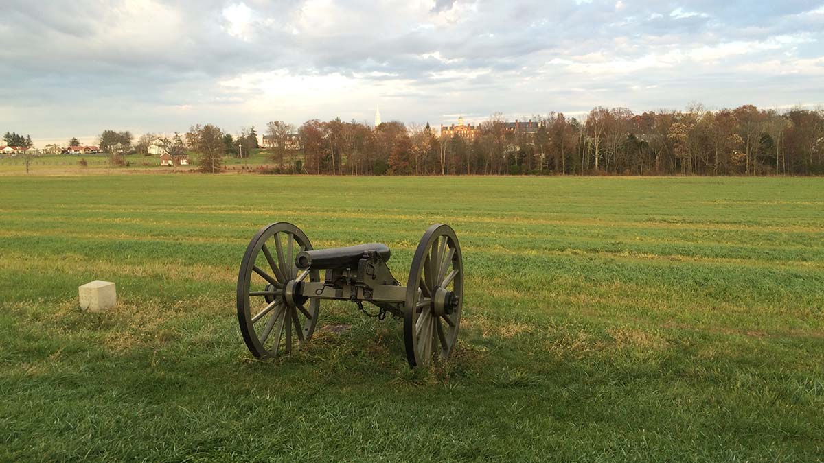
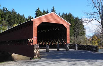
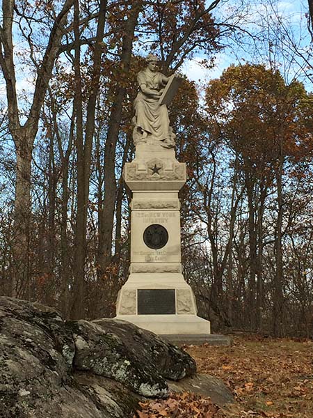
The Gettysburg Battlefield spreads out over about a twenty five square mile area and is dotted with monuments, cannons, and markers identifying the historic events that unfolded here from July 1-3, 1863. No matter the kind of tour one decides to undertake, visiting the site is an emotional experience. The self-guided tour is beautifully organized and one can easily follow the entire sequence of events of those three days chronologically by following the map provided at the Visitors Center. With time on our hands, we decided to spread out our tour over the whole day by first just doing a drive by through the entire national park followed by time spent at the museum and visitors center and then returning back to the battlefield to stop at various monuments for a detailed and closer look.
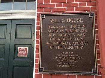
At the Visitors Center, the principal attraction is the Cyclorama painting platform, a truly massive 360 degree oil painting by Paul Philippoteaux from the 1880s that illustrates Pickett’s Charge from the third day of the Battle of Gettysburg. While viewing the painting, I felt as if I had a front seat to the eventful happenings of that day. On the third day of the battle, Confederate Gen. Robert E. Lee and his troops started an infantry assault on the Union troops of Maj. Gen. George G. Meade at Cemetery Ridge. The attack was led by Maj. Gen. George Pickett and the Confederates were driven back and they had to withdraw. They suffered a decisive defeat that concluded the Battle of Gettysburg. For history aficionados, the Gettysburg Museum at the Visitors Center is a treasure trove of information and one can easily spend a couple of hours exploring the various galleries. These galleries tell the story of the Civil War and the Battle of Gettysburg through exhibits, artifacts and interactive visuals from the viewpoints of everyone affected by the war.

Gettysburg is equally famous around the world for President Abraham Lincoln’s “Gettysburg Address”, a 272 word speech that he delivered here in November 1863 at the dedication ceremony of the Soldiers’ National Cemetery at the battlefield. Considered a landmark speech of American history, it reaffirms the importance of human equality as defined by the Declaration of Independence and restructures the Civil War as a struggle for the same.

Wills house plaqueAt the Wills House Museum, located in downtown Gettysburg, visitors can see the room where Lincoln stayed the night and prepared the final draft of Gettysburg Address. The house was the home and office of David Wills, an attorney who was the driving force behind the creation of the National Cemetery.

A little crunched for time, we were unable to tour the house but decided to visit the Shriver House museum instead. This museum that offers a civilian’s perspective of the Civil War is the 1860 home of George and Hettie Shriver. We walked through the beautifully restored home and in the process learned about the effects of that war on the life of the regular people of Gettysburg. I discovered that George Shriver volunteered to fight for the Union troops in 1861 while his wife Hettie and their two daughters continued with their life at this house. When the war came to Gettysburg in July 1863, Hettie decided to move to her parents’ farm a few miles away with her children. What she didn’t know is what we know now. That farmhouse was situated between two hills known as Big Round Top and Little Round Top, the two sites where some of the worst fighting took place. They lived through the battle in that house and returned back to their home on July 7th and found out that their home was now being used as a hospital and had been taken over by Confederate soldiers. It was fascinating to visit the attic and hear about the Confederate sharpshooters who had taken up positions there to fire at the Union soldiers and two of whom died there during the siege.

covered bridgeIf you get tired of all the Civil War related sightseeing, Gettysburg also offers some other places of interest. One such place is the Sachs Covered Bridge, one of four such bridges in Adams County and arguably the prettiest. Though this bridge too has a war related history, the Confederate soldiers retreated by marching across it, what catches your eye here is the beauty of this wooden bridge and the surrounding landscape. Although the effects of autumn weather were not yet seen, I could imagine how pretty the entire place would look once the trees showed their dazzling fall colors.

The next day we decided to take in the other attractions of Gettysburg, namely its charming downtown area filled with cafes, restaurants and gift shops selling folk art and Americana. Of course there are also stores selling authentic Civil War memorabilia and artifacts and we found a lot of antique stores as well.

Gettysburg turned out to be an ideal weekend vacation destination with a mix of history, culture and shopping but one can also spend a more leisurely week visiting other places of interest such as the Eisenhower National Historic Site, the weekend retreat of President Eisenhower and his wife Mamie that also served as his home after his presidency and the Hall of Presidents and First Ladies. A longer and more leisurely visit would also be perfect to explore the natural splendor of the surrounding Adams County.

If You Go:

Destination Gettysburg

National Park Service Gettysburg

Gettysburg Foundation


About the author:
Susmita Sengupta is a freelance writer who loves to travel. She and her family have traveled to various parts of the USA, Canada, Europe, the Caribbean, Middle East, Southeast Asia and India. She resides in New York City with her family.

All photographs by Susmita Sengupta

  1. One of the many cannons at the Battlefield
  2. Monument dedicated to soldiers from New York
  3. Wills House exterior
  4. Sachs Covered bridge


Tagged With: Civil War battle sites, Pennsylvania attractions, USA travel Filed Under: North America Travel

Pennsylvania: Oh Little Town of Bethlehem

Wilbur Trust & Lehigh Valley RR building

by K.A. Thomsen

There is no place like Bethlehem, Pennsylvania. Nicknamed by locals the “Christmas City,” it is the most peaceful place on earth. You get the sense that the land is at rest, and maybe it is. It was spared the anguish and bloodshed of the French and Indian war that raged from July of 1754 to 1763 literally all around it. The main reason for this was simply because its founders, the Moravians, had paid for their land. The had no desire to civilize or displace the first inhabitants of the Americas. They just wanted a place to live free from religious persecution.

Three hundred years earlier, the denomination began when small groups of Bohemians and Moravians (present day Czech Republic) had broken off from the corrupt Catholic Church, under a young zealous Bible scholar named Jan Hus. He was later burned at the stake for heresy, which only angered the local populace and fueled the revival which he had initiated. This in turn threatened the Catholic monopoly in the area and so began the Hussite wars. Almost 300 years later, in 1722, the tensions between the two groups were still so bad that a small group of Hussites from Moravia fled to Germany. They were sheltered there by wealthy Count Zinzindorf, who had enough land to do so comfortably, for almost 20 years.

Nazareth, Pennsylvania was founded first in 1740 and then, in 1741, came Bethlehem. The first immigrants held their services and wrote their hymns in German. They lived in segregated housing arrangements called choirs: one for single sisters, one for single brothers, and one for married couples. They loved music, and the choir designation referred to the fact that they were always singing, in order to keep themselves uplifted while they worked the menial jobs of a pioneering existence.

From the Moravians came the first orchestra in America, The Bach Choir, (which is still going on to this day), and the iconic Christmas Star, the Love Feast (on Christmas Eve) and Moravian sugar cake.

The star is indeed the symbol of Christmas City, USA. In 1937, to commemorate this, a giant star was placed on South Mountain which overlooks the city, guiding those who traverse the labyrinth of streets and modern buildings to find historic downtown nestled in the centre.

Gemeinhaus
Gemeinhaus

Historic downtown Bethlehem is home to several treasured buildings including the oldest log structure still in use in the USA, the 1741 Gemeinhaus, which now holds the Bethlehem museum; the Brothers, Sisters, Widows and Miller’s stone houses; the Old Chapel; the Sun Inn; The Bell Tower; the 1762 Waterworks; (also a national historical landmark, as America’s first pumped municipal water system) and the archeological remains of the buildings dedicated to butchery, tannery, dying, pottery and oil.

The Moravians are a kind and unassuming sort, seeking always to share their faith in a respectful way and only with those who are open to hear. Their focus remains ecclesiasticism, personal piety, missions and music. They were the first denomination to start a 24 hour prayer vigil, and once it began, it continued for over 100 years.

The first few times I visited Bethlehem I was too young to remember much. But when I was six and in first grade, they sent me to the Moravian Academy (built on my family’s lands) for one day.

Next to the Academy is the Cemetery, where all the gravestones are flat and arranged by name and marital status rather than family, because to the Moravians, the dead are all equal “before God.”

I remember going to visit my grandmother on July 4 one year (I was 12), and the minister opened up the Bell Tower for us to climb to the very top. We could see over all the rooves of the entire town, and then there were fireworks.

We had been touring around the Lehigh Valley Music festival for hours, absorbing all the culture our souls could possibly sponge up. There was a local polka competition, food vendors, book sellers, beeswax shapes, ornaments and candles of every possible denomination.

They also have a store – the only one I’ve ever known of – dedicated 365 to everything Christmas. What else could you expect from The Christmas City, USA?

Several Christmases before we were in Bethlehem for the love feast. It is held in the colonial Old Chapel, on Christmas Eve. Everyone brings their children and in the middle of the service, ushers bring out mugs of hot chocolate and giant cookies. Then, they take up the dishes and hand out beeswax candles. It smells amazing.

Before the end, the whole sanctuary is darkened and filled with the light of hundreds of candles held by the children and their parents lining the pews.

On my recent trip we took the bus from nearby Allentown to the Newark airport. Within the first 20 minutes I spotted a large sign on a building that said, “Moravian Academy.” I pointed it out to my mother.

Apparently it was the middle school and new athletic grounds build on land that had also been in my family. It had been owned by an aunt or first cousin of my great-grandmother and her husband who made a lot of money with a successful business back in the 1920’s before there was such a thing as income tax in the Americas!

I tip my hat to the 18 brave souls who volunteered to be the first settlers in Bethlehem…it was a dangerous place back then, largely wild; the surrounding lands were populated by various first nations tribes with differing values and political alliances. One never knew if accepting the hospitality of one would make them an enemy of the others, as history proved it sometimes did.

When I was a child my grandmother gave me a book. It told the story of how the first trombones came to Bethlehem, and how through those instruments a miracle was delivered, and a war with the natives averted.

Today, in the United States the Moravian church has become allied with the Episcopal and Methodist denominations. But some still exist in Canada, Germany and other parts of the world. For example, when I went travelling in India we came upon a Moravian church and school in the highest human settlement on earth sitting in the Himalayas, at 18,000 feet. We stayed there for a week and ran an after school club at the church and also spent time with the children at school. I still have pictures of my teammates in front of the Moravian logo and symbol which is a lamb holding a blue flag with a white cross in the middle, and says in Latin, “Our Lamb Has Conquered, Let us Follow Him.”

If You Go:

This is an excellent website that tells about the history and locates everything Moravian.

Wikipedia has a great recreation and entertainment section:   i.e.: “The city is famous for its annual Musikfest, a largely free, ten-day music festival that draws over a million people to the city each August. Since its founding in 1898, The Bach Choir of Bethlehem has been attracting thousands of visitors to the annual Bethlehem Bach Festival,[36] now held largely on the campus of Lehigh University and on the historic grounds of the Moravian Community. Other festivals include The Celtic Classic, which celebrates Celtic culture, food and music,[37] and the SouthSide Film Festival, a non-competitive, not-for-profit film festival. The city has also been the past, and current host of the North East Art Rock Festival, or NEARFest, a popular 3-day Progressive rockmusic event…

The city is the location of Pennsylvania’s largest casino, the Sands Casino Resort Bethlehem, located on the former Bethlehem Steel property.

The Lehigh Canal provides hiking and biking opportunities along the canal towpath which follows the Lehigh River in Bethlehem. Both the Lehigh Canal and the Monocacy Creek are popular for sport fishing, and both are stocked annually with trout.

In spring 2011, the city opened Steel Stacks, a ten-acre campus that showcases music, art, festivals, films and educational programming throughout the year.[42] It is located in the backdrop of the blast furnaces of the former Bethlehem Steel plant.”

The motto of the Moravian church is: “In essentials, unity; in nonessentials, liberty; and in all things, love”

Visit Bethlehem PA

Get Downtown Bethlehem – Festivals

Everything you need to know about Bethlehem, PA

Mitchell, Barbara: Tomahawks and Trombones, Carolrhoda, 1982.

About the author:
K. A. Thomsen is a BC writer with an emphasis on historical fiction and poetry. Her first novel, The Hidden Valley, a junior fiction cowboy story set in the Chilcotin wilderness was published in August 2016. It deals with tweens coming of age, issues of land stewardship, first nations peoples, ranching, and horsemanship. She is married with two children.

Photographs:

  1. Wilbur Trust & Lehigh Valley RR HQ  by Shuvaev / CC BY-SA
  2. Gemeinhaus by Jerrye & Roy Klotz, MD / CC BY-SA


Tagged With: Bethlehem PA attractions, Moravians, USA travel Filed Under: North America Travel

  • 1
  • 2
  • 3
  • 4
  • Next Page »

MORE TRAVEL STORIES:

Sailing the Maine Coast

Christmas and New Year in Japan

Dancing to a Different Drum

Nazareth, Israel

USA: Exploring Summerville, South Carolina

France: Flying on the 600

Andersonville Cemetery – “Is This Hell?”

The Roots of Flamenco in Granada


SEARCH

DESTINATIONS

  • Africa Travel
  • Antarctica travel
  • Asia Travel
  • Australia travel
  • Caribbean Travel
  • Central America Travel
  • Europe Travel
  • Middle East Travel
  • North America Travel
  • Oceania Travel
  • South America Travel
  • Travel History
  • Travel News
  • UK Travel
  • Uncategorized
  • World Travel
facebook
Best Travel Blogs - OnToplist.com

Copyright © 2025 Cedar Cottage Marketing | About Us | Contact | Privacy Policy | Terms & Conditions | Copyright Notice | Log in