Oahu is the heartbeat of Hawaii and a paradise that puts together a beautiful landscape and rich cultural heritage. Called “The Gathering Place,” it brings together breathtaking beaches, landscapes full of greenery, and lively cityscapes, all in one. It creates a chance for one to experience Hawaii in serenity, together with landmark historic exploration and activity adventure. Whether it is history, beach, or food that one loves, it all comes with no end when it comes to Oahu’s variety. In that regard, this travel guide takes one through its most breathtaking destinations and unforgettable activities.
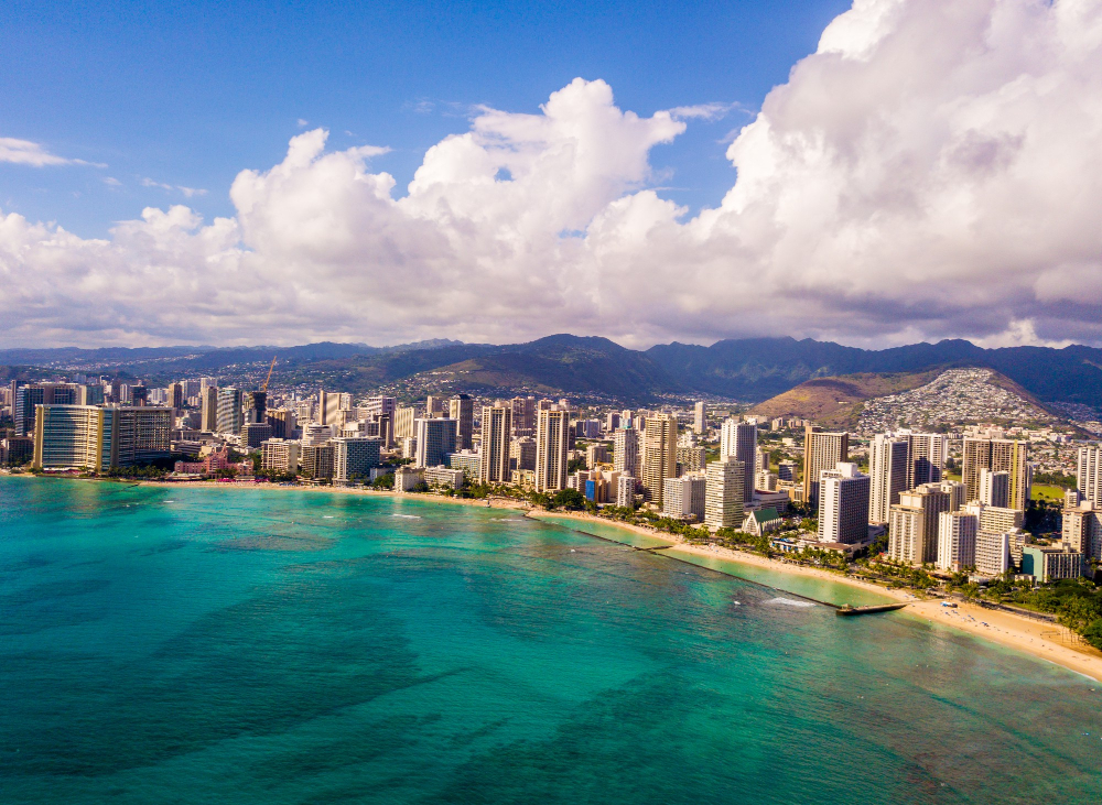
Waikiki Beach: Sun, Surf, and Skyline
Waikiki Beach, one of the most famous destinations worldwide, exudes the very spirit of Oahu. With golden sand, crystal clear water, and the iconic craggy backdrop of Diamond Head, it offers sunbathing, surfing, and swimming.
Further inland, Waikiki presents the biggest shopping and restaurant action of the islands, as well as nightclubs and other watering holes.
From shark diving oahu taking surf lessons to lying in the burning sun, Waikiki presents an unrivaled mix of relaxation and adventure, hence the non-skippable destination for tourists.
North Shore: A Paradise for Surfers
The North Shore of Oahu is famous for big waves and is a laid-back place. During winters, professional surfers from around the world come to the shores to try their luck with these tall waves at Pipeline and Waimea Bay.
In summer, waves turn harmless, giving way to excellent spots for snorkeling. Small towns, like Haleiwa, have joints serving local delicacies such as shaved ice and garlic shrimp. North Shore is a remedy to the urban way of life.
Hanauma Bay: An Underwater Eden
Oahu is the right destination if you are looking for a place to enjoy your underwear adventure. Hanauma Bay is a dream come true for this purpose. This protected marine sanctuary is full of colorful fish and coral reefs, along with other sea animals.
Snorkeling here is like plunging into an aquarium that is alive. The bay is well preserved, with measures to educate people on aspects of conservation. Come early to get a good spot and enjoy snorkeling in one of Oahu’s prettiest natural spots.
Cultural Delights: Of Luaus & Food
Oahu can be a feast for the senses-from the richness of Hawaiian culture down to its delectable food. Avail yourself of a traditional luau where there is hula dancing, the spectacle of fire knife performances, and a Hawaiian buffet featuring kalua pork, poke, and much more.
Be sure to check out the local farmers’ markets and food trucks for the real taste of the islands. Cultural attractions like the Polynesian Culture Center would help one to understand traditions and history better.
Oahu is more than an island; it’s a destination where nature, history, and culture combine to make for an experience not easily forgotten. From shark diving oahu to lively Waikiki Beach to the tranquil beauty of Hanauma Bay, there is magic in every corner of this island. Be it an adventure, time for relaxation, or a cultural journey-it’s lifetime memories that Oahu promises. Plan your trip and rediscover timeless charm in the most vibrant of Hawaii’s islands.