Within days of the April 1906 earthquake and fire, San Francisco’s leaders were already telegraphing architects up and down the West Coast. The fire alone destroyed an estimated 28,000 buildings across roughly 490 city blocks. Nobody wanted to wait for a careful plan. That urgency, more than any single blueprint, defined San Francisco’s rebuilding era and left a permanent mark on the city’s neighborhoods. You can see it in the tight grid of downtown streets and in the manufactured ground beneath the Marina District. Decisions made between 1906 and 1915 are still visible on an ordinary walk through the city today.
Why Did the 1906 Earthquake and Fire Force Immediate Rebuilding?
The earthquake itself lasted less than a minute. The fires that followed burned for three days. San Francisco had grown explosively since the Gold Rush, packing wooden boomtown construction onto a compact peninsula. That density is exactly what let the fire spread so fast once the water mains cracked.
Towns that trace their own growth back to that same rush of fortune-seekers show a similar pattern. The Gold Rush footsteps in Sacramento, California reveal how quickly a boomtown’s building stock can outpace any real planning. San Francisco had the same problem, only at a much larger scale, with a population that had grown tenfold in a few short decades. Its merchants had no patience for a slow recovery. Banks reopened within days. Property owners started clearing debris before city officials had even finished touring the damage. The city issued rebuilding permits for some of the very same lots before the rubble had fully cooled. That impatience shaped nearly every decision made during the reconstruction that followed.
Why Was Daniel Burnham’s Grand Plan Left on the Drawing Board?
Architect Daniel Burnham drew up a sweeping City Beautiful plan for San Francisco in 1905, a full year before the earthquake. It proposed grand diagonal boulevards and a hilltop civic monument. The disaster briefly seemed like the perfect blank canvas to build it. Instead, merchants and property owners rebuilt fast, right on the original street grid. Redrawing property lines and boulevards would have meant costly delays and legal disputes over land, and nobody wanted that.
The old grid won out almost everywhere. That same tension between a planner’s ideal and a city’s practical habits shows up elsewhere in American urban history. What Philadelphia’s colonial grid tells you about getting around the city echoes a similar story: an inherited street pattern that outlasted whatever came after it. San Francisco kept its grid. But it gained new civic architecture along the way, including a Beaux-Arts City Hall completed in 1915.
How Did Chinatown’s Rebuilding Shape the Neighborhood You Walk Through Today?
City leaders initially tried to push Chinatown’s rebuilding to a different part of San Francisco. They hoped to reclaim the neighborhood’s valuable downtown land for commercial use. Chinese merchants and property owners refused to leave. Business ties across the Pacific gave them more leverage than city officials expected.
Rather than simply reconstruct what had burned, community leaders and architects rebuilt Chinatown in a deliberately ornamental style. Architects added pagoda roofs, painted balconies, and lantern-strung streets to draw tourists rather than blend in. Look Tin Eli, a prominent Chinatown merchant, pushed the idea, hoping to make the neighborhood too profitable for officials to keep threatening it. That decision is the reason Chinatown’s architecture today looks more theatrical than the Chinatown that existed before 1906. Walking down Grant Avenue now means walking through a neighborhood that was rebuilt as a statement of permanence as much as a place to live.
How Did New Building Codes Reshape San Francisco’s Skyline?
City officials used the years after the disaster to force through changes that would have faced resistance under normal circumstances. Officials blamed wood-frame construction for feeding the fire so quickly. It gave way to steel frames and reinforced concrete across the rebuilt commercial core. A few of the most consequential changes included:
- Mandatory fireproof materials for new construction in the downtown core
- Wider water mains and additional cisterns built directly into new streets
- Stricter limits on flammable materials in dense residential blocks
- Taller, steel-framed commercial buildings replacing older wood structures
Historians studying the period have pointed out that Burnham’s City Beautiful vision for San Francisco survived mostly in fragments. It shows up in scattered Beaux-Arts buildings rather than the grand boulevards he proposed. Those piecemeal changes still show up in the mix of building styles and heights across downtown blocks today.
How Did the Marina District Rise from the Rubble of 1906?
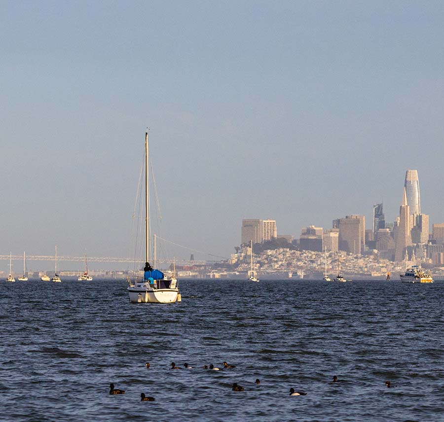
The Marina District did not exist as a neighborhood before the earthquake. The area was mostly tidal marsh and open water at the northern edge of the city. Debris from the collapsed and burned buildings downtown was hauled north and dumped into the marsh. That gradually created solid ground where none had existed before.
The reclaimed land later hosted the 1915 Panama-Pacific International Exposition, a world’s fair built to show that San Francisco had recovered. When the fair closed, developers subdivided much of its footprint into residential streets. Those streets make up today’s Marina District. The Palace of Fine Arts was originally built as one of the fair’s temporary exhibition halls. It is the only structure from that event still standing on its original site.
Reading San Francisco’s Rebuilding Era in Its Streets Today
San Francisco’s rebuilding era did not just restore what the earthquake destroyed. It set the pattern for neighborhoods that still define the city, from Chinatown’s theatrical streetscape to the reclaimed ground under the Marina District. The choices made between 1906 and 1915 are still legible to anyone walking those blocks with an eye for detail. They include keeping the old grid, rewriting building codes, and turning disaster recovery into a world’s fair. Next time you trace a route downtown or along Marina Boulevard, notice which decade’s decisions are still holding the ground beneath your feet.
Claire Whitmore is a travel writer who focuses on historic cities, walkable neighborhoods, and the stories behind urban design. Her work explores how streets, public squares, architecture, and transportation shape a visitor’s experience. She has occasionally partnered with relocation specialists like Neostart while researching how a city’s neighborhoods get physically reshaped over time. Away from writing, Claire spends her time photographing old buildings, browsing antique maps, and testing local bakeries.