Travel Thru History

Historical and cultural travel experiences

  • Home
  • Airfare Deals
  • Get Travel Insurance
  • Writers Guidelines

Solo Traveling to Costa Rica? Read This Before Heading Out

Costa Rica beach

Although people have been backpacking solo across Western Europe, just outside Barcelona, hiking in the foothills of Mount Tibidabo for years now, solo travel became a global trend fairly recently.

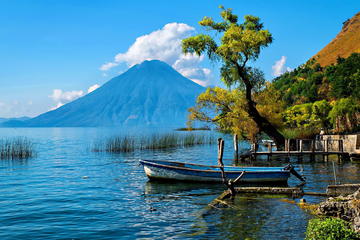
The year 2024 saw an unprecedented rise in the number of solo travelers. Thanks to the easy availability of affordable accommodation and a fantastic social scene, Costa Rica has emerged as one of the top solo traveler’s destinations.

Did you know that Costa Rica entered the list of the top 20 happiest countries in the world? Costa Ricans are chill, welcoming people who know how to make their tourists feel at home. If you are planning to explore Costa Rica on your own this year, we have prepared a checklist just for you.

This is not your run-of-the-mill travel guide. It’s an “I wish I had done this while I was there” list, handed to you in advance so you don’t actually miss a beat.

Plan Your Accommodation Carefully

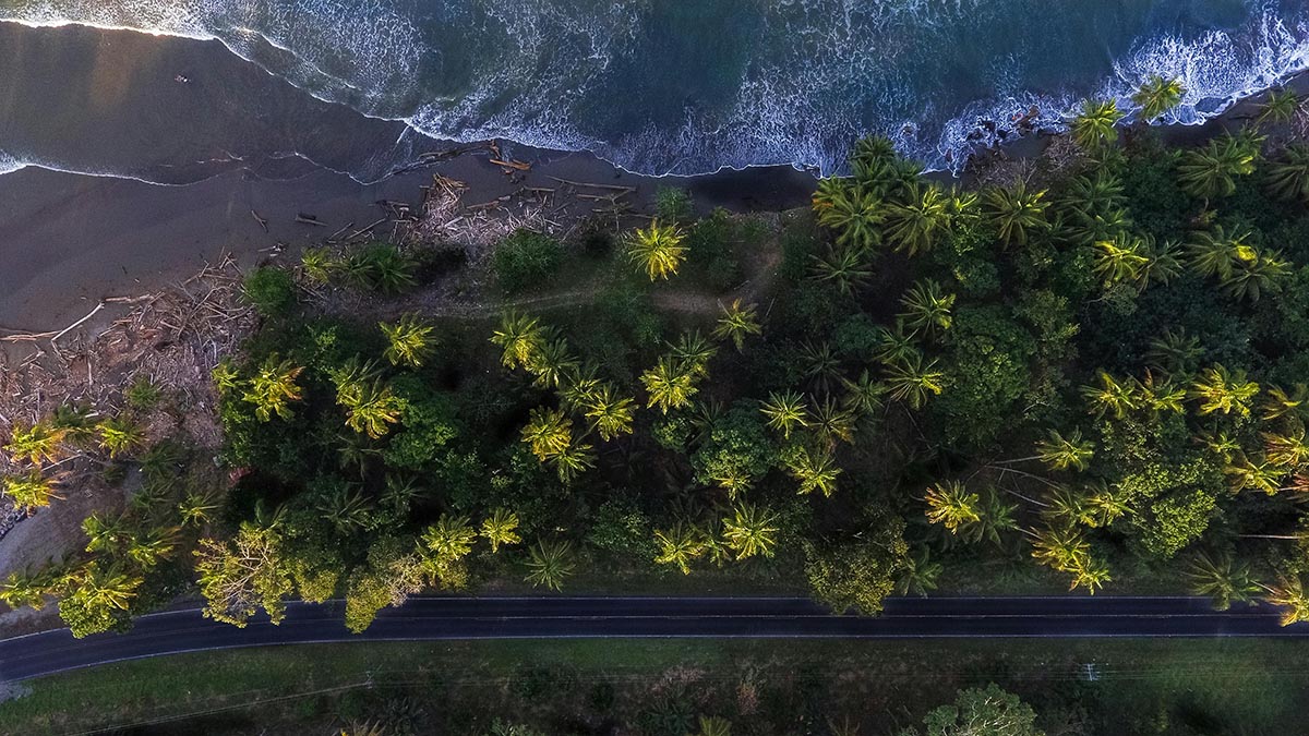
Costa Rica is the ultimate haven for backpackers and surfers, which is why you’ll notice a vibrant hostel culture across the country. However, this country isn’t just for backpackers or party animals. Every year, tons of people from around the globe visit Costa Rica just to soak up its serene natural beauty.

With the rising number of eco-friendly and self-sustainable hotels in the country, your stay options aren’t limited to dorms anymore. You can easily check out available hotel offers with cozycozy and pick the one that suits your needs the best.

If you are visiting this place for a wellness retreat, book a boutique hotel that offers a front-row seat to Costa Rica’s stunning natural beauty. Look for a boutique hotel in Costa Rica with a majestic view of the Pacific coastline.

If solo surfing is on the cards, we highly recommend looking for a property in Nosara. Don’t know how to surf? No worries. Most of these hotels offer surfing lessons.

Because of its consistent waves, Nosara is every surfer’s dream destination, says Domo Hotel. Boutique hotels in Nosara also offer restorative activities like yoga, pilates, and breathwork. Come, live a tranquil life, far removed from the noise of the everyday grind.

Catch a Sunrise in Manuel Antonio

Quietly watching the stillness of dawn unfold is one of the biggest rewards of traveling solo to a place like Manuel Antonio. Wake up early and head out for a peaceful sunrise hike—because few things rival the magic of watching a new day unfold in solitude. You’ll be the first to witness the sky brighten over the beach, with playful monkeys swinging nearby and colorful birds greeting the day.

This tranquil experience, uninterrupted by the bustle of crowds, gives you a chance to connect with nature in a way that’s deeply personal. After soaking in the calm, reward yourself with a swim in the clear waters or venture to hidden spots like Playa Gemelas for more seclusion.

If you still have a lot of energy left, continue exploring the park’s scenic trails, where you might spot sloths hanging lazily overhead. For the real thrill, book a guided boat tour to witness wildlife from the coast.

Surf Like There’s No Tomorrow

There’s a reason Costa Rica is considered a surfer’s paradise. The surfing tourism market size crossed the USD 65.30 billion mark in 2023 and is expected to grow at a steady pace. From the iconic waves of Playa Hermosa and Nosara to off-beat spots like Santa Teresa and Pavones, there’s something for solo surfers of all skill levels.

Playa Hermosa is renowned for its powerful breaks and is perfect for experienced surfers looking for a pure adrenaline hit. Nosara, on the other hand, offers consistent, gentle waves – ideal for beginners or those looking to take it easy.

Then there is Pavones. It’s home to one of the longest left-hand breaks in the world and promises an unforgettable experience for both beginner and intermediate-level surfers.

However, the vast majority of solo surfers prefer Santa Teresa because it’s less crowded. Plus, the peaceful vibe and stunning sunsets make it the perfect place to unwind after catching those epic waves. In other words, Costa Rica truly has it all.
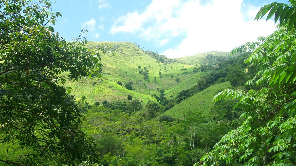
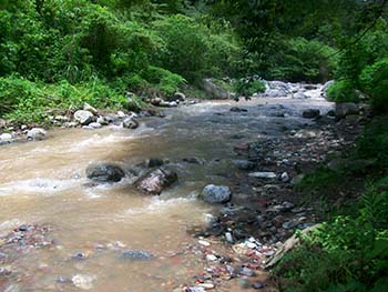
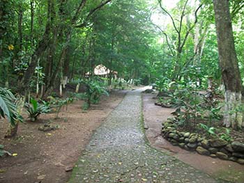
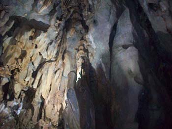
Forest Walking

Forest walking or forest bathing in Costa Rica is one of those activities that doesn’t get enough credit. It’s the perfect solo adventure, presenting a fantastic opportunity to connect with nature at your own pace. We would recommend starting off by visiting the hanging bridges in the Arenal Rainforest.

The whole point of visiting a country alone is to soak up its magic without distractions, and a walk through the hanging bridges of the Arenal Rainforest lets you do just that. Suspended above the trees, you’re treated to an uninterrupted view of the lush canopy below and the rich wildlife around you, creating a deeply personal and unforgettable experience.

Next up, spend a night in Monteverde’s Cloud Forest for a truly magical experience. Guided night walks reveal nocturnal creatures: glowing insects, owls, and elusive frogs. It’s a totally different world once the sun sets, and your curiosity will definitely keep you on your toes. Honestly, it’s like discovering a whole new world after dark.

During the day, don’t miss out on Corcovado National Park. It’s home to incredible wildlife and some of the lushest forests you’ll ever see. If you’re lucky, you might even catch a glimpse of a jaguar.

Forest bathing is not just about taking a walk—it’s an immersive ritual for the soul. The fresh, earthy air, the rustling of leaves, and the birdsong- they work like magic, helping to ease your stress, calm your mind, and reset your energy. It’s nature’s therapy in its purest form.

The Day Is Young, and the Adventure Has Just Begun

Solo traveling in Costa Rica offers unforgettable moments and the freedom to explore at your own pace. Whether you’re catching sunrises, surfing perfect waves, or walking through lush rainforests, each day promises a unique adventure. So, pack light, travel smart, and let the beauty of Costa Rica do the rest—you won’t regret a single moment.


Tagged With: Costa Rica solo travel Filed Under: Central America Travel

The Caledonian Dream

1699 map of Panama

A Scottish Effort to Colonize Eastern Panama in the late 17th Century

by Georges Fery

The conquest of the New World was devastating for its ancient cultures. Its aftershocks are still deeply felt today in communities across the Americas. Soon after Spain’s subjugation, other European nations tried to organize trade with her colonists or forcefully capture part of her new possessions. When foreign ships, among them were those of buccaneers and corsairs, succeeded in their penetration of Spain’s colonies, they returned to Europe with the rich spoils of the West Indies. Commercial ventures sprang up to trade or settle in those new lands. At the end of the 17th century, a Scotsman, William Paterson, devised a plan to establish a colony in Darien in eastern Panamá. In fact, it was no less than a filibustering expedition into Spanish America, with the aim of securing a foothold on the Isthmus. The plan was to control the passes over the central mountain range, with the goal of capturing a trade route between the Atlantic and Pacific oceans. A vision that flew in the face of reality given the two hundred years occupation of the isthmus by Spain.

William Paterson, a co-founder of the Bank of England and instigator of the Darien Scheme as it was called, was born in 1658 in Scotland. At seventeen, he was involved in a Presbyterian plot against the rule of King Charles II and had to run away from home. He went to Bristol, a port of infectious adventure and, at nineteen, he went to sea from there like the buccaneer Henry Morgan, to seek his fortune first in the Dutch settlement of New Amsterdam and then in the English colony of Jamaica. When he came back ten years later, he was a wealthy man; he had also acquired an understanding of trade and high finance, together with a collection of maps and reports of Central America, no doubt acquired from the buccaneers calling in Jamaican ports.

The end of the 17th century was the only time when the Scots could have formed the national project of a colony, since at this time, Scotland was independent from England. The “seven ill years” of the 1690s saw widespread crop failure, famine and extreme poverty that may have killed ten to fifteen per cent of the population; Scotland was desperate. In the ninety years since the death of Elizabeth.I (1533-1603), the Scots had shared the English kings but had their own Parliament, except when Cromwell (1599-1658), brought them under English rule.

In the 1680s, there was no sign that Scotland would ever be capable of embarking on such grand design as the one proposed by Paterson. He took his idea to Germany and offered it to the trading cities of Emden and Bremen, but everyone turned him down. So, he came back to England and settled in London as a merchant and, at thirty-nine, took a leading role in founding the Bank of England.

The Darien Company

In 1683, Scotland’s Parliament passed the Act for Encouraging Trade, and on June 26, 1695, created “The Company of Scotland Trading to Africa and the Indies,” generally known as the “Darien Company.” Paterson, and the Company directors’ covert plan was to capture a foothold on the isthmus, to secure a gateway and control trade between the Atlantic and the Pacific oceans. The company was given monopoly of trade for 31 years and freedom of taxation for 21. Paterson was named a director. On November 13, 1695, Paterson and his co-founders raised the capital for their venture; half of it in London, the other half in Scotland.

East India Company sailing ships drawing

The East India Company took alarm at the prospect of a Scottish rival and petitioned the House of Commons. Political pressure led the king to withdraw his already lukewarm support for the Darien Company, and the whole London stock issue had to be withdrawn. It was sold in Scotland; every Scotsman with a hundred pounds rushed to invest. That is when Paterson revealed his dream to his fellow directors and showed them his maps and reports from Darien; they were captivated by his plans. But at that time, England was at peace with Spain, and the English were forbidden to supply ships or sailors so the Darien Company was forced to order five ships to be built in Hamburg and Amsterdam. Large stocks of supplies and trade goods were purchased, which were stored in warehouses in Edinburgh.

The board of directors sent Paterson to Hamburg to pay for five ships and their equipment. He deposited the money with James Smyth, that proved to be an untrustworthy merchant friend in London. This led to a tragedy that had dire repercussions, and from which Paterson never recovered. To get a better rate of exchange, he was robbed of £17,000 by Smyth, of which £9,000 were later recovered. The investigation committee ultimately cleared Paterson of any wrong doings but held him morally responsible for the loss. He was told that he still could go on the expedition but only as a volunteer, without any official capacity or authority.

In November 1697, the five ships arrived in Leith Roads, Scotland, and wintered in the nearby Firth of Forth. In March 1698, the Company selected about 1,200 individuals, of which 60 were ex-army officers and soldiers; there were few women among them. At that time, a famine in Scotland pushed people to seek their fortune in faraway lands, and far more Scots volunteered than could be accepted. However, there was still no mention of Darien or any other destination. On July 17, 1698, the fleet set sail, taking the highest hopes of Scotland with it. The captains had received sealed orders, which they were to open in Madeira. Not a soul on board the ships, except for Paterson, knew for certain where they were going.

drawing of sailing ships

The five ships were the St. Andrew, the Unicorn, the Caledonia, the Endeavour and the Dolphin; the first three were armed merchantmen of forty-six guns, the last ones were tenders. Paterson was on board the Unicorn and traveled as a simple planter. Upon opening their sealed orders, the captains proceeded to a sandy bay southeast of Golden Island, off the coast of Darien, where they dropped anchor in a protected bay on the morning of October 30, 1698, they named it Caledonia Bay. The port was well sheltered from the sea by a long peninsula, where the Scots selected the site of New Edinburgh for their settlement. A battery of 16 guns was erected to command the harbor they called Fort St. Andrew.

Across the bay was the deserted Spanish settlement of Acla founded by order of the Governor of Castilla de Oro, Pedro Arias Dávila, in 1515. Acla was then to be the Atlantic anchor of a trail leading to a future town on the Gulf of San Miguel, on the Pacific coast.

Bay of Caledonia map

Spain was much alarmed by the invasion and settlement by other Europeans in its “Castilla de Oro” or Golden Castile territories. They remembered the raids of buccaneers on the isthmus by Francis Drake, twice: Nombre de Dios on the coast of Darien in 1572 and the sack of Panama in 1595, and then again by Morgan in 1671. The Spaniards realized that the Scots settlement close to Acla was not a random choice but one driven by a bigger plan than that of a trading outpost. The record shows that the Directors instructed the Council in Darien to purchase land on the Atlantic coast from the Indians as well as on the Pacific, “for certain reasons, of which you shall be acquainted with in due time.” The governor of Panamá and Cartagena gathered land and sea forces to evict the invaders. In December 1698, an English ship called on the colony and was able to report to England that the Scots were indeed carving a settlement in Spanish America, against the wishes of the Crown, then at peace with Spain. The king issued secret orders to the English colonial governors of America, forbidding them to trade, supply food or offer any assistance to the Scottish colonists.

In Darien a small group of Cuná Indians approached the Scotts settlement waving their unstrung bows, a sign of friendship, no doubt they learned the hard way from the Spaniards. The Scots told Pedro the headman, that they meant to settle in Darien if the Indians received them as friends. After two months, a turtle-hunting ship stopped over and the colonists took that chance to send their first report to the Company at home. The report reached Edinburgh in March 1699. All over Scotland, there was rejoicing and pride at the news of the colonists’ safe arrival, the Indians’ welcome and the verdant beauty of the country. At the very time the bells were ringing in Scotland, and prayers of thanksgiving were being offered in the churches, the colonists were faced with disaster.

The seeds of the ultimate tragedy had been planted by the stubborn ignorance of the Company’s directors. They had not only fitted the expedition out with a ludicrous choice of supplies and goods, and rejected Paterson, who was by far the wisest man at their disposal. They had appointed a council of seven men to rule the colony but had not appointed its president. It was to be run by a committee, the catastrophic effect of such decision was to deprive the colony of effective leadership.

A Heavy Price For Terrible Mistakes

In April 1699, the worst disaster hit them. It had started to rain. The settlers had arrived, by chance, at the beginning of the dry season, but now it was over. Their delight in the climate, which had at first seemed so healthful turned to disgust and horror. For the colony, Paterson had selected a site in the middle of the coast of Darien, because he believed there were no Spanish settlements there. The reason, of course, was that no European had ever been able to live for long there. The rainy season arrived and now, with pouring rains, the swamps steamed, the mosquitoes bred, and the Scotsmen paid a heavy price for their terrible mistakes.

Colony of Darien map

Upon receipt of the first report of the colony, and while the directors in Scotland were rejoicing over the good news and anticipated profits, the Caledonians were preparing to leave Darien. The accumulation of troubles, very real and oppressing, and fears both justified and fancied, brought the colony into a state of panic. Furthermore, sickness among the colonist, attributed to “flux and fever” (yellow fever), aggravated by lack of food took a heavy toll, and about 400 of them had already died of diseases. On June 22, 1699, about eight months after landing, and having heard nothing from the company, the 800 enfeebled survivors evacuated New Edinburgh.

Each ship selected her own course to hasten away from the mortal bay. The St. Andrew reached Jamaica, losing 120 persons to sickness. Paterson was carried on board the Unicorn in delirium; his wife, her maid and his clerk had already died; this ship steered for New York, losing about 250 souls to diseases. In New York, they found the Caledonia which had arrived ten days before, having lost 150 people to the same causes. People that died in transit were perfunctorily buried at sea.

The story ought to have ended there, but it did not. It started all over again, simply because nobody on either side of the Atlantic knew what was happening on the other side. The directors fitted a small relief fleet with provisions made up of two ships, the Hopeful Binning of Bo’ness and the Olive Branch with 300 recruits. The small fleet sailed from Leith Roads on May 12, 1699. They found New Edinburgh deserted. A week after their arrival, a careless accident by a steward set fire to the Olive Branch, burning all supplies. The would-be settlers could not stay with the few supplies in the second ship, so about 12 Scots elected to stay in Darien, including the carpenter and his wife, while the rest boarded the remaining ship which sailed to Jamaica, where most of them died.

A third expedition was ready to sail in the Clyde in western Scotland, on August 18, 1699, four days after the Unicorn, from the first expedition, had crept into the port of New York. The news of the Colony’s desertion was on its way to Scotland, and if only it could have arrived in time, the new ships might have been reequipped and the old mistakes rectified.

The Caledonian Disaster

The four ships in the Clyde, packed with over 1,200 men and a few women, were delayed a whole month by contrary winds. Meanwhile, a ship was beating its way across the Atlantic bearing the news of the Caledonian disaster. It finally reached Bristol and a coach rumbled up the Great North Road to Edinburgh with the details. On September 22, 1699, while the fleet still waited, orders were dispatched to the fleet commander with new instructions. The captains, fearful of further delays and since that night the wind had changed course, disregarded their instructions. In less than twelve hours after receiving the orders, the fleet set sail at dawn on September 24, 1699.

This third expedition was the largest body of colonists sent to Darien and was called the Rising Sun Party. The four ships party were, the Rising Sun, the Company’s Hope, the Duke of Hamilton and the Hope of Boroughstomen. The Rising Sun Party reached Caledonia Bay on November 30, 1699 and was shocked to find New Edinburgh deserted. During the trip, 160 people perished, and once again all the old mistakes from the first expedition were repeated. Like the previous parties, things went rapidly from bad to worse. Time and again, the headless council overrode the most sensible advice made by knowledgeable people; its members fighting among themselves could not grasp the magnitude of their mission.

A sloop from Jamaica brought news of four Spanish men-of-war that had newly arrived from Spain to Portobello, a few miles from Caledonia on the Atlantic coast, and of three more expected from Cartagena. On February 13, 1700, Cuná Indians warned the colonists of a Spanish army approaching across the isthmus. Two days later, Captain Alexander Campbell and Lieutenant Turnbull, with two hundred Scots and forty Indians, clashed with the Spaniards and defeated them. Both Campbell, Turnbull and Chief Pedro were wounded while seven Scots were killed. The Caledonians were elated over the “successful” encounter, but their joy proved to be short lived, for this was only a skirmish. A few days later, on February 25, eleven Spanish men-or-war anchored within Caledonia Bay, in plain view of the settlement.

soldier with sword image

Following the interrogation of two Scottish deserter, the enemy landed troops at Caret Bay, two leagues to the west of the settlement, under the command of the Darien governor, Don Miguel Cordoñes. Spaniards, Creoles, and Choco Indians were reported coming from Panamá and others from Santa Marta. A few skirmishes left several Scots dead and wounded; they could not be replaced. In defiance of serious losses and the Caledonians’ bravery, the Spaniards advanced their line of battle to within a mile from the Scottish fort. They also captured small streams, a half mile from the settlement, where the colonists got their drinking water. There were no options but to surrender.

Articles of  Capitulation

During the second meeting with the Scots on March 31, 1700, and their signing the Articles of Capitulation, the Spanish commander, Don Juan Pimienta governor of Cartagena and Panamá, gave the Scots fourteen days to prepare for sea and leave Darien. The capitulation terms were favorable to the Scots allowed to retain their weapons and leave with drums beating and colors flying. The Cuná Indians were included in the Seventh Article that specified that they would not be molested following the Scotts’ withdrawal.

Early in the morning of April 11, 1700, the sixty-gun ship Rising Sun, was helped by a Spanish ship out of a wind locked Caledonia Bay. The following day, the three other vessels sailed, heading for Blewfields, Jamaica. All four vessels met with disaster. The Hope of Boroughstomen leaked so badly, it had to be sold in Cartagena. The Company’s Hope missed Blewfields and was wrecked on the rocks called Colorados off the west end of Cuba. The Rising Sun reached Blewfields then struggled on to Charles Town in Carolina where, on August 24, 1700, it anchored about 9 miles from the harbor on a sand bar. Two week later, the ship was lost to a hurricane together with all hands, 112 passengers and Captain James Gibson. The Duke of Hamilton also went down in the same storm, but the crew was saved for most were on shore.

sailing ship in storm image

The 1,200 members of this third expedition fared no better than those of the first two. On the outward voyage, 160 perished, 315 died during the brief stay in Darien, and after evacuating New Edinburgh, 250 died of diseases and, with a hasty ceremony, were thrown overboard. Another 100 or so died in Jamaica, and 112 were lost in the wreck of the Rising Sun. About 360 survivors were dispersed among the English settlements; fewer would return to Scotland.

What Happened to William Paterson

As for Paterson, he reached home from New York on December 19, 1699, too late to help save the third expedition. Yet, even after this third disaster, he refused to give up. Now, however, he could not convince anyone. The Crown’s investigation of the disaster lay most of the blame on the directors in Edinburgh. On March 25, 1707, the Parliament of Scotland’s last motions before its dissolution, was to reimburse the Darien subscribers for their losses and “to recommend Mr. William Paterson to her Majesty for his good services.” In 1714 an Act of Parliament of Great Britain granted Paterson an indemnity of several thousand pounds. He died in 1719 in his native land and is buried in Sweetheart Abbey.

The wreck of the Scots dream carried a heavy toll. The cost was horrendous, accounting for the loss of nearly 2000 souls, in the Darien and at sea. From the 14 ships that sailed from Scotland, 11 never returned. Should a traveler visit Caledonia Bay today, one would only see those indestructible remains the jungle could not eradicate. There is the berm of the moat that the Scots dug to defend Fort St. Andrew. Indians today pole their canoes in it, and have no idea or care, what it is. The actual fort built of wood, decay and vanished long ago. The place where it stood is covered by a dense palm grove and tropical foliage; among their roots, if anyone cares to disturb them, the bones of a thousand Scots might be found.


Image Credits:

Graphic.1 – Map of the Isthmus of Darien, 1699 – Credit: Trustees of the National Library of Scotland, Edinburgh
Graphic.2 – Ships of the East India Co. – Credit: in “The Disaster at Darien”, Russell Hart, Riverside Press, 1929
Graphic.3 – Toward the Unknown – Credit: artwork @ art-antiques-design.com
Graphic.4 – The Bay of Caledonia – Credit: Wikipedia.org, public domain
Graphic.5 – The Scots at Caledonia Bay – Credit: Wikipedia.org, public domain
Graphic.6 – A Short Lived Victory – Credit: artwork @ elgrancapitan.org
Graphic.7 – Return on Stormy Seas – Credit: Andy Simmons, 2004 @ ans.graphics.co.uk

References:

The Disaster of Darien – Francis Russell Hart, Riverside Press, 1929
Caribbean Sea of the New World – German Arciniegas, Knopf, 1946
Old Panama and Castilla del Oro – Dr. C. Anderson, North River, 1944
The Darien Disaster – John Prebble, Secker & Warburg, London, 1968
The People of Panama – John and Mavis Biesanz, Columbia Press, 1955
The Price of Scotland – Douglas Watt, Luath Press, Edimburgh, U.K., 2007

About the author:
Freelance writer, researcher and photographer, Georges Fery (georgefery.com) addresses topics, from history, culture, and beliefs to daily living of ancient and today’s communities of the Americas. His articles are published online at travelthruhistory.com, ancient-origins.net, popular-archaeology.com and in the quarterly magazine Ancient American (ancientamerican.com), as well as in the U.K.  at mexicolore.co.uk. The author is a fellow of the Institute of Maya Studies instituteofmayastudies.org Miami, FL and The Royal Geographical Society, London, U.K. rgs.org. As well as member in good standing of the Maya Exploration Center, Austin, TX mayaexploration.org, the Archaeological Institute of America, Boston, MA archaeological.org, the National Museum of the American Indian, Washington, DC. americanindian.si.edu, and the NFAA, Non-Fiction Authors Association nonfictionauthorsassociation.com.
Contact: Georges Fery – 5200 Keller Springs Road, Apt. 1511, Dallas, Texas 75248, (786) 501 9692 –gfery.43@gmail.com and www.georgefery.com


Tagged With: Darien disaster, William Paterson Filed Under: Central America Travel

Chillin’ on the Chicken Bus in Guatemala

Guatemala chicken buses and driver

by Rick Neil

The first streaks of daylight brush the sky as I approach the bus station in Huehuetenango, Guatemala. My breath is visible in the dank morning air as I search for my bus among the worn-out Bluebird models strewn across the dusty lot. I locate my chariot near the back, the most beat-up warhorse of all. The destination is scrawled barely legible across the front: “Nebaj”.

Over the past week, I’ve traveled to popular Guatemalan destinations like Antigua and Chichicastenango in secure private minivans. Now, spurred on by tales of lush semi-tropical forests and vibrant Mayan culture, I’m about to venture into the country’s seldom visited northern highlands. Comfy shuttles are not an option here. The only modes of transport are segunda clase “chicken buses” that take animal as well as human passengers. The seven-hour trip ahead should be anything but boring.

 I toss my bag up to a young guy on the roof, who fastens it among the others, securely I hope. Several local men squat amongst the baggage. Their situation doesn’t look too comfortable, but upon entering the bus I’m tempted to climb up and join them. The seats are bench-style, designed for two bodies but with three jammed into each. And those are the lucky ones. From front to back bodies stand pressed together like cold anchovies.

chicken bus guatemalaI shove my way to the rear where I hope it might be less congested, but no such luck. I’m surrounded by people who look to be Mayans or a mix of Latino and Mayan. The women have long raven hair, tawny complexions, and full Mayan lips. Many wear huipiles, handmade garments woven in multihued geometric patterns.

The men are not as colorfully attired. A few wear crisp, black suits but most look as if they’ve been wearing the same wrinkled garments for days. They have the lined faces and cracked, blackened hands of dirt farmers. I spot only one chicken, tucked quietly beneath the jacket of a sheepish-looking gent seated by the window. I’m kind of disappointed, until I notice three squealing baby pigs tied to the back of the rear seat.

As more people continue to squeeze onboard, I’m pushed even further back. An old man with sun-baked skin and a toothless grin leans into me, reeking of gin and chili peppers. Again I consider joining my backpack in the crow’s nest. In spite of the cramped conditions and early hour, the passengers are animated, chattering and laughing with typical Latino gusto. My limited Spanish only permits me to grasp smatterings of conversations, but I understand enough to realize that everyone is gossiping about friends and family. “My son wants to move to Guatemala City,” a stout, middle-aged man grumbles. “Who will help me on the farm?” “How can Lupe marry that worthless drunk?” a young Mayan woman with coal-black eyes asks. “She thinks she’ll change him but we’ll see.” Apparently, this bus is not just a means of transport, it’s a local forum.

I’m jolted from my musings by earsplitting Latino music pounding from a cassette our driver has plopped into the dashboard stereo. It’s way too early for this, I think, until I realize that this musica may be the only thing keeping our pilot awake.

As the The Gipsy Kings resonate throughout the bus the engine groans and then roars to life. The driver, who wears a torn, filthy t-shirt far too small to contain his massive belly, spits out the window and grinds the skeleton-head stick shift into gear. He makes the sign of the cross to a tiny image of Jesus as we lurch over mammoth potholes and onto the road in front of the station.

Within minutes the city lights fade as we ascend into brown, rocky hills toward lush, green mountains. In the muted light of daybreak I observe an old man in a white outfit leading a donkey up a dirt path. Naked children bathe in tubs outside modest adobe homes.

On a steep incline a camouflage green army truck races by. Bleary-eyed soldiers dressed in fatigues crouch in the back, shivering in the frosty morning air. They look no more than sixteen, clutching rifles nearly as big as they are.

When I check to see if my money belt is still with me, I realize that I no one has come to collect bus fare. I wonder if we pay when we get off, though that seems unlikely. My question is answered when a pimply, teenage boy clutching a wad of bills emerges from the wall of humanity in front of me. Somehow he manages to collect money from each passenger, make change, and inform the driver where each party wants to be dropped off. I lay out fourteen quetzals, or about two dollars, for the seven-hour trip, a tenth of what I paid for private shuttles.

Guatemala chicken busWe never pass anything that resembles a bus stop. If someone wants to be picked up they stand by the roadside and gesture at the driver. Passengers are dropped off wherever they please. After the baggage guy has tossed down their luggage from the roof he signals with a loud BANG-BANG on the metal roof that it’s okay to move on.

After a couple of hours we’re in the mountains. The bus whimpers up the increasingly windy, now unpaved road. It’s full daylight now but low clouds make for poor visibility. Through the mist I catch outlines of turquoise mountains, fertile valleys, and fields of corn. At the base of a cliff I spot an overturned bus just like the one I’m on. Flowers decorate nearby tombstones, a reminder that this journey is no magical mystery tour.

When we approach the first of several hairpin turns, a fourth crew member jumps off and runs forward to check for oncoming traffic. When he is satisfied that the road ahead is clear he indicates with a shrill whistle that it’s safe to continue. He then leaps back on while the bus is moving. Once, when a truck approaches around the bend ahead of us, we must inch slowly down the hill for several hundred feet till we reach a point wide enough for the vehicle to pass. I’m numb with fear the entire time, but my fellow passengers seem unruffled, as if they go through this all the time.

Just after we’ve negotiated a particularly sharp curve, we approach a wide clearing where the army pickup that passed us earlier is parked next to a larger military truck. A young soldier motions with his rifle for us to pull over, and then barks something at our driver who motions for us to disembark and wait outside.

What now? I wonder. I read that there had been problems with rebel guerillas but that the region was now stable. I wonder if the soldiers are on the lookout for banditos, or if they’re only disguised as soldiers and are actually banditos themselves. What if I’m held for ransom? I realize that no one back home knows I’m here. I have visions of myself as the subject of a CBC documentary about a Canadian who mysteriously vanished in the highlands of Guatemala.

A moustachioed hombre in fatigues emerges from the rear of the truck brandishing a long metal object that looks at first glance like a machine gun. My heart leaps into my throat, but as he approaches I can see that he is actually carrying a large canister. He enters the now empty bus and proceeds to spray the inside from front to back. After he finishes what I assume is a de-lousing we are told to re-board and within minutes we’re back on our way. For the next twenty minutes everyone is sneezing and coughing from the noxious fumes. I’m certain that whatever I’m inhaling is not at all healthy, but relieved that my name is less likely to pop up on the CBC news.

A voluptuous señora with a prominent beauty mark beams up at me. “We arrive very soon in Nebaj,” she explains in halting English, “is very lovely and good Mayan culture.”

“I hope so,” I tell her, “I’ll be glad to get off this bus.”

“This normal for me,” she chuckles, “I ride every week this bus for work.”

I nod, reflecting on my “chicken bus” odyssey. This ride hasn’t exactly been fun, but for the last several hours I’ve definitely been living “in the moment”. Part of the reason for my wanting to visit the secluded village of Nebaj was to seek out an authentic Mayan experience. To my surprise, I found exactly that on this dilapidated bus. As we approach the outskirts of Nebaj I recall the new age mantra: “It’s not the destination, it’s the journey.”


If You Go:

NEBAJ

Nebaj is the largest of three villages that make up the Ixil Triangle in Guatemala’s northern highlands, one of the smallest ethnic regions in Central America. Few tourists venture to this isolated area, though it offers spectacular scenery and captivating Maya culture. Local women wear blouses with multi-colored geometric patterns over bright crimson skirts, and decorate their hair with red and green pompons. Many sell gorgeous hand-woven wall hangings, crocheted handbags and thick woolen blouses directly from their homes.

Nebaj is only accessible by second-class bus from Huehuetenango (7 hrs.) Santa Cruz del Quiche (2.5 hrs.) or Sacapulas (1.5 hrs.). Reportedly, the road has recently been paved. Pack some Gravol.

HOTELS, RESTAURANTS and HOMESTAYS

For a small town well off the beaten track, Nebaj has a good selection of budget and mid-range accommodations priced from $20 to $40 for a clean basic double. All are within a few blocks of the main square, and many have internet access. It is also possible to arrange a homestay with a local family in Guatemala, or to bone up on your Espanol at a local Spanish school.

www.nebaj.com


Tikal Maya Ruins Full Day Tour from Guatemala City

About the author:

Rick’s travel career began as a college student when he impulsively signed up for an international student exchange program and spent that summer working in Turkey. “Don’t go there!” the naysayers said, “it’s not safe!” Luckily, Rick ignored their advice and discovered that the outside world is a place of wonder worth exploring. Since then his wanderlust has taken him to Central and South America, England, Vietnam, Morocco, and China, where he spent an unforgettable year teaching English. Rick makes his home in East Vancouver, Canada, where he writes for various travel publications.


Guatemala chicken buses and driver photo by: Erik Albers / CC0

Tagged With: chicken bus, guatemala homestays, guatemala travel, Nebaj Filed Under: Central America Travel

Honduras: Exploring Talgua Cave

Catacamas, Honduras countryside

by James P. Hogan 

The September day was just starting to get pleasantly warm as our taxi deposited us on a dirt road almost five miles from the large town of Catacamas, Honduras. Looking up the road, my companions and I could see our way leading us along a river, the Rio Talgua. Our destination, Parque Arqueologico Cuevas de Talgua, lay a short distance ahead and along the river, tucked into the high Sierra de Agalta range of mountains.

river near talgua caveIn the 1990s, some American Peace Corps volunteers discovered skeletal remains that were in the cave and publicized their find drawing world-wide attention to the park. The cave soon became known as “the cave of the Glowing Skulls” due to light reflecting off deposits of Calcite on the skeletal remains found there. Who these people were is still uncertain, as this part of Honduras had been something of a frontier zone between the Mayans to the north and other people groups to the south. Archaeologists have estimated the remains to come from between 900 and 1000 B.C.

path leads to cave entranceEntering the park, we made our way down a narrow but clear path by the river. September falls within the “wet season” in Honduras and the swollen, flowing body of water to our left was evidence of this. The path itself hugged the side of the mountain on the one side of the river. Towering over the river not far from the water’s edge loomed the light green of a partially treeless mountainside. The bright green of the mountain combined with the clear, cloudless blue of the sky to give me a feeling of smallness in the face of a powerful and overwhelming natural world.

A guide was waiting in front of the entrance to the cave and following behind him, we entered into the darkness. Winding our way into the silent, rocky cave I found myself meandering slowly and enjoying the sounds round about. Most noticeably there was the sound of running water. At times, this could be a faint trickling in the distance and at times it was louder and nearer, such as when our path crossed a small underground stream. Whereas the cave had no doubt once made a superb home for wildlife, the only animals to be seen that day were bats. At times, some fluttered quite close to our heads as they made their way through the darkness in search of food.

metal bridge into caveThe path itself varied throughout the length of the cave. At times it was a metal bridge spanning a bed of rocks or a crack in the rocks. Other times it was a soft bed of dirt and dust, dust such as might have been trod on by the indigenous inhabitants of the region nearly 3,000 years before. Sometimes the path grew narrow, forcing us to stoop momentarily. A minute later, we might emerge into one of several rooms that were found in the cave. Several of these had ceilings so high one would have to squint to see it in the dim light cast by small electric bulbs placed throughout the cave.

cave stalactitesPerhaps the most important thing to be seen there were the stalactites and stalagmites. There appeared to be more of the former. These were large chunks of hardened lime that looked like snow, formed from hundreds if not thousands of years of dripping water. Some clung to the ceiling, others were partially attached to the rocky walls of the cave. Often, these were not entirely white, being tinged with yellow or a little bit of brown due to some other substance being in the water. Each one was like a well-shaped piece of art.

Eventually, we came to a ladder. The cave did not appear to go any further. Climbing up this ladder, we could peer into a tiny chamber. Bars prevented us from entering there and there was no other exit to it. The guide told us this had been a burial chamber but now it appeared to have been emptied by archaeologists. Following this, we slowly made our way outside the dark gray cave and back into the sunlight and noises of the lush green forest. Out amongst large trees shading the winding path, I felt at peace. With the cave to my rear and the river in front of me, all sense of hurry and belonging to an outside world not far away had vanished. With no sense of reluctance, I basked in the here and now.

If You Go:

A taxi ride from nearby Catacamas will cost you no more than $2 to $3. If you arrive at the right time, buses travel between Catacamas and Talgua and will no doubt charge an even lower fee than the taxis. While Hondurans pay only $1 to enter, Americans pay $20. The guide will also charge several dollars. In addition to the cave itself there is a small but interesting museum and visitor center with some artifacts or replicas of artifacts displayed that had been found in the cave. Between two and three hours should be allowed in order to see everything. It is open daily from 9 am to 5 pm.


20 day Guatemala – Belize – Honduras – middle class

from: Viator

About the author:
James P. Hogan is an aspiring travel writer who lives in Vermont. He has worked at various professions over the years and in between has found time to do some traveling on three different continents. James is hoping to work more on the photography aspect of travel writing to better supplement his articles. You can read more about his adventures in Honduras at his blog at: vermonttraveler.wordpress.com/

All photographs by James P. Hogan

  1. The mountain side on the other side of the river
  2. The Rio Talgua, full of water due to the wet season
  3. The tree shaded path outside the cave
  4. A metal bridge as part of the path
  5. Stalactites hanging from the ceiling of the cave


Tagged With: cave of glowing skulls, honduras tours, honduras travel, talgua cave Filed Under: Central America Travel

Honduras: The Mines and Ruins of Yuscaran

Yuscaran Honduras

by James P. Hogan

It was as if I had become Indiana Jones. A North American following behind a guide native to the country, swatting at pesky insects as he made his way through thick forest and brush in search of something. But whereas the fictional adventurer was in search of riches, I found myself on this overcast fall day searching for traces of those who had themselves gone in search of riches.

Thankfully, in order to be at this place I hadn’t had to travel to the depths of the Amazon or anywhere in South America. Tegucigalpa, the sprawling capital of the Central American nation of Honduras, is less than 3 hours by plane from Miami. From there, a two-hour bus ride will take you to the sleepy town of Yuscaran, located under the brooding shadow of the mountain of Monserrat.

Yuscaran wasn’t always so quiet. Founded in the early 18th century by the Spanish due to both gold and silver being found in the area, Yuscaran received an injection of activity in the 19th century as mining companies from Europe and North America set up operations in the town, bringing it prosperity in a country which had and continues to have very little of it. While this activity eventually evaporated a little past the midpoint of the 19th century, traces of this era are still to be found there today.

On the recommendation of some friends in town, I decided to investigate some of this history myself. The guide for this tour, Carlos Rodriguez, is a life-long native of Yuscaran. Following his lead, I wound my way down a street which quickly turned into a washed-out road filled with stones of various sizes. To the left could be seen a stone foundation in a field not far out of town. This, he explained to me, was the remains of a building that was once part of a mining company from Great Britain.


Walking down to the river from Yuscaran Not long after this, we reached the Rio Aguacatal. This river had been used by the mining companies for gold panning. The day I was there, there was only some garbage (usually of the plastic type) to be found. With the noise of the river in the background, I re-entered the forest with Carlos leading the way. Soon we found more ruins, again largely foundations of varying sizes. These were surrounded by and at times overgrown by the lush vegetation typical of most of Central America. Carlos explained that some of these had once been houses for workers in the mines. Others had been buildings used by the mining companies for different mining-related activities.

One of the women in stone guarding the entrance to the burial place Much like the fictional adventurer in the movies, I suddenly found myself brushing aside plants to find something in stone. In my case, it was something far less dramatic. The specter-like forms of sleeping women carved in stone peered back at me. This pair of silent ladies mark the entrance to a round, open-aired area with the remains of a crucifix carved in stone and flanked by two more women similar to the ones at the entrance. Like the women outside, the stone was partially broken away. Carlos explained that this spot marked where Spanish miners who died of disease had been buried over 200 years ago. Upon entering, I felt almost as if I was committing sacrilege standing in such a place and felt slightly more at ease when I left the place.

Up the hill and through the forest, the trail fell away vertically only a few feet from where I stood. Looking down, the ground dropped away for more than 30 feet to the forest floor on three sides. Peering through the trees, I realized this had been a large building. Carlos explained that this had been where a mining company had kept a large piece of machinery for one of their buildings. It was truly awe-inspiring to think of such a large piece of metal being hauled all the way to that spot.

Inside the burial area 
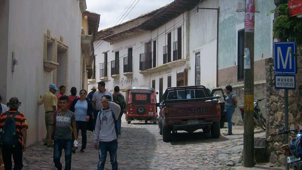
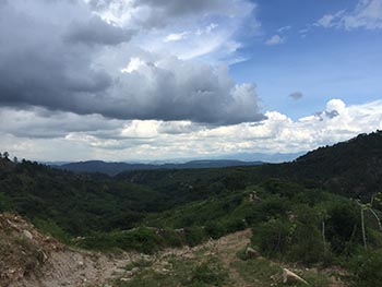
But the tour was far from over at this point. The air became clearer as we made our way uphill through long grass and pine trees towards the dusty road. A clear view could be had of mountains nearly 10 miles to the northeast. Reaching the road, we walked back towards Yuscaran. While the ruins had been interesting, there had been no mines. Now, Carlos promised to show me some.

Along the way, we sidetracked a short distance to view the entrances to some of the mines. While some entrances were near the road and filled with trash, others off the main road tended to be built straight down into the ground. Carlos had been in some of them before and gave me some details as to their dimensions. While none of them were especially long or deep as mines go, he spoke of there being dozens of them located in the near vicinity of Yuscaran.

By the time the tour had finished, I was starting to tire. Yet none of my day was regretted. Getting to see, touch, and feel history all around me was an experience to be treasured. It isn’t every day one can feel like an explorer and for a small fee, that opportunity can be had by many.

If You Go:

Buses leave from Mercado Jacaleapa on the east side of Tegucigalpa for Yuscaran every hour or so. A one-way bus ride to Yuscaran costs a little less than $2.

La Casa Fortin is a museum dedicated to the town of Yuscaran. Many pictures and artifacts relating to its history and that of the mines can be found there. It is located just down the street from the central park. Hours of admission are from 9 am to 4:30 p.m. Admission is free. To contact Carlos Rodriguez, ask Oscar Lezama, the curator here.

About the author:
James P. Hogan is an aspiring travel writer who lives in Vermont. He has worked at various professions over the years and in between has found time to do some traveling on three different continents. James is hoping to work more on the photography aspect of travel writing to better supplement his articles.

All photographs by James P. Hogan
A street scene showing old houses in Yuscaran
Walking down to the river from Yuscaran
One of the women in stone guarding the entrance to the burial place
The inside of the burial area


Tagged With: honduras travel, Yuscaran mines Filed Under: Central America Travel

  • 1
  • 2
  • 3
  • Next Page »

MORE TRAVEL STORIES:

Ports of Menorca, Spain: Cuitadella and Mahon

Riding the White Pass & Yukon Railway

Greece: Marathon and the Ghosts of Ancient Warriors

Arizona: The Navajo’s Long Walk

Detroit’s Hamtramck Neighborhood

The Endless Conquest of Yucatán

France: The Historical Roman Bridge of Sommieres

What Happened to the Minoans on Crete?


SEARCH

DESTINATIONS

  • Africa Travel
  • Antarctica travel
  • Asia Travel
  • Australia travel
  • Caribbean Travel
  • Central America Travel
  • Europe Travel
  • Middle East Travel
  • North America Travel
  • Oceania Travel
  • South America Travel
  • Travel History
  • Travel News
  • UK Travel
  • Uncategorized
  • World Travel
facebook
Best Travel Blogs - OnToplist.com

Copyright © 2025 Cedar Cottage Marketing | About Us | Contact | Privacy Policy | Terms & Conditions | Copyright Notice | Log in