Memories of a Tragic Past
by Wynne Crombie
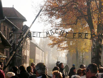
When I first saw the sign, it was a black and white photograph against a background of snow. The sun sparkled on the words that once struck so much terror … Arbeit Macht Frei. Ahead of us were brick buildings that could have come from a college campus. They were former Polish army barracks. The few birch trees adjacent to the sign were still shedding their leaves. Two adjectives came to mind: peaceful and simplistic. These were hardly words for a former concentration camp. From 1941-1945 one million people had been killed here. My husband Kent and I were at Auschwitz.
 We were part of a continuous line of visitors from around the world who did not need a Silence sign. The only noise came from the shuffling of feet. We were on a tour of Poland and had been visiting Krakow. After making the one hour drive from Krakow, we arrived at Auschwitz I. (Auschwitz II or Birkenau, is a mile away). Admission is free.
Anya, our English- speaking guide, told us she felt a strong sense of responsibility in sharing the story of the camp. Someone asked if this didn’t become stressful after a time.
“It helps to know,” Anya replied, “that I am informing people about what happened here. It becomes second nature after a while. I don’t think of the deaths.”
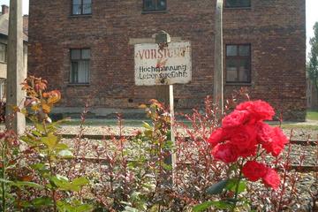
I felt the rocks on the dirt path as we began our trek. I was wearing shoes while Auschwitz prisoners had walked in bare feet, even in winter. The kitchen building with its smokestacks was on the right. In its foreground a band had played. Anya told us this had been a way to increase camp morale. An enlarged black and white photo of the musicians was displayed next to the building. The entire perimeter of the camp was surrounded by a barbed wire fence and twenty-eight watch towers with armed guards. This made prisoner escapes virtually impossible. Even so, there were one hundred escapes over the four years.
 During the early days, the Nazis would take pictures of each inmate. These seemingly endless 8 x 10 glass-covered photographs surrounded a long narrow hall. The inmates looked healthy, for they had just arrived. The name was printed below each photo and included the date of arrival and the date of death—sometimes just days apart. When photography became too expensive, the Nazis started tattooing numbers on the inmates’ arms.
In the next barrack was a gallery of a different sort. Sculptures and paintings of camp life were on display. The artwork had been done in secret, as it was strictly forbidden. Cameras had been smuggled in and photos out.
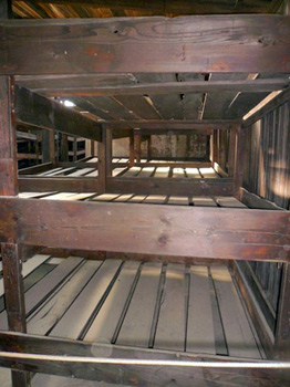
Those who managed to survive the “Selection Process” upon arrival were housed in unheated barracks. There was no running water and they could use the toilet only twice a day. Ventilation came from holes in the roof. The stench would become so bad, the guards would not go in. Three hundred prisoners were crammed into each barrack. The prisoners slept six to a bunk on straw mattresses. They had to lie on their sides so they would all fit .My first thought was, that’s not even enough room for one person.
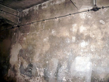 Those who were not selected for the barracks were told they were to take showers. Only Zyklon-B gas was used instead. (The shower heads are still embedded in the cement wall). From there, their bodies were taken to the crematorium The Nazis destroyed evidence of the gas mass killings by blowing up the buildings. Anya told us they liked to use gas because they didn’t have to look at the person while he was being killed.
How could the guards do this every day?
“For the most part,” said Anya, “guards were ordinary people who could kill by day, and then go home and be loving fathers and husbands.”
 This was confirmed by Jerzy Kowalewski, an eighty-eight-year-old Auschwitz survivor. We attended a seminar he had given in Warsaw.
He said: “I had been imprisoned for being an underground resistance fighter. Somehow I was given work at the commandant’s home. One morning he invited me to have breakfast with his family. There were eggs, bacon, real coffee….everything. He was wonderful to me. That afternoon I saw him take a pistol to a prisoner’s head and shoot him. It made no sense.”
We found ourselves looking into Room Five of the so-called, Death Block. These barracks held the “court rooms” where the prisoner was tortured into confession, tried, and sentenced to death. The table that had been a part of the “sham trials” was still there. The Gestapo found everyone guilty.
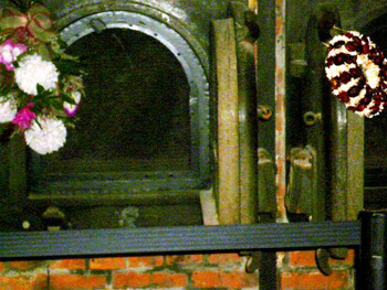
Father Maksymilian Kolbe, a Catholic priest who was interned at Auschwitz, offered to take the place of a man who was about to die The Nazis put him in the “Starvation Cell” where he remained until he died. Today, a simple bouquet of chrysanthemums and a candle mark his cell. In 1982 he was canonized by the Catholic Church.
Anya showed us where they removed the prisoners’ clothes and marched them out naked where they were shot in front of the “Death Wall. Their bodies were placed in gravel pits in and around the main camp.
 At the daily roll call, the entire camp stood in their meager rags as the SS guards called out their names. The roll call was given as a collective punishment for the wrongdoing of just one prisoner. The inmates stood for up to four hours in the rain and snow. Some of the extremely weak and sick prisoners would die in the lines during the roll call. After roll call, the prisoners received their ration for breakfast. They were given 10 ounces of bread with a small piece of salami or one ounce of margarine and brown, weak coffee, with no sugar.
Even after Anya had presented the evidence I still couldn’t put it all together, until we saw the barracks I call, the Evidence of Living. Then the people became real.

 In the Block (or Building 5), on either side of the middle aisle, behind glass, were piles fifteen feet high of human hair on both sides. Rows of long braids popped out at me first.
Ironically, I did not see any grey or dyed hair. In a nearby case a three by five foot blanket was on display. It had been made entirely of human hair. There were also piles of eyeglasses, artificial limbs (from WWI vets) shoes and suitcases. and other items of a personal nature.
It has been sixty-five years since these atrocities occurred but with such overwhelming evidence, people will not forget. In fact, photography is encouraged, so that the world will remember. In addition to all the visitors, once a year 8,000 schoolchildren make the mile walk from Auschwitz I to Auschwitz II (Birkenau).
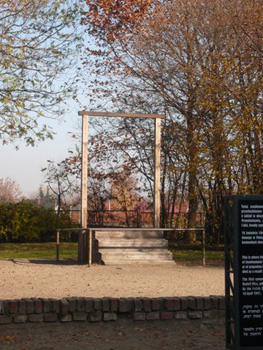
It is fitting that Rudolf Hess, the first commandant of Auschwitz, was hanged in 1947, a few feet away from where he murdered his victims.
Auschwitz Birkenau Tour from Krakow and Evening Klezmer Music Concert with Dinner
If You Go:
♦ Auschwitz to Auschwitz II-Birkenau is a 20 minute walk, or you may take a taxi.
♦ Krakow to Auschwitz is about an hour’s bus ride. Catch the bus at the main bus depot at 18 Bosacka. You could take the train, but it is not as convenient.
♦ Auschwitz to Krakow buses can be found in the main parking lot next to the Auschwitz I entrance.
♦ Lodging: Oswiecim (the Polish name for Auschwitz) is a town of about 4,000 people and does have a few hotels. However, we found the Auschwitz experience to be so profound, we had to go back to reality to try and sort out what we had just seen. We stayed in Krakow.
♦ Food: There is both a café and cafeteria at Auschwitz I. The people at the information center are very helpful.
♦ Lodging in Krakow: We stayed at the Radisson Blu, a large chain hotel. It was rather impersonal, but featured a fantastic breakfast buffet. Very centrally located, just off the Old Town Square.
♦ Dining in Krakow: We heartily recommend the Wesele right on the Square. It reminds you of an old country inn. Polish cuisine. I had the goulash in a bread bowl. Superb.
Full-Day Auschwitz-Birkenau and Oskar Schindler Factory Tour from Krakow
About the author:
Wynne Crombie has a master’s degree in adult education. She has been published in, Travel and Leisure, Dallas Morning News Travel, Air Force Times and Senior Living. She’s a frequent contributor to Travel Thru History.
All photos are by Wynne Crombie:
Main entrance (with Arbeit Macht Frei sign)
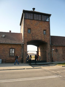
Berkenau entrance
Bunk beds
Showers (gas came out the black pipe)
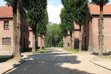
The Auschwitz “main street”
An oven as a memorial
The site of Hess hanging (on Auschwitz grounds)
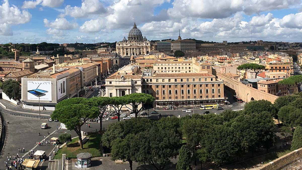
 My wife and I are on a Mediterranean cruise along the coasts of Italy and France celebrating our 20th anniversary, sailing on the ultra-deluxe Norwegian ship. Sea Dream I, which carries just over 100 passengers. Sea Dream I is a magic carpet, easing us in comfort and style through a region full of fascinating history. We have been anticipating visits to some wonderful ports and are not disappointed. What we had not foreseen, though, is the many ways that Napoleon, or perhaps just his spirit, would keep making his presence felt, as if popping up unexpectedly in little cameo appearances. These underscore just how completely he dominated Europe in his brief but dramatic era of war and conquest, supreme glory and abject defeat.
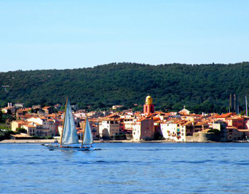 The next planned destination is the Italian island of Elba, the one place where we would expect to find sites intimately linked to Napoleon’s life. It was on Elba that he was forced into exile (along with about 1000 servants and troops as bodyguards) after a series of defeats in 1814.
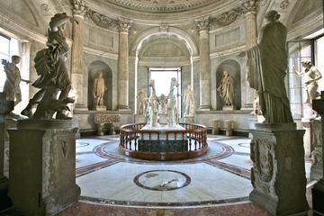
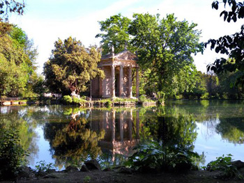 Then we anchor off Viareggio, back on the Italian coast in Tuscany, and take a day trip inland to Florence. We have arranged a walking tour to enjoy the glorious and stunning medieval and Renaissance architecture, monumental public sculptures and inviting pedestrian-only piazzas. It is far too brief, of course, but our personal guide takes us to some special places, such as the studio of a blacksmith who creates fantastic birds, fishes and other creatures in steel, and to the guide’s own favourite and funky “Cafe of the Artisans.” We stroke the snout of an iconic bronze wild boar and share a kiss, thus assuring our return to Florence some day.
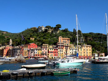
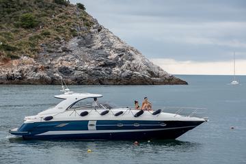
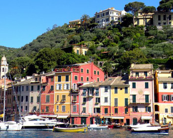 Farther north on the Italian Riviera, our ship anchors off the picturesque village of Portofino, with its brightly painted old houses. Once a simple fishing village, it now has an upscale yacht harbour catering to the rich and famous. Going ashore for a few hours, we hike up to a striking castle that dominates the small bay. And sure enough, Napoleon left his mark here as well during the years when France controlled northern Italy. What we see is an ancient fortification that Napoleon modernized, greatly expanded and equipped with better cannons. Not one for modesty, he renamed the village Port Napoleon.
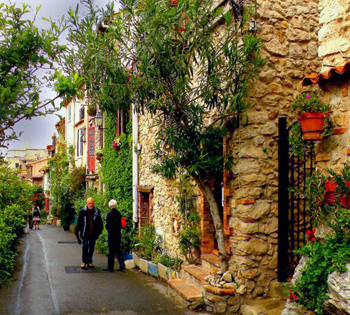
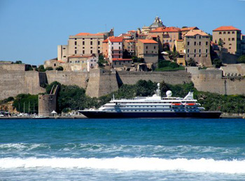 While a student, I had bunked at a unique youth hostel in a little modern castle overlooking Finale Ligure, a lovely stretch of coastal villages on the Italian Riviera only an hour east of Monaco. We decide to return to explore those intriguing shores, with their rich and diverse history. It was here that the 15-year-old Margaret Theresa of Spain stopped briefly in 1666 while on her way to Vienna to marry Leopold I, the Holy Roman Emperor. A triumphal arch commemorating the event dominates the central piazza, not far from ancient fortifications that marked the long-fought-over boundary between Spanish and Genoese-controlled territories. A few miles east is the village of Varigotti with its strikingly Moorish houses. These were built in the ninth and tenth centuries by the Muslim Saracens, who ruled the area for nearly 100 years. Long thereafter, they remained both a threat and a trading partner to the region, bringing such goods as salt from Ibiza when Spain was still under Moorish rule.


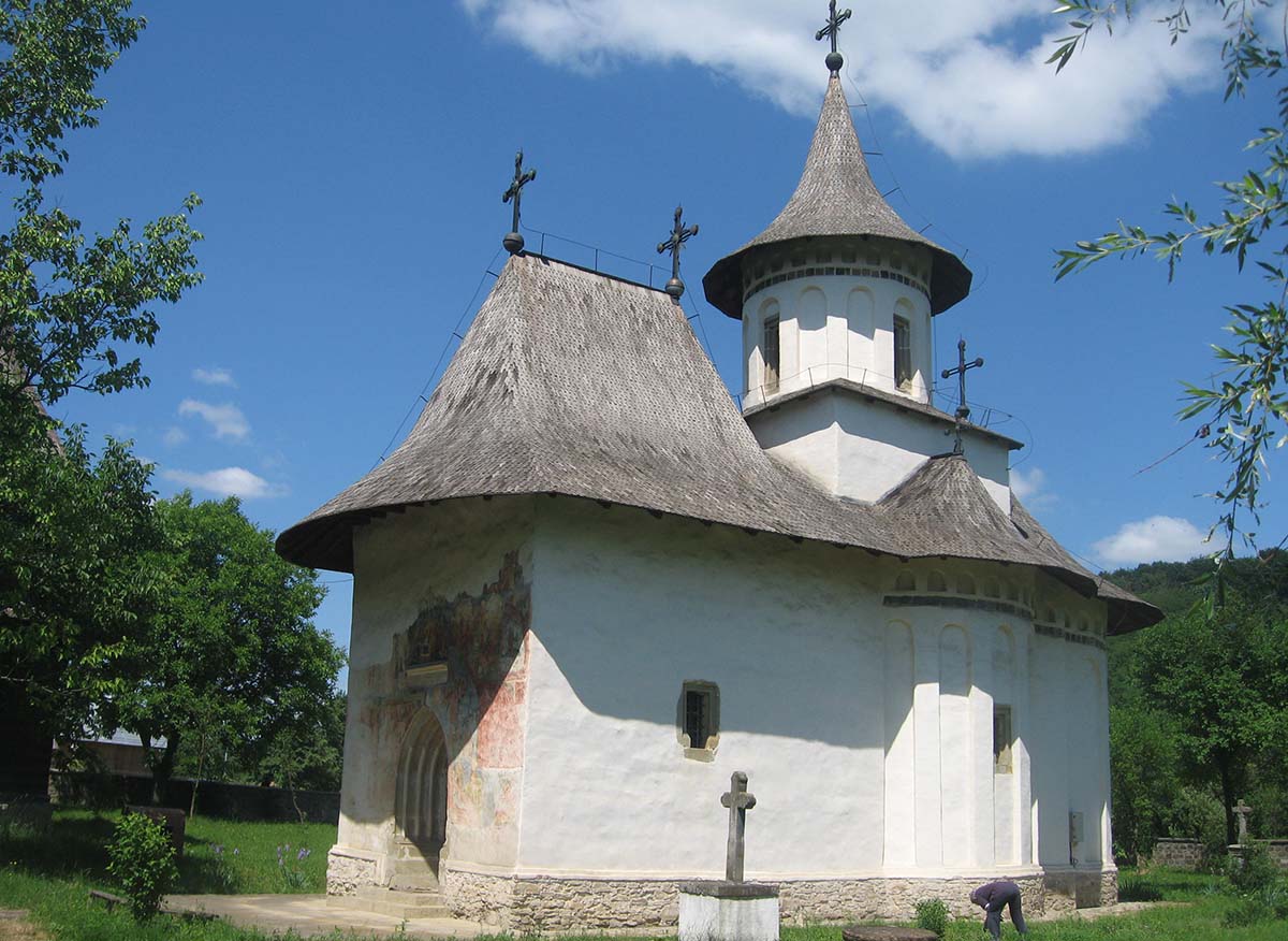

 In the twenty-four years of my life I spent in Romania, I only once had the occasion to visit a unique region of Romania called Moldova and I was just nine years old then.
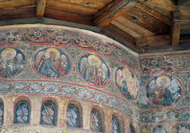
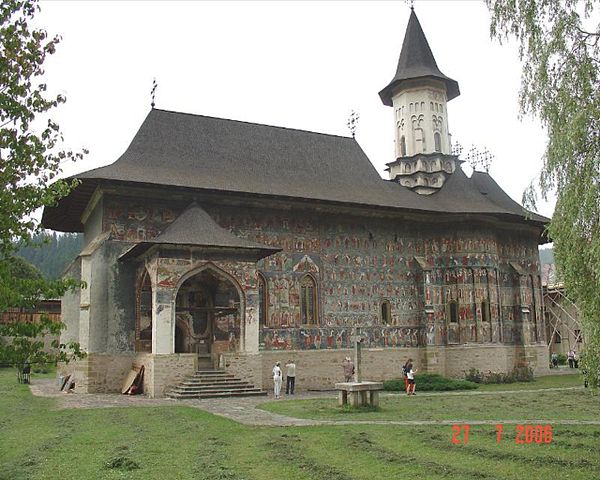 Entering the church, you are inclined to approach solemnly and humbly. Passing two separate stands that hold hundreds of thin yellow candles lit for the souls of the departed, you head slowly towards the altar, mesmerized by Byzantine-influenced icons and priests in holy attire. It was quite a thrill to be free to explore my own religion, free from the Communist regime which totally discouraged the population to go to church and believe in a higher power.

