Door County, Wisconsin
by Megan Kopp
The rolling, tree-covered spit of land sticks out like a thumb into the treacherous waters of the Great Lake. So treacherous were the waters where Green Bay meets the open body of Lake Michigan, that it was given the name ‘Porte des Morts’ or ‘Death’s Door.’ The peninsula that would eventually become Door County has 300 miles (483 km) of shoreline. Dotting these shores with life-saving lighthouses to guide shipping vessels in the late 1800s and early 1900s was essential.
Light on the Rock
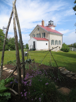
 Severe weather, jagged shorelines and increasing shipping traffic led to the construction of Door’s first lighthouse in 1836. Pottawatomie Lighthouse was built high on the dolomite bluffs above Lake Michigan on Rock Island. The lighthouse was named after the Native Americans living in the area; it means ‘keepers of the fire.’
David E. Corbin – a veteran of the War of 1812 – became the first keeper in 1837. A bachelor, Corbin stayed at the isolated post guiding ships through stormy waters for 15 years. The original lighthouse was poorly built and the weathered structure was torn down and replaced just six years after Corbin left his position.
William Betts, Abraham Capers, James Fuller, Abraham Grover and Frank O. Sawyer were all keepers or assistant keepers of the light at Pottawatomie over the years – and they were all Civil War veterans. Lighthouse keepers were appointed by order of the President of the United States. The position was choice and veterans of the War of 1812 and the Civil War were given priority consideration. In addition to a yearly salary, keepers received free housing, yearly supplies of staples such as sugar and flour and a pension once they retired.
The U.S. Lighthouse Board was established the same year Corbin left the rock – and with it came a strict rulebook for lighthouse operation. Each morning, keepers were required to clean and polish the lens and refuel the lamp before 10 a.m.; the rest of the day was to be spent working the grounds, cleaning and painting the lighthouse and maintaining outbuildings. Day in, day out, this was the routine until the Rock Island light was automated in 1946.
Where Eagles Soar
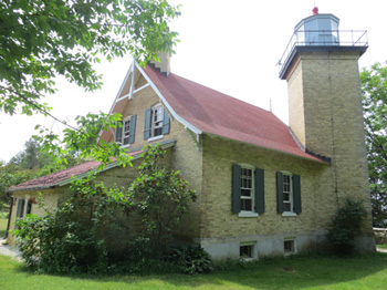
The federal government built Eagle Bluff Lighthouse to safely guide ships through Green Bay’s narrow Strawberry Channel in 1868. The cream-colored Milwaukee brick, ‘Norman Gothic’ building on the 40-foot high bluff cost $12,000 to build. An unusual architectural feature of this lighthouse was the diagonally built tower jutting into the northwest corner of the house. Keeper Henry Stanley lit the tower’s original third-and-one-half order Fresnel lens on October 5th.
William Duclon, a Civil War Vet, served as Eagle Bluff’s second – and longest – keeper. Starting in 1883, William and his wife Julie raised seven sons while working and living for 35 years on the bluff. The lighthouse was automated in 1926.

Keepers of Cana Island
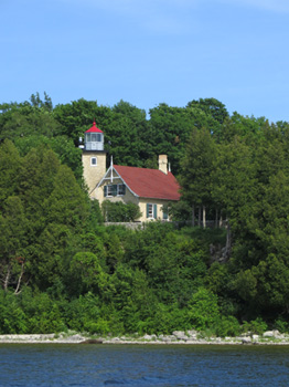
 William Jackson became the first keeper on Cana Island in November 3, 1869. His wife Caroline was the assistant keeper. William was paid $600/year for his work; Caroline received $400. These wages would remain the same for all keepers and their assistants for the next 30 years. William and Caroline left their positions in 1872.
When the light station was first built, Cana Island was a rocky point jutting into Lake Michigan. The tower was constructed of Cream City brick, as was the house. By the turn of the century, many of the bricks in the tower had been damaged from repeated storms. In 1902, the Lighthouse Board covered the tower in steel plates to stop the bricks from deteriorating further. The steel was then painted white.
 The one and a half storey keeper’s house was set up as a duplex – with the keeper and his family living on the first floor and his assistant and family on the second. In 1945, the light was automated and the last keeper left the island.
The Legacy
Today, these three lighthouses (of 11 in Door Country) are open on a regular basis, allowing visitors to climb their towers. From the ferry pier on Rock Island, it’s an uphill, one-mile walk through the woods to Pottawatomie Lighthouse. The Wisconsin Department of Natural Resource and the Friends of Rock Island formed a partnership to restore the building and surrounding landscape to how it looked in the early 1900s.
 Volunteers spend a week at a time living (and working) in the restored lighthouse. They guide visitors through the building in addition to keeping the building spotlessly clean. The lantern room was removed in 1988 and the light now shines from a tall steel frame set away from the house. A replica lantern room is now open in the lighthouse and visitors can scramble up the steep wooden steps for view.
Eagle Bluff Lighthouse is easily accessed via a short paved path off the parking lot in Peninsula State Park. Eagle Bluff Lighthouse celebrates their 50th anniversary as a living museum on September 1, 2013. Join curator Patti Podgers and her paid docent staff – many of whom are former teachers – for fact-based tours of early keeper life.
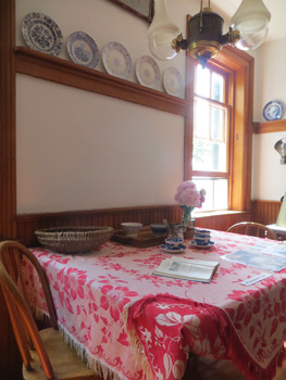 Walter Duclon’s guitar and his mother’s piano can be seen in the lighthouse today – refurbished by the Door County Historical Society to include a few of the Duclon family heirlooms. The walls are now whitewashed instead of the traditional layers of green or grey paint, but otherwise the restoration has taken the building back to what it looked like in the early 1900s.
The once water-covered causeway of Cana Island is now high and dry and visitors can stroll up the old road after paying their entrance fee at the booth. On the left, tucked in thickets of Dame’s Rocket, is a weathered wood barn. The first building encountered is an old brick outhouse, closely followed by an octagonal-shaped oil house. An old stone wall built by a keeper during the 1920s to keep the waters of Lake Michigan at bay can still be found behind overgrown lilacs.
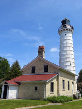
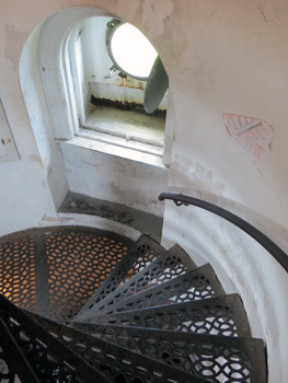
Volunteers of the Door County Maritime Museum maintain the buildings and grounds at Cana Island, control self-guided tours of the keepers house and climbs up the 97-step spiral staircase in the iconic tower and are ready and willing to answer visitor questions. Historic photos, hands-on exhibits and a short video help tell the story of the buildings.

If You Go:
♦ Travel information for Door County can be found online at: www.DoorCounty.com. There are small fees for tours and/or admittance to the lighthouses.
♦ The Door County Maritime Museum organizes the annual Lighthouse Festival events each June. Details for the festival can be found on the museum webesite at: www.dcmm.org/events-activities/special/annual-lighthouse-festival/.
About the author:
An avid traveller and freelance writer of 15 years, Megan enjoys actively experiencing history – whether climbing towering stairs or wandering through old family homes. She loves hearing passionate historians share tales – especially if they’re tall, but true!
All photographs are by Megan Kopp:
Eagle Bluff’s Norman Gothic design
Cana Island Lighthouse
Rock Island Lighthouse
Cana’s climb
A bird’s eye view of Eagle Bluff Lighthouse
The Duclon family plates and tablecloth grace the interior of the restored lighthouse


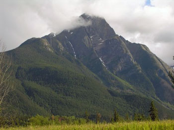 Turning off the Yellowhead Highway (Highway 16) at Hazelton, under the majestic gaze of the Roche de Boule Mountain Range, we journeyed 29 kilometres over breathtaking single lane bridges spanning jaw-dropping gorges and chattering rivers, wending tree-lined ways (largely paved) to emerge at the Kispiox Festival grounds hard by the Kispiox River. On the way we disturbed a solitary black bear strolling leisurely along the road.
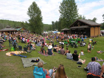
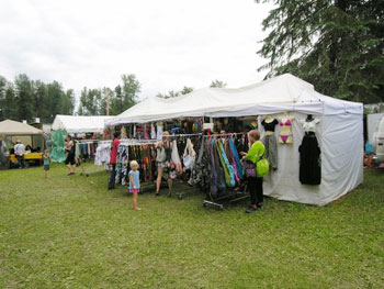 We arrived at the main River Stage in time to experience the large, colourfully attired, and local Twisted String Band, pumping out lively pieces which had audience members up and dancing while others watched from benches, personal seating or the natural amphitheatre overlooking the stage. The crowd, itself awash in colour, was composed of folk of all ages, hair lengths and attire. Nearby the Hall Stage, housed appropriately in a building with a hall, afforded entertainment free from the warming hand of the Sun.
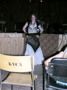 The 2018 headliners included The Tequila Mockingbird Orchestra, Jacki Treehorn, Fish and Bird from Victoria, multi-faceted CR Avery, the “post-modern Vaudeville duo the Cromoli Brothers, Hannah Epperson, Joanna Chapman-Smith, Jenny Ritter, the Harpoonist and the Axe Murderer, childrens’ performer Angela Brown of the Ta Daa Lady Show, Liron Man playing the hang drum and Bocephus King.
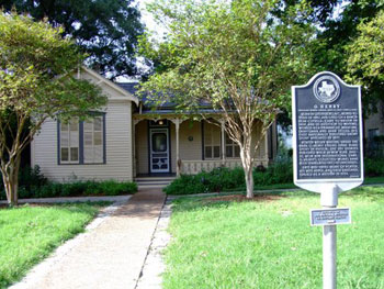
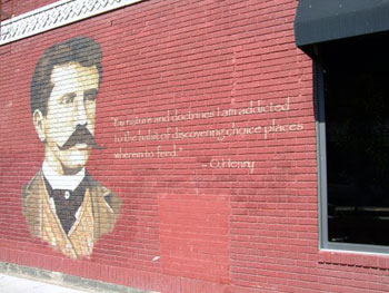 Before moving to Houston to work full-time as a writer for the Houston Post, Porter collected some unique information and experiences in the Texas capital, which later appeared in his works Bexar Scrip No. 2692, Georgia’s Ruling and Gifts of the Magi. Inspired by his work in the Texas General Land Office, Bexar Scrip No. 2692 takes its name from a land grant file that Porter accessed during his daily duties, which had somehow gone astray. In O. Henry’s fictional story, the file goes missing because a rich railroad owner steals it in order to illegally obtain a poor homesteader’s land. Porter’s real-life boss, however, was adamant that such a crime could never have actually occurred, based on the office’s own rules and regulations. Whether you are interested in the historical angle of the document or the writer’s literary take on ordinary events, the original land grant can be viewed online at the Portal to Texas History at
 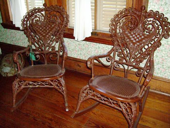 Returning to the O. Henry Museum, visitors can glimpse two more objects that provided inspiration for Porter’s writing. The home showcases two wicker chairs, which were allegedly the inspiration for O. Henry’s best known story, Gifts of the Magi. The author’s wife, Athol, apparently bought him the chairs as a present to decorate their rented home, using money he had saved to purchase her tickets to attend the World’s Fair. Inspired by his wife’s generous act, he wrote the ironic Christmas story in which two lovers buy each other gifts that neither can use, having sold off their most prized worldly possessions in order to pay for the other’s gift. Though the moral is that it’s better to give than to receive, O. Henry’s infamous twist ending provides a bit of dark humor amidst more typical seasonal tales of sharing and caring.

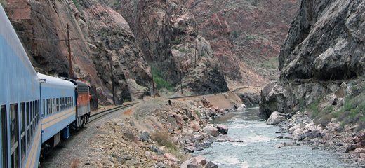
 As the vintage blue and white train climbs upstream following the banks of the Arkansas, the canyon walls grow ever closer and higher. Soon a fragile looking suspension bridge comes into view high overhead. It spans the width of the canyon from north to south. From the unobstructed view of an open railroad car, passengers can actually see light between the wooden boards that form the deck of the bridge.
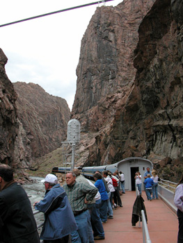
 Beneath the suspension bridge, the canyon is so narrow and the walls so steep that a place for railroad tracks seemed impossible. The river simply must occupy the entire canyon bottom. But in 1879 a “hanging bridge” was devised and built to allow the tracks to pass through the narrow space suspended above the rushing water. This bridge still serves today.
 It wasn’t a Civil War skirmish; the only one of those fought around here was at Glorietta Pass just south of the New Mexico border. This was a war for territory between two railroads: Colorado’s “baby road,” the narrow gauge, Denver & Rio Grande, and the big, standard gauge, Atchison Topeka & Santa Fe. But, many of the men involved had been soldiers in that bloody war: quite notably the D&RG’s president, General William Jackson Palmer.
 Santa Fe seized the entrance to the canyon west of Cañon City cutting off the D&RG for the second time. The outraged D&RG built forts upstream in the canyon to block the rival’s progress. Both sides recruited men well accustomed to the use of firearms – the Santa Fe brought in Bat Masterson with a crew of men from Dodge City. The resulting standoff was widely known as “The Royal Gorge War”.


.jpg)