by Jason Burke
From the historic Inca city of Cuzco, my wife, Alexa, and I took a collectivo taxi (a mini van filled with local Peruvians) over the mountains surrounding Cuzco down into the “Sacred Valley” to the village of Pisac. The town is situated in the bottom of the valley created by the Urubamba River. The Sacred Valley is lined with massive mountains on either side of the river, with flat farmland in the bottom of the valley. The Urubamba River originates in the altiplano south of the Cuzco area, and eventually flows into the Amazon River, travelling through the arid Sacred Valley and the downstream ruins of the more famous Inca site of Machu Picchu.
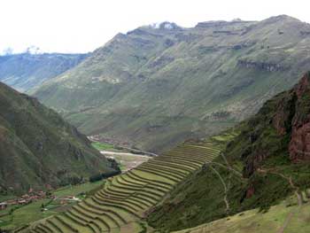
 The town of Pisac (elevation about 9,500 ft) has a central market that is frequently visited by tour buses on their way to the ruins on the hills above Pisac. Most tours stop at the craft market and then head up to the ruins for the morning, and then move on down the Sacred Valley to other archaeological sites. From the town of Pisac, you can view the ancient Inca terraces far up on the steep hillsides. Looking up the steep slopes from Pisac, it is hard to imagine walking up the steep slopes of the mountains to labor making stone terraces and farm these remote and high fields, but evidently the Inca did it. In the ancient construction of the agricultural terraces included both normal stairs and stones inserted into the walls to allow them to move up through the terraces as they tended their crops on the high slopes.
We came to Pisac to stay for a few days and hike all the way up to the ruins, for our own Inca trail experience. The perched towers of the ruins are visible from town, way, way above the central market plaza, on the top of the towering mountains.
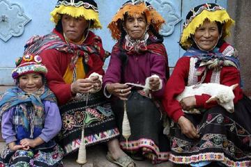
 The next morning after arriving in town, finding a place to stay and getting some food for the hike, we set out up the stairs leading from town to the first set of terraces. We headed through the market stalls selling colorful alpaca wool shawls, blankets and hats, stopping to barter and eventually buy some woolen hats to ward off the chill of the thin mountain air. Leaving the market by a small back street passing between mud wall compounds and heading towards the steep slopes at the edge of town, we walked over the cobblestones of a path which led up towards the first ascent into the terraces above the village.
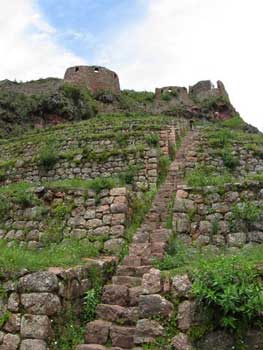
We climbed slowly up the smooth old stone stairs and terraces, gaining elevation and rewarding views of the valley below. As we steadily climbed the smooth stones, we reflected on the hard work it took to form the stones and fit them together to create the stone stairs we now climbed. The stairs lead up through a series of terraces created by more formed and stacked stones. For us, it was enough physical work to climb the stairs, but the Inca stone workers who built the terraces and trails we hiked on had not only walked these same trails, but then spent theirs days laboring to do the stone work and farm the terraces we were passing through.

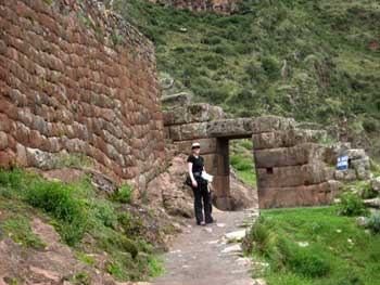
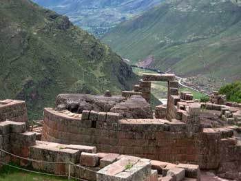 Fortunately, we had been at high elevations for over a week to allow our bodies enough time to adjust to the elevation and thin mountain air, so the climb did not cause any altitude sickness. As we steadily climbed the hill, breathing heavily as we strained to extract oxygen from the cool and crisp morning air, we climbed a long series of stairs up between two small guard towers. We continued through the high farm terraces and into the ruins of small settlement on the steep slopes where the buildings had been laid out to form the shape of a bird when viewed from above. Then we climbed up to the ceremonial center of Intihuatana within the ruins.
Intihuatana (“hitching post of the sun”) was an important ceremonial site and solar observatory that has very fine rectangular stone work and forms a temple around a large rock that has been shaped by Incan solar observers to determine the time of the winter and summer solstices, important for the timing of agricultural work for their society. There is a central stone that was very important to the Incan priests, with a complex drainage system that captured the runoff from the stone and stored it in a basin that discharged to a series of channels and fountains below the hilltop site.
 From the ceremonial center, we moved up through an Inca tunnel carved into the rocky mountain top, along a defensive wall beneath military barracks (where they guarded the main entrance) and into a saddle that had sacred baths and views of cliff sides with burial caves in them. Since the caves have been hit by grave robbers, tourists are not allowed into that area. We finished by going to the tour bus drop off area to get a some fresh squeezed orange juice before heading back down into town. In addition to the sense of accomplishment from having climbed all the way up (11,200 feet above see level) from town (over 1,700 feet of elevation gain) we got to visit the site in the opposite direction as the flow of the tour groups, and we could not help but feel a little smug as tourists huffed and puffed their way back to the bus parking area after their short tour, loudly complaining about the short hike.
Returning down the ancient trail to the valley below, we passed a local boy whom we had seen on the way up as he nimbly passed us while we labored our way up the slope. However, now he was dressed in traditional Inca clothing over his sweet pants and athletic shirt, which he had taken from his backpack. In his Inca costume, he was now perched up on a rock below some ruins, was playing a wooden flute in the hope of earning a few tips from tourists at the ruins. The sound of the wooden flute floated through the air as we headed down from the mountain-top stronghold, through the agricultural terraces and into the valley below.
When we made it back down to town, we feasted on lomo saltodo (beef cooked with onions, tomatoes, seasoning and served with fries and/or rice). Then we moved to another restaurant on the central plaza of Pisac for views of the mountains we had just climbed and tried some alpaca skewers and chocolate cheesecake, just to be sure we were full after our long and rewarding climb.
If You Go:
Map and other information: www.maplandia.com
Travel guide: www.vivatravelguides.com
Fullscreen Virtual Tour: www.destination360.com
About the author:
Jason Burke works as a city planner and used the housing market crash as an opportunity to take a year off to pursue his passion for travel. Along with his wife Alexa, he spent 13 months travelling around the world. The blog of their entire trip can be found at: fadedbackpacks.wordpress.com
All photos are by Jason Burke.
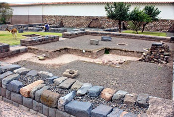
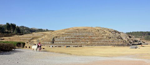
 Old Tiwanaku covered at least 30 hectares; the vast majority of the site has yet to be excavated. The most outstanding structure, the Pyramid of Akapana, was constructed during the Classical Age of Tiwanaku Culture around 300 CE. At 18 meters high, this square structure consists of seven stacked platforms set over a natural hill. The present structure had to be partly reconstructed because the Spanish conquistador Oyardeburu’s demolition crew had haphazardly searched for treasure inside.
 The Akapana Pyramid appears to have been multi-purpose. According to Miguel, the summit was an observatory. The astronomers worked within the bounds of a shallow, sunken, chamber open to the sky. This chamber was once shaped like an Andean Cross; a stepped-cross made up of an equal-armed cross indicating the cardinal points of the compass and a superimposed square. This cross symbolizes the three levels of heaven, earth and underworld. Needless to say, you require some imagination to see this figure. The summit holds the remains of a house whose rooms were used for preparing ritual ceremonies involving human sacrifice to the sun.
 Descend the pyramid and move toward the nearby Kalasasaya Temple platform. The walls of the platform include huge red sandstone and andesite blocks, some of which weigh as much as 100 tons. The nearest andesite quarries are located at Copacabana – 40 kilometers distant. The sandstone quarries were only 10 kilometers away. The massive blocks were transported to Tiwanaku using wooden boats.
 The mere eight-foot climb to the top of Tiwanaku’s most sacred temple also leaves you short-of-breath. At the top of the platform to your left is the National Symbol of Bolivia – the Gate of the Sun (Puerta del Sol). Weighting three tons, this gate is carved from a single slab of andesite. The crack in the lintel occurred when the gate was moved from its original location near the center of the platform.
 Contrasting with the raised Kalasasaya Temple, the open- air Semisubterranean Temple is 2 meters below ground level. Descending a shallow set of stairs into the open-air room, you find yourself surrounded by 175 stone faces jutting out from the walls; they might be sizing you up as the next potential sacrifice. Each of these well-worn limestone faces is unique and might possibly represent the different tribes/peoples living within the empire of Tiwanku. At its zenith, the empire stretched from present-day northwest Argentina to northern Chile. On the other hand, Miguel did refer to one of the faces as “an alien”. Perhaps the empire is a little larger than originally believed.
 Next door, the Ceramic Museum outlines the Tiwanaku culture from its origins as a village circa 1580 BCE to the demise of the empire around 1200 CE, possibly the result of a prolonged drought and a receding Lake Titicaca.
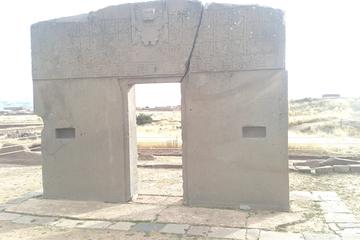
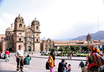
 The very Spanish-looking Plaza de Armas was once surrounded by Inca palaces but now it is a holy square. The Cathedral, flanked by two lesser churches, is the focal point. The conquerors disassembled the Palace of Viracocha and re-used its gray stone blocks in the Cathedral as walls and supporting columns.
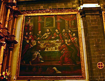 The cathedral also contains over 400 colonial paintings. The most interesting is “The Last Supper” where the main course is guinea pig and a local corn beer called chicha. At the bottom of the painting, to the right of center, Conquistador Francisco Pizarro sits as Judas.
 Novice nuns were trained at the monastery until 1960. Their bedrooms were filled with personal furnishings that they were expected to provide for themselves as a condition of entry into the Order. Two-foot long cords were hung near their personal crucifixes suggesting that self-flagellation was fashionable at one time.
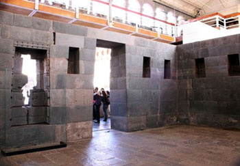 More recently, part of the cloister crumbled during an earthquake thereby exposing four of the original Inca chambers within Qoricancha. The cyclopean walls are striking because of the carefully interlocking stonework. The Incas did not use mortar so as to provide the walls with greater flexibility during an earthquake. This design appears to have functioned very well over time but it was not fool-proof. Past tremors have misaligned a number of stones situated in the upper section of one room.
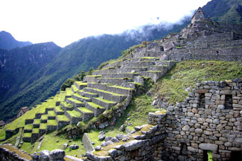 Coming down into the bulk of the ruins, I walk along the extensive agriculture terraces that flow down the mountainside. They don’t seem to end – eventually the vegetation just thickens and pulls the terraces from my sight. The terrace system has interesting benefits that I, being more familiar with farming on plains, would not have predicted. The terraces vary in temperature as they climb the mountainside. This allowed the farmers to plant various types of crops in their ideal conditions. Also, rain directed nutrients from the higher crops to improve the soil below.
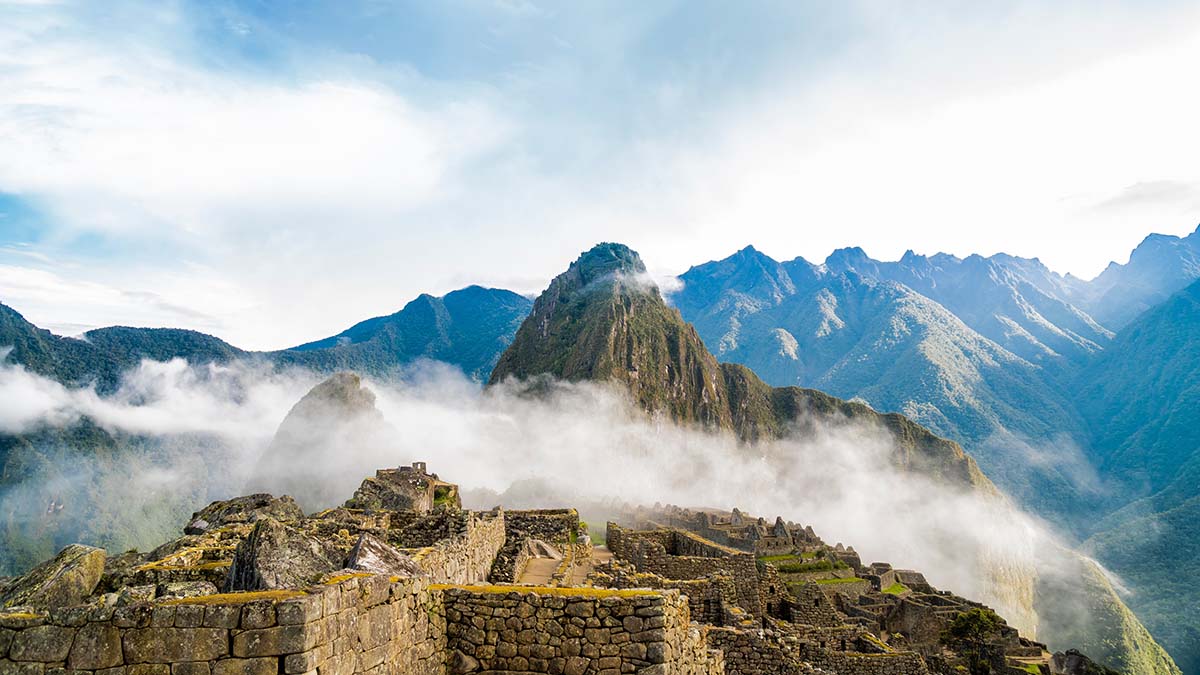
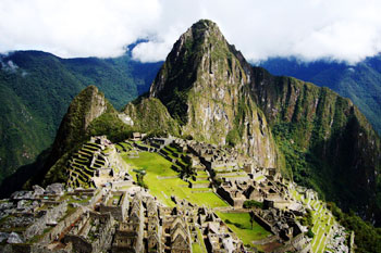
 I enter the ceremonial area, and come upon the Temple of the Sun, a semi-circular temple made with well-worked stones. The stones interlock and hold together without using mortar. This is a common trait of Inca architecture that makes it earthquake-resistant. Inside the structure is a large altar and a trapezoidal window that is thought to have been used for astronomical observation. Below the temple is a cave called the Royal Tomb, even though no human remains have ever been found there.
 I continue up a staircase past a series of ceremonial baths to a quarry. The scattered boulders seem to emphasize the incomplete nature of Machu Picchu. Despite the extensive work the Incas put into this series of mountaintop structures, they never completed the city.
 Crossing the central plaza leads me into the residential area of the ruins. It is easy to tell that the stonework is of lower quality than what I saw in the ceremonial area. The structures are simple and domestic, making it easy to imagine people using these stone buildings as houses.
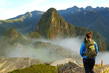
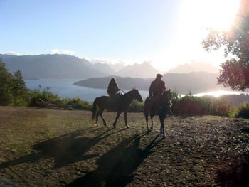
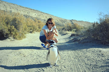
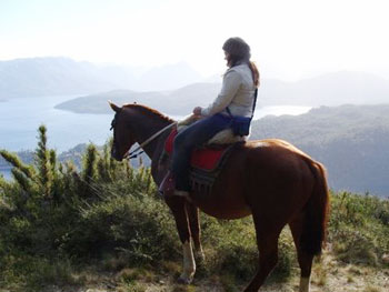 We are riding in the Parque National Nahuel Huapi, in Argentine Patagonia, just above Villa la Angostura, and between Bariloche and San Martín de los Andes.
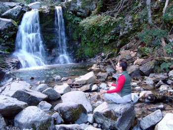 Half-way up the Cerro Belvedere, we stop at a waterfall, the Cascada Inacayal, to rest.
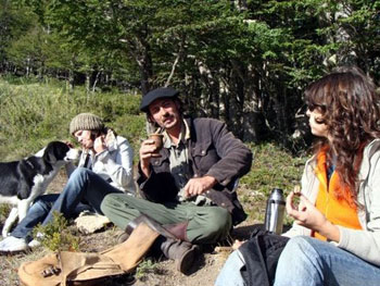 We sit on our coats on the ground, and Andrés produces a mate gourd filled with yerba leaves, a silver straw, and a flask. He soaks the leaves with hot water, sips, refills, and passes it round. The taste is much milder than what I had become used to living in Uruguay. I have never shared mate with strangers. At the top of that mountain, backed by the sound of a woodpecker, it was a truly bonding experience. After each of us has drained the bitterish, warming liquid, Andrés refills the gourd for the next person.
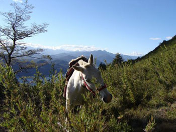 We relax for a while longer, enjoying the sunshine, then Andrés gets the horses ready for our descent. I hadn’t realized that we would have to lead the horses a long way down the mountain on foot, as it was too steep and dangerous to ride them, and their saddles would slip. I feel almost less confident off Luna’s back than on her. I can sense her bulk as she carefully picks her steps, so close behind me that I can almost feel her warm breath on my neck. I dread to think what might happen if she or I should slip.