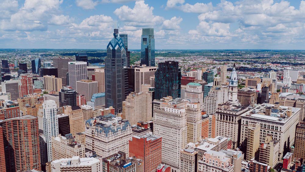
Philadelphia can feel surprisingly easy to understand once you start walking. Center City has busy roads, historic buildings, public parks, shops, and transit stations. Yet its central street layout usually remains clear. I noticed this while walking through Center City from City Hall to Rittenhouse Square. My route was simple. I walked south toward Walnut Street, then continued west toward the park. Philadelphia’s colonial grid helped the entire journey make sense. City Hall provided a strong starting point. Numbered streets measured my progress. Walnut Street connected several useful landmarks and commercial blocks. Finally, Rittenhouse Square offered a natural stopping place. Of course, not every intersection felt perfectly predictable. Smaller streets, subway entrances, and wide crossings occasionally changed the rhythm. Still, the basic plan made the walk approachable. It also showed how Philadelphia’s earliest planning decisions continue shaping everyday travel.
How did Philadelphia’s original plan shape Center City?
William Penn founded Philadelphia after receiving Pennsylvania’s royal charter in 1681. The following year, he appointed Thomas Holme as Pennsylvania’s surveyor general. Holme planned the city between the Delaware and Schuylkill Rivers.
His design used straight streets, rectangular blocks, and five public squares. Broad Street became the principal north-south route. High Street, which later became Market Street, crossed it from east to west.
Where did those major streets meet? At the planned center.
That central square eventually became the site of City Hall. Four additional squares served separate parts of the growing settlement. Today, they are Franklin, Washington, Logan, and Rittenhouse Squares.
Penn wanted more space than many crowded European cities offered. He also wanted better airflow and safer development. Wider roads and open squares reduced congestion and fire risks. Similar features still shape other historic American city streets, although every colonial city developed differently.
Why is City Hall such a useful starting point?
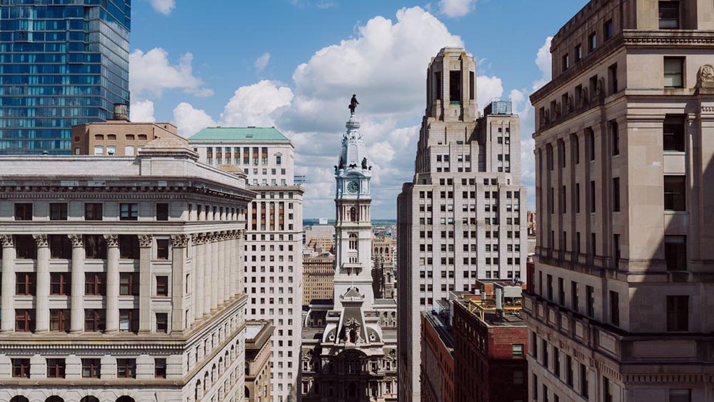
City Hall occupies the site of Penn’s original central public square. Philadelphia voters selected Penn Square for the building in October 1870. Construction began during the following decade and officially finished in 1901. The building is difficult to overlook. It measures approximately 486 feet by 470 feet. It originally contained 634 rooms and covered over one million square feet.
Then there is the tower. It reaches 548 feet, including the large William Penn statue. Alexander Milne Calder designed the bronze figure. The statue stands 37 feet tall and weighs roughly 27 tons.
That scale makes City Hall a dependable navigational landmark. I could see parts of it from several surrounding blocks. Nearby, I spoke briefly with a person from BR Moving. They explained that local moves require careful route planning around busy streets and narrow access points. The company has served Philadelphia since 2010 and offers packing, storage, and transportation services.
City Hall’s position also helped me choose my own direction. Rittenhouse Square lies southwest of the building. Therefore, I needed to move south and west. Once I understood that relationship, the route seemed much less complicated.
Which route connects City Hall with Rittenhouse Square?
I began near the southern side of City Hall. From there, I followed Broad Street toward Walnut Street. This stretch belongs to Philadelphia’s Avenue of the Arts district.
Several important performance venues stand nearby. The Academy of Music sits at Broad and Locust Streets. It opened in 1857 and remains one of America’s oldest operating opera houses. The Kimmel Center stands farther south at Broad and Spruce Streets. Its main glass-roofed building opened in December 2001.
However, my route turned west before reaching the Kimmel Center. At Walnut Street, I turned right and continued toward Eighteenth Street. I crossed Fifteenth, Sixteenth, and Seventeenth Streets. Then I reached Rittenhouse Square’s eastern boundary.
Chestnut Street ran one block north. Locust Street remained one block south. Sansom Street appeared between Chestnut and Walnut. The directions were refreshingly simple. South toward Walnut Street. Then west toward the square.
How do numbered streets help visitors measure progress?
Philadelphia’s numbered streets are especially helpful within Center City. Most run north and south. Their numbers generally increase as you move west from the Delaware River.
That pattern gave me a simple progress check. City Hall occupies the area around Broad and Fifteenth Streets. Broad Street replaces Fourteenth Street within the main numbering sequence. Rittenhouse Square begins at Eighteenth Street and extends west toward Nineteenth Street.
So, how far did I really need to walk? Only a few numbered blocks. After crossing Sixteenth Street, the destination already felt close. Seventeenth Street placed me one block away. Eighteenth Street confirmed my arrival.
However, Philadelphia’s blocks can vary in length. Smaller streets also appear between major numbered roads. Therefore, counting every intersection can become misleading. I found it more useful to track two details. First, I watched the numbered streets. Second, I remembered my nearest major east-west road. Simple. Effective.
Why was Walnut Street my favorite discovery?
Walnut Street became the most enjoyable section of my walk. I expected a practical route. Instead, I found a lively mix of shops, restaurants, offices, theaters, hotels, and historic buildings.
The street also changes as you move west. Near Broad Street, the surroundings feel busy and commercial. Closer to Rittenhouse Square, residential buildings and smaller businesses become more noticeable.
Walnut Street forms an important part of Rittenhouse Row. That district includes boutiques, galleries, cafés, restaurants, theaters, and major hotels. National retailers operate beside independent Philadelphia businesses. Narrow side streets provide even more choices.
What made Walnut Street especially useful? It remained interesting without becoming confusing. Chestnut Street offered another route one block north. Sansom Street provided a narrower alternative between them. Locust Street stayed one block south. Because these streets run parallel, I could make short detours. Then I could return to Walnut Street without losing my direction.
What can make the route confusing?
The main route is straightforward, but several areas require closer attention. The streets around City Hall feel less regular than the blocks farther west.
Market Street, John F. Kennedy Boulevard, Broad Street, and South Penn Square all meet nearby. The intersections are wide, and traffic approaches from several directions. Subway entrances also appear around multiple corners.
City Hall Station serves the Broad Street subway, now branded as the B Line. Nearby Fifteenth Street Station serves the Market-Frankford corridor and underground trolley connections. Those entrances can make one side of an intersection look very different from another.
Farther west, smaller streets may interrupt your block count. Sansom Street is the clearest example. It runs between Chestnut and Walnut Streets.
Does that make the route difficult? Not really. You only need two reliable reference points. Remember the nearest numbered street. Then identify the closest major east-west road. That method helped whenever traffic, shopping stops, or brief detours interrupted my progress.
Why is Rittenhouse Square an easy destination?
Rittenhouse Square occupies one city block in southwest Center City. Walnut Street borders its northern side. Eighteenth Street marks its eastern boundary. West Rittenhouse Street forms the western side. South Rittenhouse Street defines the southern edge.
The park covers approximately six acres.
It began as Penn’s Southwest Square. Philadelphia renamed it in 1825 to honor David Rittenhouse. He was an astronomer, mathematician, clockmaker, surveyor, and public official. He also served as the first director of the United States Mint.
Architect Paul Philippe Cret redesigned the square in 1913. He introduced diagonal paths, formal entrances, and a central circular walk. Those paths still make the park easy to cross.
I entered near Walnut and Eighteenth Streets. The change felt immediate. Busy sidewalks gave way to lawns, benches, mature trees, and open paths.
That made the square an ideal endpoint. It was easy to locate, comfortable to explore, and connected directly to Philadelphia’s original plan.
Which details should visitors notice inside the square?
Rittenhouse Square contains several notable sculptures. Many of them also provide clear meeting points.
- Antoine-Louis Barye created Lion Crushing a Serpent in 1832. Philadelphia’s bronze cast was produced in 1891. Workers installed it inside the square during 1892.
- Paul Manship’s Duck Girl dates from 1911. It stands near the central reflecting pool. Albert Laessle created Billy, a small bronze goat, in 1914.
- The Evelyn Taylor Price Memorial Sundial provides another recognizable feature. Beatrice Fenton designed it in 1947. Cornelia Van Auken Chapin’s Giant Frog dates from 1941.
- More recently, Eric Berg designed the Gardener’s Cottage Gates. The park installed them in 2010.
These sculptures show how public art in city streets can become part of everyday navigation.
Where should you meet someone? Near the goat. Beside the sundial. Close to the lion.
Much clearer than saying, “near a bench.”
What transport options support this walking route?
Several SEPTA services support the route from either direction. City Hall Station serves the B Line beneath Broad Street. Fifteenth Street Station connects with east-west rapid transit and underground trolley services.
Routes 10, 11, 13, 34, and 36 use the nearby trolley platforms. The underground South Broad Concourse also links parts of the City Hall area with Walnut-Locust Station.
Near Rittenhouse Square, bus services operate along several surrounding Center City streets. Walnut-Locust Station remains within walking distance of the park. Riders can therefore combine a subway journey with a shorter walk.
However, my direct route required no transit changes. That simplicity became one of its greatest advantages. I could arrive near City Hall, walk through central Philadelphia, and finish beside the square.
The route also works within a longer journey exploring Pennsylvania. It offers a compact introduction to the state’s largest city before visiting other destinations.
What does this route teach first-time visitors?
My walk connected two places from William Penn’s original city plan, giving me a taste of local life. However, it also showed where extra attention helps. The roads around City Hall can feel complex. Smaller streets interrupt the larger pattern. Transit entrances also change how some intersections appear. Still, the system remains practical. Remember the nearest numbered street. Then identify the closest major east-west route. For this walk, those routes included Market, Chestnut, Walnut, and Locust Streets. Together, they created a clear mental map. The result was more than a simple walk. It connected architecture, public art, transportation, shopping, and Philadelphia’s early history.
About the author: Claire Whitmore
Claire Whitmore is a travel writer who focuses on historic cities, walkable neighborhoods, and the stories behind urban design. Her work explores how streets, public squares, architecture, and transportation shape a visitor’s experience. She enjoys turning detailed historical research into practical guidance for curious travelers. Away from writing, Claire spends her time photographing old buildings, browsing antique maps, and testing local bakeries.