Travel Thru History

Historical and cultural travel experiences

  • Home
  • Airfare Deals
  • Get Travel Insurance
  • Writers Guidelines

Paris Welcomes Croatia: Glagolitic script

Blagolitic Baska tablet cast

by Sonja Slijepcevic

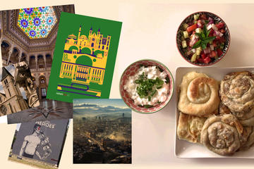
Two big names in the travel industry met in Paris in the autumn of 2018. The exhibition titled “Croatia-full of colours” was hosted by Carrousel du Louvre underground shopping centre at the Louvre in Paris. Organizers expected that a few million people would see it until November 20, 2018.

Croatian exhibit in Louvre26 large-size photographs taken by Croatian photographer, traveller and published National Geographic contributor Davor Rostuhar, presented different regions of Croatia showing nature, traditions, historical city sites, traditional costumes and gastronomy.

The importance of this exhibition is also in showing many possibilities and roads less traveled, besides the famous city of Dubrovnik, Split or some of the Dalmatian islands. In Croatia every town, every village or region has hidden secrets and places worth exploring.

The Istrian Peninsula and the island of Krk are considered the cradle of Glagolitic script- the oldest Slavic alphabet. Near the Istrian city of Buzet, between the towns of Roc and Hum, the unique Glagolitic Alley – the eleven memorials, were set as a monument of Glagolitic culture and literacy.

During the summer months, the school of Glagolitics regularly takes place in Roc.

Glagolitic alphabet
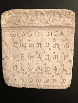
The origin of the Glagolitic script is related to the work of two monks, Cyril and Methodius, in 9th century. They were sent by the Byzantine Emperor to Great Moravia to spread Christianity among West Slavs in the area. To translate the old Christian liturgical books into the old Slavic language was not an easy task since the words of the Slavic language could not be easily written in the Greek or Latin alphabet. Therefore, Cyril invented a new script – Glagolitic, which was based on the local dialect of the Slavic tribes. After the deaths of Cyril and Methodius, the Glagolitic alphabet faded in Moravia, but Cyril and Methodius’ students continued spreading it to the West. In fact, the Glagolitic alphabet was only preserved and used by the clergy of Croatia until the early 19th century.

The name “Glagolitic” came from the verb “Glagolati” in old Slavic, which means “to speak”. In Croatia (Dalmatia) even the Pope Innocent IV in 13th century officially granted the Croatians of Southern Dalmatia the unique privilege of using their own language and script in liturgy, instead of Latin. The permission was extended to all Croatian lands, mostly to the Adriatic coast.

Therefore, if you like to explore history through written words and monuments, from the Glagolitic Alley in Istria, you may have a nice drive towards the cities of Opatija and Rijeka, also interesting travel destinations, then cross the bridge to Krk and you will be welcomed with another historically unique area.

The island of Krk is the largest Croatian island (some consider Cres the largest), in any case, it is an island, but conveniently connected with the main land by a bridge. Even with the first steps on the island or even earlier, on the bridge, you are facing an interesting fact from modern history. The bridge, when constructed in 1980, had the privilege of being the bridge with the longest reinforced concrete arch in the world.

Cobblestone street in KrkThe next stop on your discovery trip could be just a couple kilometres (miles) from the bridge, a town of Omisalj – across from the airport. Here you will find yourself in a typical Mediterranean town with old yellowish stone houses and buildings. The town centre is a cobblestone plaza surrounded with stone houses and a church Our Lady of the Assumption and a bell tower. A few cafes and restaurants will offer pleasant shade under umbrellas on hot summer days and the opportunity to have a break with excellent Mediterranean specialities (seafood or pasta “surlice,” or smoked ham) and local wine.

After a break you have the option to discover the site of the nearby ancient Roman city Fulfinum Mirine or you may continue your Glagolitic discoveries on island of Krk. On Krk you will find a trace of this old alphabet and historic documents everywhere.

You may visit the village of Gabonjin where you will find another Glagolitic park and artistic work of local artist Sretko Usalj, who devoted a lot of time to historic research of Glagolitics.

In a city of Vrbnik, a city on the cliff, in the summertime you may join the Glagolitic workshop and learn the alphabet and write your own name in this old script.

The church of St. Mary was mentioned in 1325 and has valuable Glagolitic manuscripts. The town’s library holds more than 10,000 titles, of which the most valuable is the World Atlas by Johann David Kochler printed in 1718 in Nuremberg. One of the two known copies is in Vrbnik, while another one is kept in Cambridge, England.

You can’t leave Vrbnik, before you try or purchase a bottle of the original “Vrbnicka Zlahtina” golden white wine.

If you continue towards the city of Punat, you may take a short boat trip (800 m from Punat) to the tiny island of Kosljun where you may visit the Franciscan monastery. At the entrance you will be welcomed with the Glagolitic inscription “Peace and Well-being” and the Frankopan family coat of arms, who once owned the island. The monks collected numerous valuable items over the centuries and kept them in the monastery and the museum which has a rich ethnographical collection.

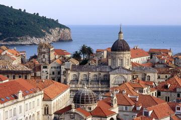
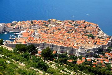
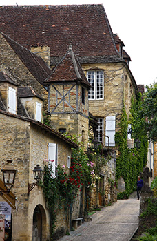
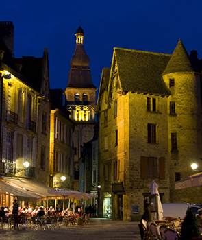
Close to Punat is the city of Krk. This centre of island Krk has an urban history of 3000 years. Even the ancient Romans called it “the most splendid city of the people of Krk.”

Church in Krk city
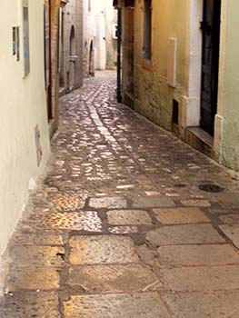
The old part of the city is surrounded by ancient walls which date back to the 12th century. The cathedral “Assumption of Mary” was also mentioned in written documents from the 12th century. In the cathedral there is a silver altar cloth made in the 15th century, which in 1980’s travelled to Paris – France where it was exhibited as a part of the Yugoslav and Croatian cultural heritage.So, another meeting of Croatia and France. Within the city walls you could find many secrets of the city’s rich history; layers of history from pre-roman and Roman times as well as Medieval times. Polished cobblestone narrow streets, polished by millions of feet throughout history and gray-yellowish stone houses may astonish you, but you may get lost in the labyrinth of the streets. There is a local secret how to avoid being lost. All the streets that lead somewhere have a line of the stones in the middle, in the direction of the street. If the old street does not have these stone signs, it most likely is a dead end. I found myself lost a few times, but every time I also discovered something new and interesting such as an old stone water well or a stone arch over the entrance with the Latin or Glagolitic inscription. The view from the top of the walls is absolutely splendid. This summer my daughter and I climbed the narrow stone stairs again which led to the top of the walls. It was hard to decide which view was more magnificent, the one overlooking the harbour and the open sea or the one of the bell- tower and the old tiled roofs against a clear blue sky.

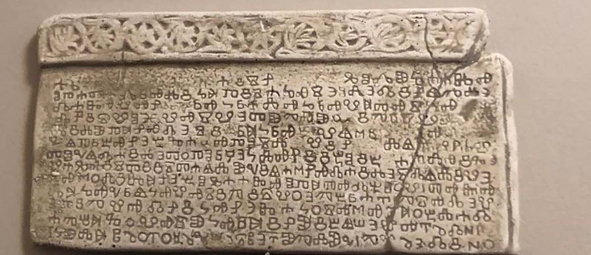
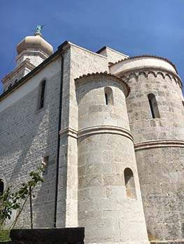
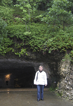
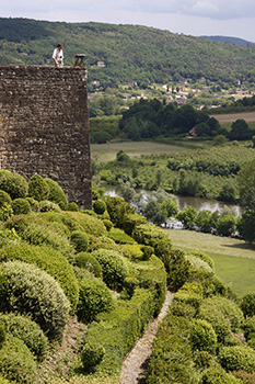
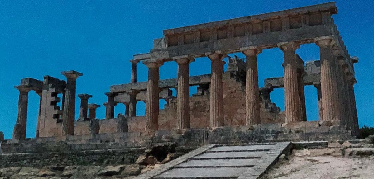
To round your historic trip, you should visit Baska and the small village of Jurandvor. In Jurandvor the priest Petar Dorcic discovered on the ground of the church of St. Lucy a stone tablet (199 cm long and 99 cm high) with an unusual inscription in 1851. He informed the historians about his discovery. In the years to follow, the mysterious text was decoded and historians concluded that this tablet called “Baska tablet” (Bascanska Ploca) from 1100s is one of the oldest documents written in Glagolitic alphabet and it became one of the icons of Croatian culture and literacy. In 1934 the original stone tablet, in order to be protected from further degradation, was placed in the entrance of the Croatian Academy of Science and Art in Zagreb – capital of Croatia. Today there is a cast of the Baska tablet in the church of St. Lucy in Jurandvor. [Photo at top.]

Finally, to relax from the history and have fun at the beach, you will find the well-known Baska two-kilometer long pebble beach nearby or you may try the several hill trails which offer great views.

 If You Go:


8-Day Croatia Tour: Dubrovnik, Split, Trogir, Zadar, Zagreb and Plitvice

1) The best time to visit the area and locations is June or September, but to attend the workshop in Vrbnik it should be July

2) The busiest time and the most of tourists visit in July and August

3) The best way to discover the island of Krk is by car

4) The driving distance from town of Buzet in Istria to city Rijeka is approx. 52 km (32 miles)

5) There is a toll per car to cross the Krk bridge only when coming to the island

6) Additional information about the island and accommodation is available at tourist offices on the island

7) English and German languages are widely used at the restaurants, hotels, tourist offices and agencies


5-Day Croatia Islands Hike and Bike Adventure from Korcula Island

About the author:

Sonja Slijepcevic is a freelance travel writer and photographer, a member of the International Travel Writers and Photographers Alliance (ITWPA). For years she has been combining her love of travel, passion for photography and professional career in the project management field. She likes meeting people from different cultures and backgrounds, enjoys history and art, and likes to write about these experiences. Some of her photography has been published in different Canadian magazines and newspapers.

Sonja was born in the capital city of Croatia, Zagreb and has been living in Canada for 25 years.

Photos by Sonja Slijepcevic

Tagged With: Croatia culture, Glagolitic script, Krk island Filed Under: Europe Travel

Dawdling in the Dordogne

Sarlat la Caneda Place street scene

by Karoline Cullen

My eyes search in vain for a sliver of light. The blackness is absolute and our shallow breathing the only sound. When the guide finally spotlights the frieze of beasts above our heads, our gasps of appreciation echo off the cave walls.

The author at grotte entranceWe collectively crane our necks to study the 13000-year-old paintings gracing the cave’s ceiling. We are in Grotte de Rouffignac, just south of Périgueux in the Dordogne area of southwestern France. In this region of dark forests, wending rivers, and rolling hills, inhabitants from prehistoric Cro-Magnons onward created decorated caves, gas lit towns and gardens. For modern day travelers like my husband and me, dawdling through these sites perfectly fill our days in the Dordogne.

On a gray rainy day, we agree that going into a cool, damp cave is an ideal alternative to getting wet above ground. We almost miss Rouffignac’s unassuming entrance in the woods and are soon on a little electric train whirring off into the darkness. The guide highlights large, round hollows in the rock where cave bears denned for the winters and long scratches on the walls where they sharpened their claws. The bears were long gone before early man created his art by the light of tallow lamps in these galleries and passages. Spotlights dance over paintings of bison, horses, ibex, wooly rhinoceros, and what this Grotte is famous for, multitudes of mammoths. There are single animals and groups. Some were engraved with chisels or, on some softer surfaces, with fingers; others were outlined in black. Using the curved surfaces of the cave and strong simple lines, the prehistoric artists captured the beasts’ enormity, power and shagginess. The anatomical correctness of the mammoth drawings vouches for their authenticity, the guide explains. Until modern researchers studied frozen mammoths in Siberia, only people who lived amongst these animals could have drawn them with such exacting detail. Why Cro-Magnons ventured so far into this cave to make these paintings is unclear. In this, and many other caves throughout the region, our relatives left powerful depictions of the animals populating their world.

lane in sarlatFast-forward many millennia to when Dordogne residents were not painting on rock but building with it. Sarlat-la-Canéda is a bustling market town with a wonderfully preserved medieval centre. Narrow cobblestone lanes wind between golden stone buildings with black slate roofs.

sarlat main square at nightMany of the ground floor buildings date from the 13th century, while distinctively styled Renaissance houses were added in the 15th century. At night warm, glowing gaslights bring out the fine architectural details and highlight cheery flower boxes on mullioned windows. On a ramble through the maze of streets leading away from the main square, my husband and I savour the atmospheric ambience.

The bronze geese in “Goose Square” pay homage to one of the regional specialties, foie gras. We pass animated patrons at sidewalk restaurant tables and their jolly noise echoes down a deserted walkway presided over by leering gargoyles. Tomorrow, these streets will teem with shoppers attending one of France’s best markets. We will be amongst them, shopping for picnic supplies.

gardens at MarqueyssaAfter rock caverns and stone buildings, I long for the freshness of outdoor greenery. On a bluff high above the Dordogne River, the gardens at Marqueyssac are the ideal counterpoint. We could tour the 18th century chateau but the garden paths beckon. Thousands upon thousands of boxwoods were planted in the 19th century along winding paths to give a fanciful, labyrinthine effect.

marqueyssac path and valley viewThe bushes are hand pruned into bulbous shapes and swirling patterns. It is an extravaganza of green! Wandering further, I sniff the wafting fragrance of rosemary and lavender before I see the sizable herb gardens. Along sinuous paths in the forest of oaks, cypress, pine, and lime trees are delightful surprises of sculptures, stone huts, waterfalls, or hidden benches. We have no trouble finding a secluded spot for a picnic while appreciating the plants, the views, and the occasional peacock wandering by. At the end of the walk is the Belvedere lookout, with its expansive view of the river, rolling vineyards, far off chateaux, and the cliff hugging ochre houses of a town below.

It’s possible a distant Cro-Magnon relative contemplated this view before he descended into the valley in search of another cave to paint in. Of course, no mammoths or wooly rhinoceros roam the valley floor today, but we know from those old paintings that long ago, they most assuredly did.

 If You Go:


Full Day Tour Dordogne & Vezere Valley

For photos of the cave paintings and information: http://www.grottederouffignac.fr/index.php/fr/

Sarlat-la-Canéda

The gardens at Marqueyssac are a National Historic Monument.


Half day Tour of The Villages of the Dordogne

About the author:

Karoline Cullen always travels with camera and pen at hand. Her works have been published in numerous newspapers, magazines, and on-line and she is a member in good standing of the British Columbia Association of Travel Writers. www.cullenphotos.ca

Sarlat-la-Canéda-Place photo by Gilbert Bochenek / CC BY

All other photos by Cullen Photos

2. The author at the entrance of Grotte de Rouffignac.
3. A lane in Sarlat.
4. The lit main square of Sarlat at night.
5. Garden Marqueyssac boxwoods.
6. Garden Marqueyssac path and valley view.

Tagged With: Dordogne tours, France travel, Grotte de Rouffignac, Sarlat-la-Canéda Filed Under: Europe Travel

Sarajevo, Bosnia-Hercegovina, Where the 20th Century Began & Ended

Sarajevo Bosnia and Hercegovina

By Blaine Bonham

Eleven year-old Safet Begic played with a friendly stray dog almost every day outside his family’s apartment between bombings by Serbian forces on Logavina Street in Sarajevo, Bosnia-Hercegovina’s capital. One day, when the shelling stopped, he went outside to play with his friend. The dog growled and snarled and chased him, despite his repeated attempts to pet her. So he went back inside. Moments later. a bomb fell in front of their apartment and killed the dog. He claims the dog saved his life. That was 1993.

Safet became our personal guide on for a beautiful September day in this atmospheric city. Sarajevo was the last stop on a month-long journey through the Balkans in southeastern Europe. I studied the 1992—1995 Bosnian War to prepare for the visit. Like most Americans, the conflict in the early 1990s served as occasional news flashes and headlines for me. With no American skin in the game, it was a distant horror. I wanted to understand the nature of the animosities among ethnic and religious groups that led to the tragic siege of once beautiful Sarajevo, site of the 1984 Winter Olympics. The region is known for its stunning mountainous landscape and its rich, multicultural blend of Ottoman and European architecture. I often wondered how a tragedy like the four-year siege could happen to such a place…though the very differences that created this blend was also the touchstone for World War I war early in the twentieth century.

After Yugoslavia’s dissolution in 1992, the region devolved into open conflict. The dominant Orthodox Christian Serbs, who held the power in the former united country, attacked Catholic Croatia when it declared its independence. Serbian forces in Bosnia next turned its forces against Muslim Bosnia. Attempting to enlarge its territory, Croatia also attacked Bosnia, which contained a sizable Croatian population. Ethnic cleansing, perpetrated by Serbs on Muslim Bosnians, became the shame of this conflict.

Sarajevo’s residents considered the city an idyllic melting pot of Muslims, and Catholic and Orthodox Christian cultures, whose followers long ago learned to live side by side peacefully together. So they were unprepared for the Serbian army’s surprising attack on April 5, 1992. The ensuing siege killed 11,500 civilians and defending soldiers by with bombs, starvation, and sniper fire. And pulverized large parts of the historic, architecturally notable city in the process.

Safet is a tall, slender mid-30s man of with European features and mixed Muslim and Christian background. His light brown hair offset a darker mustache and even darker goatee. Despite his the gentle, soft-spoken demeanor, his enthusiasm, knowledge, and love for his city provided an instructive eye-opening experience.

Our first stop was the beautifully restored Stari Grad, or Old Town, featuring religious structures and unique Bosnian building style. The eastern half has winding lanes laid out by the Ottomans in the fifteenth century as a souk, or Turkish marketplace. The western end of Old Town features architecture and culture that developed under Austro-Hungarian rule beginning in the late nineteenth century.

Pigeon Square, SarajevoClosed to traffic, the souk area vibrates with an energy and influence from East and West culture. Iconic Pigeon Square, featured in every series of Sarajevo photographs, is the gateway to the souk. At its center, an 1891 ornately carved wooden Ottoman drinking fountain is now a gathering place for flocks of the oddly iridescent gray birds and their human feeders. Two women and their children were immersed in a cloud of flapping birds devouring breadcrumbs from hands and the ground. One child waved his hands wildly, and a purplish-gray cloud of wings rose into the air, only to settle down seconds later to feed again.

shoppers in Copper Alley SarajevoCrowds of travelers, tourists, and mostly Muslim locals—including clusters of laughing, school-age young women wearing hijabs—strolled the lanes window-shopping. Clothing, books, colorful rugs, sweet and savory foods, copper and silver souvenirs, and wooden and ceramic tchotchkes are for sale. To fuel activities, dozens of restaurants serve falafel, spicy meat pies, flatbreads and olives, and assorted local dishes. Cafes are ubiquitous, and cafe sitting is a treasured pastime in Sarajevo. A dark-haired, black-mustached waiter taught me how to properly drink the viscous black Bosnian coffee: hold a sugar cube in my mouth to sweeten it as I drink.

We stopped for lunch at a small restaurant to eat cevapi, the country’s national dish. Ten minced meat sausages are grilled and inserted inside a warmed flatbread, then drizzled with a cottage cheese or sour cream sauce and topped with cubed raw or fried onions. As I peered at the menu through the bottom half of cheap bifocal sunglasses, the owner tapped me on the shoulder. I handed him my glasses, and he returned to the counter where he and three workers each tried them on. He nodded approval as he returned them and took our order.

Playing chessWe visited the courtyard of the sixteenth century Gazi Husrev-beg Mosque, the Bosnian Islamic community’s main congregational mosque, and one of the most important Ottoman structures in the Balkans. Women and men prayed separately in the portico on either side of the main temple doors. Down the next street, a group of middle-aged men played chess on a 10-foot square board of colored pavers with giant two-foot high pieces in the courtyard of an Serbian Orthodox Church. Three young Muslim men stopped to ask us tentatively if they were allowed to enter a Catholic church. (“Certainly,” we told them. Alas, the church was closed for a private function.)

Safet pointed out one of the thousands of “Sarajevo roses,” the pockmarks on streets and sidewalks where Serbian snipers’ shells exploded, spraying bouquets of divots that damaged the paving. Today the pavement blemishes are painted with a red resin to honor citizens killed by wartime shrapnel and to symbolize the rebirth of the city. “It’s so we never forget,” Safet told us.

We visited the spot where 19-year-old Bosnian Serb Gavrilo Princip assassinated Austro-Hungarian Archduke Ferdinand and his wife Sofie in 1914, precipitating World War I. A separate museum featured a graphic exhibition of the war atrocities of 25 years ago. Many buildings in Stari Grad still bore the scars of mortar attacks. The historical evidence of conflict and tragedy contrasts with Sarajevo’s present-day vibrancy. Piling into Safet’s well-traveled Toyota compact car, we headed toward the city outskirts, first driving through the designated Croat section. Our destination: the remains of the half-mile long, five-foot high Tunnel of Hope that served as Sarajevo’s lifeline to the outside world during the siege.

Tunnel of HopeThe Tunnel Museum, built onto the house whose cellar was the tunnel entrance, featured rooms depicting the horrible daily living conditions among the besieged. Maps and diagrams, footage of the tunnel’s excavation and use, and war films of active fighting underscored the heroic efforts of everyday people to support each other. The tunnel ran under the airport and connected to a Bosnian-held neighborhood. Freedom fighters laid tracks for pushcarts to bring in food, arms, and humanitarian aid, though the tunnel was often half-filled with water. Crawling through the remaining 65 feet of the tunnel caused a sickening, claustrophobic feeling.

Throughout the day, Safet shared many of his personal experiences as a young teenager during the siege. His family was forced to move frequently, as various neighborhoods were bombed or buildings hit. Often they had no heat, so hunting for anything to use as fuel was a daily challenge. Sarajevans valued furniture and shoes for burning in makeshift stoves. They searched for fresh drinking water every day, all the time dodging shrapnel and sniper fire. Safet and his father often made the dangerous journey on foot to the local brewery, which escaped bombing, to get for fresh water to carry home in pails and jugs.

The family sometimes ate canned war rations from the Vietnamese War, compliments of the American government. Safet’s mother supplemented small amounts of flour she found with sawdust to make bread and biscuits. At one point, she was hospitalized to give birth to Safet’s brother. When the hospital was bombed, she and her newborn son evacuated to safer temporary facilities. Safet should hate, but I did not sense that he did. A lover of jazz and an expressionist artist, he seems to live his life partly at peace and partly as an activist for peace. He hopes the best for a world that allows people to live freely, but he also fears that the forced peace settlement brokered by President Clinton’s administration sowed the seeds for future strife.

After we parted from Safet, I took a walk to Logavina Street, where Safet lived briefly during the war. Before the trip, I read Barbara Demick’s book, Logavina Street: Life and Death in a Sarajevo Neighborhood. Ms. Demick was the foreign desk reporter for the Philadelphia Inquirer who covered the Bosnian War from 1992-95, spending several months there over four visits. Her reporting focused on the people of Logavina Street—Muslims, Croats, and Serbs—as neighbors and friends. Ms. Demick chronicled the lives of individual families, some killed in bombings, others who turned against each other, informing enemy forces about where Muslim families lived.

I climbed the steep street, reliving what happened to the families who lived there, noting the house numbers and the damaged and repaired buildings or brand new structures that replaced rubble. At the top of the long hill, I came to the school where families took refuge in the basement from the bombing, some living there for months. Now it was a refurbished, functioning school again.

A mother in her early 30s, black hair pulled back into a ponytail, walked out the front door with her two little boys, dressed in matching army green bomber jackets. She lived right across the street from the school as a young girl during the siege. Artillery fire bombarded her house several times. I asked her about the dozens of plaques with names on them that covered the building’s front wall. They named former students who were killed during the war. Most schools displayed similar plaques, she said. She gave me permission to take their photo. Her smile and her sons’ eager faces are a hopeful footnote to my emotional visit to Logavina Street’s tragic history.

I fell quickly in love with this phoenix of a city. Its residents, with the help of the European Union, rebuilt and restored much of Sarajevo’s physical structure. They imbued it with an upbeat vibe and exciting, multicultural life again.

If You Go:


Full-Day Herzegovina, Mostar, and Blagaj Tekke Tour from Sarajevo

By plane — Sarajevo International Airport is 12kms from city centre. Connects thru international hubs in Istanbul, Vienna, Berlin, Munich, others

By train — connects to Zagreb, Croatia. Suitable for low-budget travelers

By bus — Centrotrans Eurolines, Biss Tours, and Globtours connect to major European cities

Lodging — Home Away apartment rentals

Guide — Safet Begic Email: safetbeg@yahoo.com


Sarajevo Cultural Walking Tour with Local Food Tasting

About the author:

A former non-profit management professional in the urban horticulture field, Blaine enjoys traveling the globe with his husband Rick to places less culturally typical of his hometown of Philadelphia, Pennsylvania. He captures images and records his experiences to understand the world he lives in, sharing his photos and stories on his website www.blainebonhamphoto.com.

Top photo by  Alen Djuderija Photography from Sarajevo, Bosnia and Herzegovina / CC BY
All other photos by Blaine Bonham.

Tagged With: Bosnia Hercegovina travel, sarajevo tours Filed Under: Europe Travel

Greece: The Temple of Aphaia, Aegina

Aphaia temple

by Karen B. Phillips

When you think about magnificent ancient Greek temples, the Parthenon, the Erechtheum, and the other structures on the Acropolis in Athens always come to mind. Perhaps less known to many, but very well-preserved and impressive in its own right, is the Temple of Aphaia, located on a hilltop in a pine grove on the northeast point of the Greek island of Aegina, in the Saronic Gulf. Aegina is approximately 19 miles (30 km) southwest of the Port of Piraeus near Athens.

Aphaia templeThe Temple of Aphaia forms part of what has been called the “Sacred Triangle of Temples,” along with the Parthenon in Athens and the Temple of Poseidon at Sounion. The equilateral triangle formed by these three ancient temples also has been termed “Antiquity’s Perfect Triangle.”

The temple was dedicated to the goddess Aphaia, a mountain and hunting goddess who also protected shipping, which was important on Aegina given the significance of shipping to the island’s prosperity. There are variations of the legend about Aphaia, but all seem to agree that as she was attempting to escape from a man who had fallen in love with her (perhaps King Minos of Crete), she threw herself into the sea off the coast of Aegina.

Unfortunately, she became entangled in fishing nets and was hauled aboard a boat. When a sailor on the boat fell in love with her, she fled again, jumping overboard and swimming ashore on Aegina. As she made her way up the hill to the pine forests, she disappeared and was never seen again. The name Aphaia comes from the Greek word afandos, which means one who has vanished.

 Aegina was a major sea power after the seventh century B.C. because of its strategic position and its commerce with other countries, such as Egypt and Phoenicia. The Temple of Aphaia, which is the only known site of worship of the goddess Aphaia, was constructed during this period of dominance. The current temple, erected around 500 B.C., was built over the remains of an earlier temple that had been destroyed by fire in 510 B.C. Experts believe there may be been an even earlier temple on the site, and figurines have also been found on the site from the 14th century B.C. from the Minoan civilization.

Aphaia templeThe temple was constructed of local grey limestone, and it was covered with stucco that was painted with pigments. The temple is in the Doric style of architecture, with six columns on the ends and 12 columns on the flanks resting on a roughly 50 by 100 foot (15.5 by 30.5 meter) platform; of the temple’s original 32 columns, 25 remain standing today. The temple’s 1:2 proportional relationship was different from other temples of this era, and the temple also incorporated some architectural refinements, with more slender columns that are spaced farther apart than typically seen in Doric temples.

The temple’s east and west pediments featured painted sculptures depicting scenes of battles fought by heroes from Aegina during the Trojan War. These were removed from the site in 1811 during the initial excavations of the temple. Purchased in 1813 by Prince Ludwig I of Bavaria, the pediment sculptures now are displayed in the Glyptothek Museum in Munich. Several smaller sculptures from the complex are exhibited on Aegina and at the National Archaeological Museum in Athens.

sculptures found at siteIn ancient times, the Temple of Aphaia was situated in the center of a stone enclosure wall. In addition to the temple, the sanctuary complex included an altar and a series of buildings that served the needs of the temple, including the priests’ residence. On the northern side, a cistern collected rain water from the roof of the temple and near the cistern was a large column topped by a sphinx, which was believed to have been built around 600 B.C. Experts also believe that a wooden statue of Aphaia may have stood at a distance from the temple, but only its base remains today.

model of original siteThe importance of the temple declined rapidly from the middle of the fifth century B.C. as Athens became more dominant and Aegina’s power began to wane. Experts believe some repairs to the temple were made in the fourth century B.C., but by the end of the second century B.C., the area was abandoned.

On the sunny summer afternoon that I walked up a small hill beyond the entrance to the sanctuary complex to the Temple of Aphaia, I couldn’t help but feel as if I had stepped back in time. My husband and I had arrived at a fortuitous time: there were no tour groups at the site, so it was very quiet and the perfect opportunity to experience the majestic ruins and to contemplate how the sanctuary nearby landscapecomplex must have looked in ancient times. In fact, other than my husband and myself, we saw only one other tourist at the site, so we were free to explore the temple at our leisure and take in the beautiful vistas. The temple complex is located on a hill about 525 feet (160 meters) high, which provides magnificent views of the Saronic Gulf and the surrounding wooded hills. In fact, you can see the Acropolis across the water to the northeast from the Temple of Aphaia on a clear day.

The temple has remained visible and imposing for the many centuries after its abandonment. Artists, including the British painter J.M.W. Turner, have been inspired by the Temple of Aphaia to create beautiful works. The temple truly is an architectural wonder of ancient Greece and well worth a visit. Perhaps you, too, will find inspiration at this fascinating site!

If You Go:

Aegina is roughly 19 miles (30 km) from Athens and makes an excellent day trip, but if you have more time, there is plenty to do on the island for a few days. Boat service from the Port of Piraeus to Aegina Town is frequent; the ferries take about an hour for the journey, while the smaller hydrofoil boats take about 40 minutes. Buses and taxicabs to the Temple of Aphaia are available from the plaza outside the ferry dock in Aegina Town. The Temple is approximately 7 miles (12 km) from Aegina Town, and admission to the site is €6.

About the author:
After a professional career in the government and the corporate sector, Karen B. Phillips has turned her writing focus to travel and fiction and also is an avid photographer.

All photographs by Karen B. Phillips

  1.  Temple of Aphaia
  2. The Temple of Aphaia from the east
  3. The Temple of Aphaia, from the west
  4. Statues from the east pediment of the Temple of Aphaia, displayed at the Glyptothek Museum in Munich, Germany
  5. A model of the Temple of Aphaia sanctuary complex, displayed at the Glyptothek Museum
  6. View of the surrounding area from the Temple of Aphaia complex


Tagged With: Greece travel Filed Under: Europe Travel

Germany: Cold War Berlin

Checkpoint Charlie, Berlin, Germany

ACTUNG! SIE VERLASSEN JETZT WEST BERLIN

by Wynne Crombie 

I had taken my fifth-graders down to the Berlin Wall on a field trip. Sets of binoculars, monitored by the East Germans, recorded our very actions. In those Berlin Cold War Days, I had been a teacher at the Department of Defense American School. My husband was an Air Force Security Captain. His job: decode the East Germans and Russians.

Police vehicle, BerlinKent was already in Berlin when I drove my 1965 VW Bug through the Berlin Corridor, an hour and a half journey from the West German Helmstadt/Marienborn Checkpoint. Daunting watchtowers appeared on either side of the road. My VW was inspected inside and, underneath. The latter was done with a long mirror. They inquired how much money I was carrying and demanded to see the money itself. I had inadvertently given them the incorrect amount and was detained for half an hour. They just pointed to a stool and told me to sit. I didn’t protest. Fifteen minutes later they had better things to do than watch me.

The author at Checkpoint CharlieCheckpoint Charlie was serious business. This was the pedestrian crossing from West to East. It was staffed by solemn looking American MPs. Today the shack is manned by German civilians dressed in US Army uniforms and posing for pictures. Next to them, venders sell Cold War paraphernalia such as old Soviet fur hats and swords. This was not the Checkpoint Charlie Kent and I had known in the ‘60s; this one was a replica. The original shack is in the Allied Museum in the old American sector.

During our Berlin tenure, music would occasionally interrupt our phone conversations. Since neither Kent nor I had a radio on, we concluded it was “Sgt. Schultz” the East German Stasi assigned to “listen in”. One morning East German radio came on singing Happy Birthday to Walter Ulbricht. (President of the DDR, or East Germany)

Spies and spying were going full throttle. We even had our picture taken while walking down, the Kurfurstendamn, Berlin’s main street. (and yes, he wore a black leather coat!) Life on the Ku- damn was far different from East Berlin. The large Kaufhaus des Westerns (Ka-DeWeh Department store and the Kranzler Café anchored one end of the traffic congested thoroughfare. (The Kranzler is no longer in business.)

While Kent was not permitted entrance to the East, (because of his security clearance) I was able to take a tour of East Berlin. The difference was startling: billboards showered you with propaganda. Right by the, Brandenburg Gate (and elsewhere) the warning sign: Actung! Sie verlassen jetzt West Berlin. (You are now leaving the West Berlin) was made very apparent.

East BerlinThe buildings in the East were of a stark Soviet style. There were few people on the streets. The East German car, the Trabant seemed to be the only brand on the road.

The tour bus stopped in front of one of the Soviet World War II memorials. The tour leader gave us his Soviet PR and continued to tout all the accomplishments of the East Germans.

After World War II, Berlin became the spy capital of the world, with over 80 different spy agencies running missions in the shadow of the Berlin Wall. The Stasi had files not only on your fingerprints, but your phone calls, your letters, and your daily movements. Bugs and spy cameras came disguised as pens, lamp shades and radios and whatever else they could think of.

But not all spying was cloak and dagger. Kent remembers a light moment in the world of Cold War spying: the U.S. had information that it was Sgt. Schultz‘s birthday. Up went a big sign on the watch tower…Happy Birthday Sgt. Schultz!!!

We noticed on our return trip that one corner in the former East held a display of those old East German cars, the Trabants, a.k.a. the Trabis. A subject of much deserved derision, they have been painted garish colors and put up on pedestals.

We crossed over the Glienicke Bridge, where American spies had been exchanged for their Russian counterparts.

Tempelhof, the former Berlin airport, is now a park; the landing fields are no more. But, back then in the ‘60s, Hitler’s old airfield had housed the American Air Force BOQ. Only the airlift memorial in front of the former BOQ was as we remembered it.

As we walked into the main building, a German guard sitting behind a glass partition stopped our memories short. Kent explained to him that he had been stationed here 48 years ago and wondered what had happened to his old BOQ room.

Officer at Checkpoint CharlieThe officer informed us that Kent’s old quarters were now offices for the German government.

Could we take a peek, then?

Well, Nein.

However, all was not lost; it was with some nostalgia that we found the Columbia (Base) movie theater still in place.

A new memorial had been put up since we were last in Berlin. As you stand in front of the Humboldt University, you can see a 5 x 5 feet piece of glass imbedded in the ground. Look down and you see a series of empty book shelves. They were emptied in the 1933 book burning.

Time to meet my cousin Christopher at the ESMT (European School of Management and Technology) International MBA program. The University is housed in the old DDR government headquarters in the Mitte. We had settled in for coffee when Christopher remarked we were now sitting in Erich Honecker’s old office, nicely refurbished as a lounge. They had even preserved the DDR emblem.

Another new experience was lunch at the Adlon Hotel. In our day, the Adlon was behind the Wall. Now, its pricey digs have been restored to its glory days. We could only imagine all the citizenry who came through during its pre-WWII heyday.

On our final day, we did not drive. Our last stop was the Berlin train station where Berlin’s new vibrancy was really in full swing. Trains were arriving now on more than one level, and shops and restaurants were bustling. The noise of suitcase wheels almost drowns out the trains. The last time we took the train out of Berlin, we were required to have “Movement Orders” …written in English, Russian and French. Now, we needed only a ticket stub.

If You Go:

Sightseeing:

With Berlin’s, Hop on, Hop off bus tour, you can travel easily from one point to another learning about the history of the city along the way. There are numerous stops, where you’re allowed to get off the bus to check out the neighborhood at your own pace. You can board the bus again at a different stop. Cost about $30.00

Eating experiences we recommend:

The 100-year-old Henne’s at 25 Leusvchrerdamn, famous for its fried chicken. It reminded us of an old Berlin tavern. A standing up eating experience that’s worth it. For an unusual eating experience: The Market Halle at 9 Eisenbahmstrasse. Kisoks serve gourmet foods from all over the world. Good wine also.

Hotel Best Western-Berlin…Berlin-Mitte Albrechtstrasse Berlin 10117

 About the author:
Wynne Crombie has a master’s degree in adult education. Her work has appeared in: TravelThruHistory, Italy Magazine, Irish-American Post, Get-Lost, (Au) Catholic Digest, Birds and Blooms, Yours, Cat Fancy, Mature Living, Your Genealogy Today.

Photo credits:
First Checkpoint Charlie photo by Eintracht123 under the Creative Commons Attribution-Share Alike 4.0 International license.
All other photos by Wynne Crombie.

Tagged With: checkpoint charlie, cold war berlin Filed Under: Europe Travel

  • « Previous Page
  • 1
  • …
  • 19
  • 20
  • 21
  • 22
  • 23
  • …
  • 74
  • Next Page »

MORE TRAVEL STORIES:

Liverpool Black History Walking Tour (part 3 of 3)

Berlin Wall: Wallpeckers Chip Away History

Mexico: The Day of the Dead

The Best Places To Find Peace And Quiet In London

The Christmas Tree Built For A Town On The Sea

Aztecs of Central Mexico: Lords of the Fifth Sun Part 2

Pros and Cons of Doha, Qatar

Croatia: The Island of Vis


SEARCH

DESTINATIONS

  • Africa Travel
  • Antarctica travel
  • Asia Travel
  • Australia travel
  • Caribbean Travel
  • Central America Travel
  • Europe Travel
  • Middle East Travel
  • North America Travel
  • Oceania Travel
  • South America Travel
  • Travel History
  • Travel News
  • UK Travel
  • Uncategorized
  • World Travel
facebook
Best Travel Blogs - OnToplist.com

Copyright © 2026 Cedar Cottage Marketing | About Us | Contact | Privacy Policy | Terms & Conditions | Copyright Notice | Log in