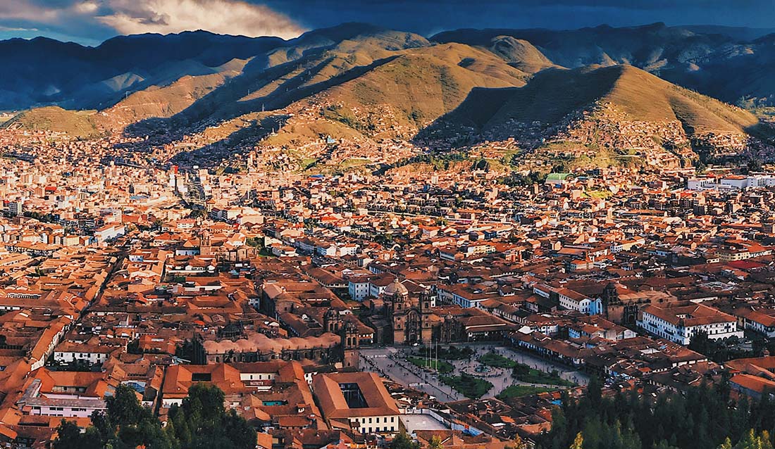
If you are one of those history buffs who also loves the great outdoors, then trekking in the mountains of Cusco, Peru, high above in the Andes Mountains, to come upon the 2 day Inca Trail should be a goal, nay, a mission for you!
There is a rich tapestry of history, mystery, and forestry all around the trail. The Inca Trail adventure is perfect for first-time trekkers and seasoned mountaineers and is sure to inspire all who dare to embark upon this unbelievable journey through the heart of the Cusco region.
- Legendary Inca Ruins and Archeological Wonders
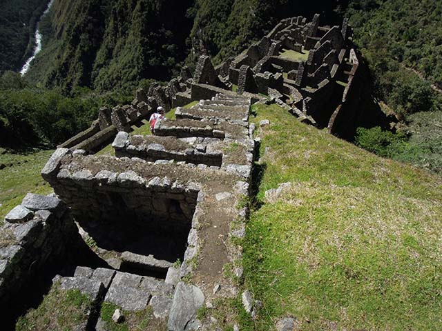
Prepare to be mesmerized by the stunning Inca ruins that will line the Inca Trail trek all throughout your sacred journey. You will walk on original Inca pathways made of stone that have survived for hundreds of years against time and elements. Hiking on, you will discover the ruins of Wiñay Wayna, an impressive masonry feat Inca settlement built into the side of the mountain.
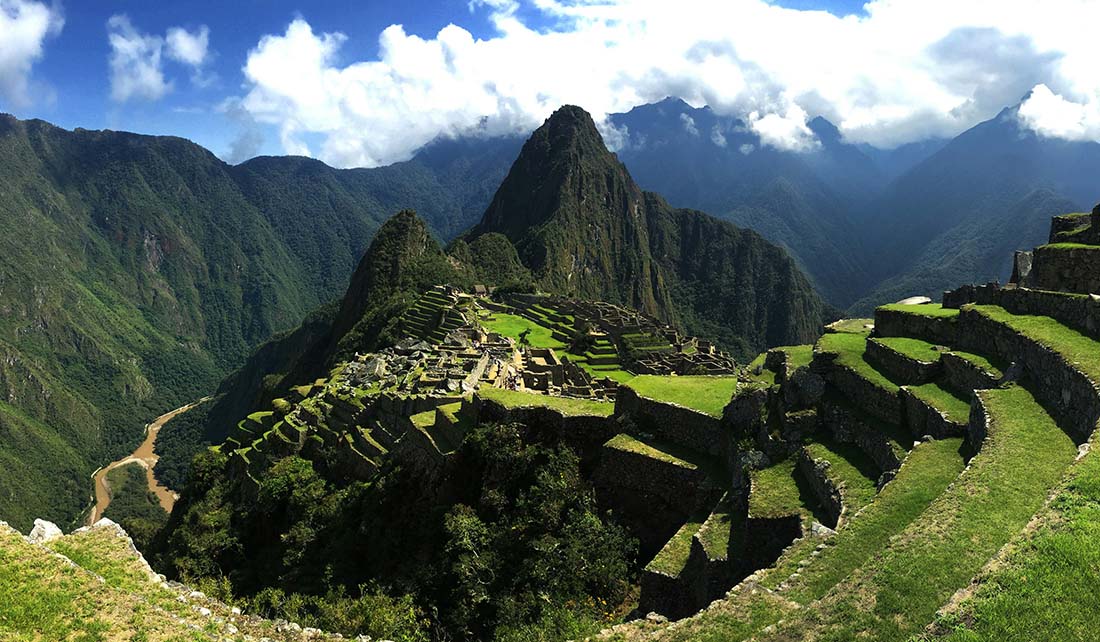
Yet the crown jewel of the Inca Trail hike is of course the fabled Machu Picchu. Referred to as the “Lost City of the Incas,” this legendary Inca fortress has captivated people from all over the world with its gargantuan stone temples and massive granite terraces.
- Breathtaking Andean Landscapes
Don’t dismiss the Inca Trail hike as merely a walk to Machu Picchu. It is home to some of the most beautiful landscapes in the world and you will journey through them to see for yourself. You’ll be far removed from the hustle and bustle of urban jungles and instead travel by foot through the world’s awe-inspiring Andes Mountains. You will pass sprawling glaciers, crystal blue lakes, and, of course, the signature Andean sky.
The Inca Trail to Machu Picchu is a tour of diverse ecological life zones that can only be truly discovered while on foot. You will trek from the lower Andean Mountain ranges, full of lush green flora and fauna, to the stone scree alpine passes at the top, inhabited by crickets and grasshoppers. These diverse and multiple lands are home to many species of flora and fauna, such as the elusive Andean Spectacled bear and the Giant Hummingbird.
- Cultural Immersion and Authentic Experiences
Walking on this hallowed ground feels like walking into rich history. The guides that go with you on this trip make sure this experience is as immersive as possible. On the way, you can take in the native Quechua culture. Meet some of the natives, admire their skill as they perform their traditional weaving, and try some coca leaves.
If you visit in June or August, you might get the chance to witness preparations for or the celebration of the Pachamama Raymi or Init Raymi festivals.
- Challenging Yet Rewarding Trekking
The Inca trail is no easy walk in the park, but the crisp, cool sense of accomplishment and growth you will experience at the end is second to none. The Inca trail is well known for its unforgiving ascents, descents, passes, and for simply testing the mettle and courage of Inca trail backpacking pros and novices alike. Yet the life you will feel and the jolt of adrenaline you experience once you get from Dead Woman’s Pass to the final descent above Machu Picchu is out of this world.
- Exceptional Guides and Support
One of the biggest reasons that the Inca Trail is such a priceless experience? The unbeatable level of service and support that guide waiters and porters provide each and every step of the way. Not only are the guides experts boasting best-in-class knowledge and expertise in the region’s history, culture, wildlife, plant life and fauna, but they care deeply for the safety, health, and welfare of each and every passenger.
The guides and porters will get you checked in for your epic sight in the new world and culture as they share one of a kind stories as well as tricks and secrets that will help make the Inca trail adventure come alive as the porters get you set up by carrying all the gear.
- Unforgettable Memories and Personal Transformation
When you combine the physical, emotional, and intrinsic experience of those few days of trekking with the incredible natural and cultural beauty of the Cusco region, you will have gone through a process of transformation yourself. Regardless of the motivation that started you on the Inca Trail, many trekkers come home with a newfound (or rather heightened) sense of appreciation for Mother Earth, humankind, and themselves!
Capping of An Adventure
If you are looking for a physical challenge, a cultural awakening, or even just an intense experience of mother nature, then the Inca Trail has something perfect to offer and memories you will be carrying for the rest of your life. Lace-up your boots, and bring some curiosity and a sense of adventure. The Inca trail awaits!


