Travel Thru History

Historical and cultural travel experiences

  • Home
  • Airfare Deals
  • Get Travel Insurance
  • Writers Guidelines

Morningside Heights, New York City

Columbia University library

A Different Look at a Well-known City

by Susmita Sengupta

When we ask anyone about New York City, invariably the phrase that instantly comes to most people’s mind is that it is a city that is perpetually in motion. “The city that never sleeps,” is the expression used consistently. Tourists flock to see the major attractions such as the Statue of Liberty, Empire State Building, the famous museums, 9/11 Memorial, Central Park and of course, Times Square.

Morningside Heights, New YorkBut then, just a few miles north of the bustling clamor of Times Square, one can enter a very different world of relative quietness and calm. This is the neighborhood known as Morningside Heights, home to several excellent educational institutions and also a few other points of interest. The area begins from 110th Street in the south, ends at 125th Street to the north and is bookended by the Riverside and Morningside parks.

Though it is now frequented by some New York bus tours, the neighborhood is moderately free of tourists. If one has a couple of extra hours available, one can take this wonderful side trip if one wants to experience a different portrait of New York.

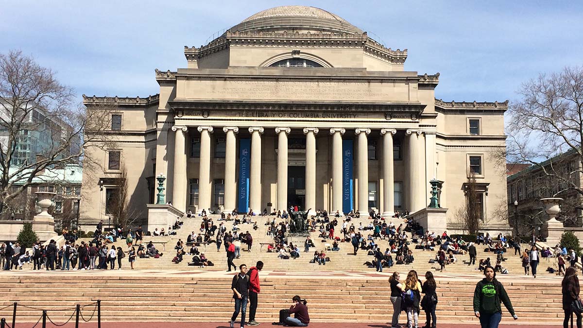
The best place to start would be at the campus of Columbia University, ensconced between Broadway and Amsterdam Avenue, the only Ivy League institution to be located in a major city. The university founded as King’s College in 1754 at the behest of King George II of England is the oldest higher education institution in New York State. Starting in a schoolhouse in Trinity Church in Lower Manhattan, the university moved to its present campus on Broadway and 116th Street in 1897. Although there are many gates to enter into the campus, I entered through the main wrought iron gates located on Broadway at 116th Street, immediately outside the subway stop and instantly felt myself transported as if to a college town. I was now on College Walk, the promenade that visually splits the campus into two halves. To my left was Low Memorial Library and to my right was Butler Library, the main library of the university. Low Library, built in the Roman Classical style is well known as the venue for the bestowal of the Pulitzer Prize, the foremost award in journalism and arts. The broad set of steps with the imposing Alma Mater bronze statue in the center that descend from the Low library was filled with students relaxing or studying.

About 23,000 students descend on the college grounds to attend classes on school days. I climbed up the steps to take a walk through the main areas of the campus, passing by the various department buildings. The campus is home to many outdoor sculptures such as Rodin’s The Thinker, Henry Moore’s Reclining Figure and Three-way piece: Points and what turned out to be my favorite, Tight Rope Walker by the Dutch sculptor Kees Verkade located on the bridge above Amsterdam Avenue on the way to Columbia Law School. Of course, I could not miss the massive sculpture “Bellerophon taming Pegasus” at the entrance to the Law School. About five stories high, it is one of the largest in New York City and was sculpted by Jacques Lipchitz.

Finishing up at the campus, I walked a few streets up to 120th Street to see Riverside Church and Grant’s Tomb located close to each other. The imposing spires of Riverside Church is visible from a distance and I found out that it reflects the 13th century Gothic Cathedral in Chartres, France. The nave has a labyrinth design inspired by the one in the Chartres Cathedral. The church can seat close to two thousand worshipers and is well known for the largest tuned Carillon bell in the world. Historically the church is famous for the “Beyond Vietnam” speech given here by Rev. Dr. Martin Luther King Jr. in 1967. Nelson Mandela, the Nobel Laureate and former President of South Africa, spoke twice from the pulpit here, first in 1990, barely four months after his release from prison and then again in 2005.

On the way to Riverside Church, one can see the magnificent red buildings of Teachers College, and the small, elegant campus of Barnard College, two other major educational institutions in the neighborhood. At Manhattan School of Music, which began as the Institute of Musical Art, the antecedent to the world famous Juilliard School, opposite Riverside Church on Claremont Avenue, one can even take in a musical performance in one of its many halls and performance spaces.

Grant's Tomb
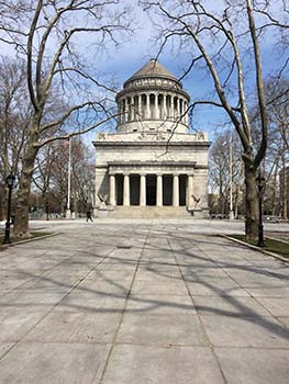
Across the street from the church on Riverside Drive is Grant’s Tomb, the second largest mausoleum monument in North America. A stark and austere granite and marble tomb, surrounded by a tree lined plaza, it is the final resting place of Ulysses S. Grant, the 18th President of the US and the Commander of the Union Army during the Civil War and his wife, Julia. It was designed by the architect John H. Duncan in the Roman Revival style and was completed in 1897.

Cathedral of Saint John the Divine at 110th street and Amsterdam Avenue can be another stop on this trip. At 125 years old and considered as the largest cathedral in the world, it is built in a mix of Romanesque, Byzantine and Gothic Revival style and is actually still unfinished. The extensive grounds of the cathedral are also open to the public and one can spend some tranquil moments in the Biblical garden or at the Peace Fountain, a startling piece of public art that is a peculiar mix of science and religion and denotes the eternal theme of good overcoming evil. On the sunny day that I visited, the benches were full and people surrounded the fountain, taking pictures at various angles. Always on the lookout for an Indian connection, I was heartened to see a little bronze plaque with the words of Mahatma Gandhi.

Tom's restaurantComing back to Broadway, lined with a variety of stores, restaurants and cafes, you can stop by at Tom’s Restaurant, a fixture of the neighborhood since the 1940s made famous in the song “Tom’s Diner” by Suzanne Vega and for being the location of Monk’s Diner, familiar to all viewers of “Seinfeld,” the hit American sitcom from the 1990s.

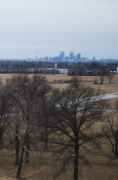
I finished off my tour by taking a walk through Riverside Park, a lengthy sweep of green filled with trees, pretty gardens and long, winding asphalt paths that extends over four miles from 72nd street to 158th street with parts of it right along the Hudson River. In the Morningside Heights area, which is situated at a higher elevation, I could see the river from the lookout areas in the park. The sun was setting and I strolled through the park, watching joggers, moms with strollers, people walking their dogs or just sitting on the many benches enjoying nature in the midst of the busiest city in the world.


If You Go:

From Times Square: 20 minutes by subway to 116th Street station (Columbia University) on the Uptown 1 train.

The M4, M104 and M60 buses also stop at 116th street.

For more information:

Columbia University History

The Cathedral Church of St. John the Divine

Riverside Church

Grant’s Tomb

About the author:
Susmita Sengupta is a freelance writer who loves to travel. She and her family have traveled to various parts of the USA, Canada, Europe, the Caribbean, Middle East, Southeast Asia and India.

All photos by Susmita Sengupta.

  1. Columbia University campus with College Walk and Low Library
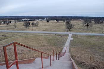
  2. A View of the neighborhood of Morningside Heights
  3. Grant’s Tomb and its surrounding plaza
  4. Neon lighted façade of Tom’s Restaurant


Tagged With: New York City attractions, New York travel Filed Under: North America Travel

Walking and Paddling Through Goldrush History in Canada’s Yukon

Fort Selkirk Yukon sign
by John Geary

Walking across the grassy field to the Stone House Interpretive Centre, it was almost as if you could still hear people talking, going about their daily business as usual among the log buildings scattered around on top of the bluff overlooking the Yukon River.

Of course, no one had lived permanently at Fort Selkirk in the Yukon Territory since the 1950s, when the highway between Whitehorse and Dawson City went through. Prior to that, if you wanted to get from the territorial capital to the settlement, or further downriver to the city associated with the Klondike Gold Rush of the late 19th century, you had to use the river or fly in, once that type of transportation came into use.

The highway did not go anywhere near Fort Selkirk, located on the west bank of the Yukon River; at that point, the highway was several miles away over on the east side of the river.

Fort Selkirk homestead buildingEstablished as a trading post by the Hudson’s Bay Company in 1852, the fort evolved into a permanent community in the early 1890s. The gold stampede swelled its population and it became a base for both the Yukon Field Force and a Northwest Mounted Police post.

While it existed as a permanent community, both white and First Nations cultures worked and lived together amicably. That partnership remains today, as the Selkirk First Nation and Yukon governments co-manage the site.

Anyone doing a multi-day canoe trip on the river stops there, as there is a very nice campground for trippers next to the historic site. No matter what your paddling schedule, you’ll want to allow at least a few hours to explore the small museum and other buildings –a church, a store, residences, to name a few – to really appreciate it.

Fort Selkirk is just one of many amazing historical sites to visit in the Yukon.

And while not everyone will be up for a canoe trip to get there – or to Dawson City – you can drive from Whitehorse along Highway 2.

Dawson City really is a “living museum” with its boardwalks and clapboard-style of architecture in most of the buildings which are not residences.

Just strolling down the street looking for a place to enjoy breakfast my first morning there, I felt like I was walking in the footsteps of numerous sourdoughs (a word used for miners in the Yukon) … or maybe even in more famous footsteps – like those of authors Jack London or Robert Service, who both spent time there.

INTERPRETIVE TOURS

Dawson Daily News buildingParks Canada plays a significant role in keeping the history alive and making sure people have an opportunity to experience the site as fully as possible. One of the best ways to ensure you enjoy the full experience is to sign up for one or more of their tours at the Visitor Information Centre along the community’s Front Street, just a nugget’s throw from the river.

One of the first things I did was sign up for a tour that took us to the old post office, the newspaper office and a building that holds many of the archival materials dating back to the gold rush.

The tour starts off with everyone donning white gloves so as not to leave any oils or smudges on the artifacts you’ll be allowed to handle. There are several historical pieces located right in the visitor centre, and we warm up our “historical trivia minds” with some of these, as the guide prodded our curiosity by asking questions about the artifacts, testing our knowledge of the past at the same time.

Then it’s off to our next tour stop, a block or two away: the post office.

Robert Service book first editionApart from looking at the facility which used to handle all the mail coming into the centre of the Klondike gold rush, we had the opportunity to examine some more artifacts – including an original first edition book written by Robert Service.

This book – Why Not Grow Young? – was not one of poetry, though; it was a non-fiction book he’d written about healthy practices that would help you live longer. Robert Service – an early 20th-century Dr. Oz! Who knew?

After looking at some “old mail” packages and envelopes and some post office public notices on the walls, we headed down the street to the Dawson Daily News – or what used to be the city’s newspaper office and presses. After checking out the press equipment used to print the day’s news, we had the opportunity to read some actual newspapers that were published on the very day we were visiting – but back in the early 20th century. Very interesting reading about items like the “recent Wall Street slump” and news of the Kaiser from Europe (this was before The Great War, remember). Even the ads were quite interesting: white golf sweaters for women, travel ads for rail lines and steamships, and food ads for products like “Juicy Clark’s Pork and Beans.”

Our final stop took us to a building which houses several archives not on display in the other buildings.

LITERARY HISTORY

A brisk 15-minute walk from the visitor centre takes you to the Robert Service Cabin. Again, a Parks Canada interpreter helps make the experience come alive. Dressed in the fashion style that the poet of the Yukon would have probably been decked out in, stories and poems pour forth from the guide’s mouth, painting a picture of the man who went there as a bank clerk, but grew to become the creator of such famous verses as “The Cremation of Sam McGee” and “The Shooting of Dan McGrew.” I learned that he wrote much more than poetry about the north and the gold rush; he was quite prolific when it came to poetry about the First World War, as well.

After the presentation, we spent several minutes in his restored cabin (he lived in it from 1909 to 1912), which contains some of the original historic artifacts, including a writing desk, writing materials, tools, oil lamps, wood stove, telephone and his bed.

Log structure at Jack London Museum
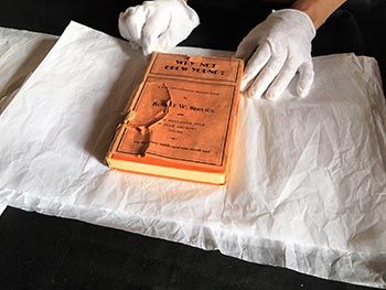
A few minutes down the road from the Service cabin sits the Jack London Museum. It contains some pieces of the original cabin the American author stayed in during his foray into gold-seeking; half of the logs are here, the other half at a similar museum in San Francisco, where he lived in the U.S. The museum contains several photos and other memorabilia pertaining to London’s time in the Yukon, and a video display that continually rotates Hollywood movies based on his writing. An interpreter gives talks about his life at several times during the day.

While you’re in the neighbourhood, take a few minutes to take a quick look at the Pierre Berton home across from the Service cabin. A resident of the community as a boy growing up, the Canadian author was a big advocate of his hometown and its history.

PADDLEWHEELER ADVENTURES

SS Keno paddleboatAnother historic site worth checking out is the SS Keno. The old sternwheeler is berthed in a dry dock on the waterfront. Built in 1922 by the British Yukon Navigation Company, it steamed along transporting silver, zinc and lead ore down the Stewart River from mines in the Mayo district to the confluence of the Yukon and Stewart rivers at Stewart City. It was retired from commercial service in 1951, again because of highway construction.

Better still, why not take a step back into time and ride on a paddlewheeler like the old sourdoughs use to sail up and down the river on?

The Klondike Spirit cruises up and down the Yukon with several tours daily on most days from mid-May to early September. An interpreter explains what you see along the way; you’ll see a paddlewheeler graveyard, a First Nations community, and the spot where an old hermit used to live just upstream and across the river from the city.

DON’T FORGET THE NIGHTLIFE!

Before leaving Dawson City for other adventures, you’ll want to check out some of the nightlife that recalls the kinds of entertainment enjoyed by the sourdoughs. A trip to Diamond Tooth Gertie’s with its turn-of-the-century stage shows is a must-see.

SourToe Cocktail

Whether you check out the dance hall girls or not, you’ll probably regret not joining the SourToe Club before leaving Dawson. Go to the Sourdough Saloon and ask for Captain River Rat. Then you purchase a shot of your choice – rye whisky, rum, vodka, or as many choose, Yukon Jack. I opted for rye when I did it, as they were out of YJ.

Then you just take the “SourToe Oath,” watch as an actual dehydrated human toe is added to your drink, and cheers! Down it (the booze, not the toe!) and you’re in!

There’s an interesting story about how this tradition began, but I’ll let you discover just what that is when you go for your cocktail.

Just remember, there is one rule: “You can drink it fast, you can drink it slow, but your lips have gotta touch the toe!”

And look at it this way: your lips are touching a part of history. And isn’t that what this journey is all about?


If You Go:

Getting there

The starting point for any trip to the Yukon is Whitehorse. Both Air Canada and Air North fly in to the territorial capital regularly.

For planning your trip itinerary, start with the Travel Yukon website; it can give you lots of ideas and contact information to help you plan your trip:

From Whitehorse, you can either fly into to Dawson City or drive Highway 2. There are car rental agencies in the capital.

If you have a mind to canoe on the Yukon River to see Fort Selkirk, Up North Adventures can supply gear, food, and guides.

Other helpful links:

Klondike Spirit Paddlewheeler Cruises

Dawson City Visitor Centre

Parks Canada Klondike Historic Sites


About the author:
John Geary is a full time freelance writer-photographer based in Vancouver, B.C. He often specializes in stories that involve paddling and bird/wildlife watching but has always been an avid history buff since the fifth grade, when he heard tales of Marco Polo that kick-started his longing for exploration and adventure.

Photos by John Geary

  1. The edge of the Fort Selkirk historic site
  2. One of the homestead buildings at Fort Selkirk
  3. The newspaper office
  4. One of the artifacts in the post office: An original Robert Service book
  5. A food cache outside the Jack London Museum
  6. All aboard! The Klondike Spirit is getting ready to shove off


Tagged With: canada travel, Dawson City attractions, sourtoe cocktail, Yukon attractions Filed Under: North America Travel

Missouri: Cahokia Mounds

Monk's Mound at Cahokia

Exploring an Ancient Civilization Just Outside St. Louis

by Kelley Baster 

Few things are appealing about a 10-hour drive in the middle of February. The gray and brown landscape along a flat, straight highway isn’t exactly scenic. Fortunately for me, this particular drive was broken up by a stop to a major historical site that I may never have visited if it weren’t for this trip. I had casually mentioned the trip from Ohio to Kansas that I was planning, and an acquaintance told me to stop by Cahokia Mounds on the way. While researching this option, I was surprised to discover that this site was once home to the most extensive and advanced pre-Columbian settlement in the modern United States. Yet, somehow, I have no recollection of ever studying it or even hearing about it.

View from Monk's Mound

As soon as I went in the interpretive center at Cahokia, I was welcomed by a friendly volunteer who let me know the next film about the settlement would be beginning soon. I made my way to a large theater and learned a lot from the brief documentary about life at Cahokia. I then began to explore the exhibits, which rivaled those of some of the bigger museums I’ve visited. They talked about daily life in the past, the surrounding environment, and the excavation that unveiled much of what is now known about Cahokia.

As early as 700 A.D., people began small settlements at the site that later became Cahokia Mounds. By the settlement’s peak in the late 11th and early 12th centuries, Cahokia is estimated to have contained 10,000-20,000 inhabitants. For some perspective, that’s double the current size of Aspen, CO, and just a little bit smaller than Key West, FL. Those thousands of residents were spread out over an area that stretched for over six square miles. The size of the settlement is even more impressive when compared to other cities at that time. The settlement at Cahokia surpassed the size of London in that time frame, and no other settlement in North America surpassed Cahokia it until Christopher Columbus and his companions arrived on the continent.

In addition to its size, Cahokia is noteworthy because of its level of progress for the time. Of course, even maintaining order in a settlement of its size shows a certain level of advancement. An extensive display even lets you walk through a life-size model that portrays a typical day at Cahokia. Walking through the scenes that depict people working, cooking, and playing truly helps visitors envision life at the time. Other indications of the settlement’s progress are present as well. One noteworthy instance is a calendar system created by a series of wooden posts, now known as Woodhenge. Similar to the way in which a sundial can indicate the time, the posts of Woodhenge indicate the time of year. A recreation of this setup can be seen today at the site.

St. Louis Skyline

After thoroughly exploring the museum, I made my way to the main historic attraction at Cahokia: Monk’s mound. At 92 feet tall, this earthwork seems to be as prominent in the park as it was in the Cahokia community nearly 1,000 years ago. While Monk’s Mound is impressive from the surrounding ground, I was certainly glad I took the stairs to the top to see the skyline of St. Louis and the surrounding park below. Numerous smaller mounds fill the rest of the park and are linked by trails that meander through the grounds. If I had visited in a warmer month, I certainly would have spent more time exploring these trails and mounds.

The historical significance of the Cahokia Mounds is so great that it has even earned the revered designation of a UNESCO World Heritage Site, making it one of only 23 such sites in the United States. It’s listed alongside much more popular destinations, like Independence Hall and the Statue of Liberty. The mounds, recreation of Woodhenge, and interpretive center all help visitors understand why Cahokia certainly deserves that designation.


If You Go:

Cahokia Mounds is located near St. Louis, MO, and is not far south of I-70.

Cahokia Mounds’ website provides museum hours, a trail map, and other information that will be helpful in planning your visit. No admission fee is required, but suggested donations are listed, ranging from $2 for children to $7 for adults.

More information about the historical significance of Cahokia Mounds can also be found on UNESCO’s website.

About the author:
Kelley has had an interest in travel, writing, and photography for most of her life, she has only recently begun to combine these interests into travel writing. She created her website, www.aboutthedestination.com earlier this year. Kelley prefers destinations that offer great hiking opportunities and natural scenery; however, she enjoys exploring cities once in a while too.

All photos by Kelley Baster
View of Monk’s Mound from ground level
View from top of Monk’s Mound. Interpretive Center can be seen in upper left corner
Stairs ascending Monk’s Mound
View from top of Monk’s Mound facing St. Louis skyline

Tagged With: Missouri travel, St. Louis attractions Filed Under: North America Travel

Mexico: In the Footsteps of Hernán Cortés and the Three Faces of Veracruz

Stone ring at Cempoala

by Troy Herrick

Ambition, wealth, power, status, a thirst for adventure and even a little luck – dreams are made of these; and dreams are what propelled eleven Spanish galleons along the southeastern coast of Mexico in the spring of 1519 in search of military intel. The conquistadors on board were in need of intel because they wanted to establish a Spanish colony in Central Mexico.

By a stroke of luck, Hernán Cortés, the leader of the expedition, rescued a shipwrecked Spanish priest who had learned the Mayan language after having lived among them as a slave for eight years. His greatest prize however was receiving a tribute that included a young female slave who spoke both Mayan and Nahuatl, the language of the Aztecs. By means of three-way translation Cortés learned about Moctezuma II and the rich and powerful Aztec Empire in Central Mexico. The long road to the Spanish conquest of Mexico had begun.

San Juan de Ulua and Chalchihuecan in Present Day Veracruz

Cortés set his sights on meeting Moctezuma. But how would he achieve this? He started by making a lasting impression on Moctezuma’s ambassadors whom he met on the Island of San Juan de Ulua in the harbor of what is now present-day Veracruz. The brash Cortés demonstrated the power of his cannons, rifles and horses to the ambassadors and then suggested that they may wish to inform Moctezuma of his impending arrival in their capital of Tenochtitlan (present-day Mexico City).

Shortly after, Cortés and his men crossed over to the mainland at Chalchihuecan, just opposite the island, in order to establish a beachhead. After setting up camp on the malaria-infested dunes, a party of men was dispatched northwards along the coast in search of a safe harbor for their ships.

Veracruz - the MaleconWalking along the Malecon opposite the island, you find nothing that hints at the significance Chalchihuecan in the conquest of Mexico. This is likely because present-day Mexicans are not proud of this period in their history.

While at this new camp, Cortés first made contact with the local indigenous people known as the Totonacs, some of whom spoke Nahautl, and was invited to visit their capital to the north at Cempoala. You also have a standing invitation to visit Cempoala and you can plan your visit over a glass of Lechero Grande coffee at the Gran Café de la Parroquia. When you are refreshed, follow in the footsteps of Hernán Cortés.

Cempoala

As Cortés and his entourage approached Cempoala, he sent riders on ahead. Upon their return, they reported that everything was covered in silver. Imagine Cortés’ disappointment when he arrived and found that the “silver” was only the sun reflecting off the white plaster surfaces on all the structures inside the city.

Passing through the defensive walls surrounding the site, you find very little of that “silver” remaining today as the plaster has deteriorated over time. What you see instead are structures assembled from smooth river stones and limestone mortar, including the peripheral wall encircling the site.

Temple of the sun, CempoalaThe six-tiered Temple of the Sun (Great Pyramid) is the largest structure at Cempoala. At the base there is a round structure that may have served as an altar or a fire pit. This circle has a 7 foot external diameter and a 10 inch depth. A similar pit is also visible about half way up to the summit. Choose one of the two balustrade staircases and climb the 17 stairs to the top for a panoramic view of the site. You also find that part of the right staircase has been cut away to reveal an earlier structure underneath as evidenced by 7 stairs that are not constructed from river stone like the outer structure.

To the right of the Great Pyramid you find the Temple of Quetzalcoatl, the god of wind. This 5-tiered structure is unusual in that it consists of two sections; the front section is a rectangular platform while the back section is a circular platform representing the serpentine nature of this god. A model in the site museum shows that a circular sanctuary representing a coiled snake once stood on top of the circular platform. After climbing the 18 steps to the top you find that nothing remains of the sanctuary.

Three stone rings [TOP PHOTO] are situated at the opposite end of the site. The largest has an internal diameter of roughly 46 feet and the smallest about 4.5 feet. The most likely explanation for these structures is that they were used in tandem for calibrating astronomical cycles like the movements of the sun, moon and the seasonal changes over the course of a year. Each ring features a number of regularly spaced stepped pillars which could certainly have been used for such measurements. The largest ring has 40 pillars while the middle and smallest rings have 28 and 13 pillars respectively.

During his visit to Cempoala, Cortés allied himself with the Totonac chief. He also pledged to help free them from their 50 year subjugation by the Aztecs and their burdensome annual tribute to the Emperor.

At this time the soldiers sent out to find a better harbor had returned with important news. They had discovered another Totonac town that appeared to be a fortified port. Its name was Quiahuiztlan.

Quiahuiztlan

Quiahuiztlan Peñon de Bernal
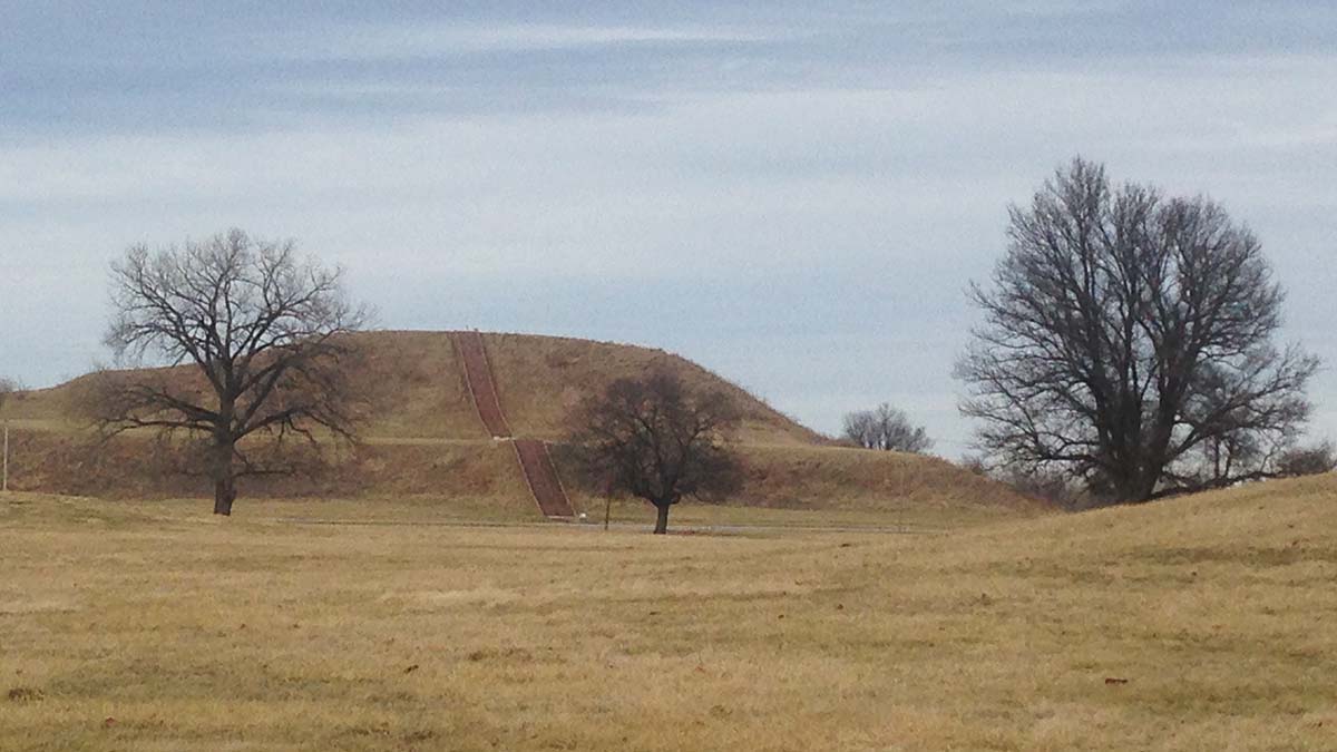
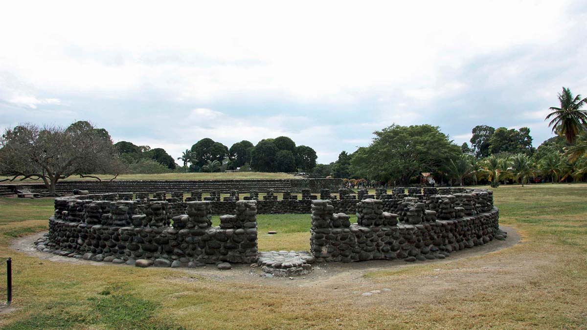
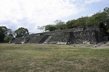
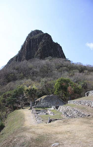
Arriving in Quiahuiztlan (pronounced “key-ah-wheez-tlahn”) you may feel that you are in Machu Picchu as this site is situated on a terraced slope adjoining a jagged mountain named Peñon de Bernal. With the aid of defensive walls, the residents must have felt relatively safe from any threats from below. These walls had proven to be ineffective as this city had also been subjugated by the Aztecs; now the Spanish were climbing the steep hill to make first contact.

Quiahuiztlan is best known as a cemetery for the nobility of Cempoala. Unique in all of Mexico, this site has over 70 miniature mausoleum-style tombs scattered around three cemetery levels. Each mausoleum is between 2 to 3 feet high with 3 or 4 miniature stairs leading up a “crypt” that only a GI Joe or Barbie doll could enter. We didn’t notice any evidence that these tombs had ever been violated so presumably the original occupants are still interred here.

Not all tombs were created equal. Some are in fact full size and you are able to climb on them. Tomb 1 has 8 ballustrade stairs leading up to a platform on which you find the remnants of 6 square pillars. Perhaps this was once a mausoleum that a priest might enter in order to leave a sacrifice.

Nearby is the 4-tiered Pyramid 1 which also appears to be associated with a tomb. Around the back of this structure, you find a platform with a rectangular hole that could have accommodated a corpse at one time. There was no one around, living or dead, who could confirm this however.

The living also resided at Quiahuiztlan as evidenced by the large rectangular structure with 24 inch thick stone foundation walls known as Building 3 and the 190 foot long ballcourt. I couldn’t help but wonder how long the game might have been delayed if the ball was accidently knocked outside the ballcourt and down the mountainside.

By the time Cortés had concluded his visit to Quiahuiztlan he had allied himself with a number of other Totonac chiefs who provided him with an army of at least 8000 warriors. He now prepared to march on Tenochtitlan to meet Moctezuma, but not before he left a garrison of his own men at what is now known as Punta Villa Rica on the beach below Quiahuiztlan.

Punta Villa Rica de la Veracruz – the First Veracruz

The sleepy fishing village of Punta Villa Rica has the distinction of being the site of the first permanent Spanish settlement in Mexico and the site of the first Veracruz. Cortés destroyed his ships on the beach here to prevent any of his men from deserting. He then utilized the wood from the ships and local stone to construct a fortress and a small church close to the beach. Only the stone foundations remain today. Visitors now travel to Punta Villa Rica for the sun, sand and beer; otherwise they appear to be oblivious to the history of this village.

Cortés abandoned Villa Rica in 1523, after the conquest of Mexico, to re-establish Veracruz at what is now known as La Antigua. This was necessitated because of the high winds that appear over the Gulf of Mexico during the wintertime. These winds were hazardous to shipping and therefore a safer port was required.

La Antigua – the Second Veracruz

Cortés and his men had initially passed through the vicinity of present-day La Antigua on their way from Chalchihuecan to Cempoala. When it came time to move Veracruz to a second location in 1523, they remembered the deep river that they had to cross and how it might be useful for sheltering their ships inland away from the gulf.

Casa de CortésArriving at La Antigua, make your way to the Casa de Cortés, a 26 room structure with a courtyard. It was built from orange-brown ballast bricks, coral and river stones taken from the nearby Antigua River. You will know you are there when you see Amate trees insidiously engulfing the walls and doorways of this “modest” home like some creature out of a horror movie. You can still find traces of how this structure may have looked in the 16th century when you see the tile flooring and weathered plaster in some of the rooms. A rusty old 12-pound cannon lies outside to provide that warm inviting atmosphere that comes with every home, because you just never know who might drop by for a visit like pirates, indigenous raiding parties or a mother-in-law.

Ceiba de la Noche Feliz
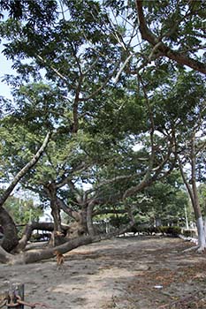
Walk towards the river and you find the massively large and gnarled tree known as the Ceiba de la Noche Feliz. One root running along the ground is over 65 feet long and at least 3 feet in diameter. Cortés and his men were said to tie their boats to this tree. When you see how far this tree is from the river, they either used very long ropes or the river has since changed its course and moved further away.

A short walk away is the Ermita del Rosario, the oldest chapel on the mainland of the Americas. The white plaster façade has 3 bells hanging over the front door. Inside you find a vaulted nave with a rather plain looking altar and brown park bench-like pews. Do not confuse this chapel with another church known as the Iglesia de Cristo de Buen Viaje which you must pass before arriving at the Ermita del Rosario. You can distinguish the two because the Ermita does not have a red dome on its roof while the Iglesia does.

La Antigua was the main port of entry into New Spain for almost 80 years but it too was abandoned in 1599 due to frequent flooding. Galleons were lifted up with the rising water and sometimes left stranded on shore. What did the Spanish do then? In 1600 they returned to where it all began and settled at Chalchihuecan, the third and final Veracruz, opposite the then relatively new Fuerte (fort) de San Juan de Ulua, but that is a different story.


If You Go:

To visit the Malecon in present-day Veracruz, walk along the harbor on San Miguel Aleman Valdes on Insurgentes.

The Gran Café de la Parroquia is located on the Malecon, across from the Mercado de Artesanias on San Miguel Aleman Valdes on Insurgentes. A glass of Lechero Grande Coffee cost 40 pesos at the time of our visit. Cempoala (sometimes spelled Zempoala) is 49 km north of Veracruz. Admission to the archeological zone is 50 pesos.

Punta Villa Rica de la Veracruz is 80 km north of present-day Veracruz on Highway 180. Look for the sign labeled Villa Rica Playa on your right to enter the village. There are no signs to direct visitors to the stone foundations. The locals may be able to provide you with directions to the ruins but some Spanish will be required as English is not widely spoken in this area.

The road to Quiahuiztlan is directly opposite to that of Punta Villa Rica. Turn to the left and drive 4 km uphill. Admission is 40 pesos.

La Antigua is 18 km north of present-day Veracruz. All sites here are free to visit. The Casa de Cortés is located at Avenida Independencia at Calle Ruiz Cortés. Admission is free. The Ceiba tree and the Ermita del Rosario are approximately a half block away in opposite directions from the Casa de Cortés.

In order to visit all of these sites, you will require either a rental car or a taxi for the day. Taxis are inexpensive and you should negotiate a price. Also note that a car or taxi from Veracruz must pass through a tollgate just south of La Antigua so factor this cost into the price as well if you drive or hire a taxi.

About the author:
Troy Herrick, a freelance travel writer, has traveled extensively in North America, the Caribbean, Europe and parts of South America. His articles have appeared in Live Life Travel, International Living, Offbeat Travel and Travels Thru History Magazines.

Photographs:

Diane Gagnon, a freelance photographer, has traveled extensively in North America, the Caribbean, Europe and parts of South America. Her photographs have accompanied Troy Herrick’s articles in Live Life Travel, Offbeat Travel and Travels Thru History Magazines.


Tagged With: Aztec pyramids, mexico travel, Veracruz attractions Filed Under: North America Travel

Delaware: The Wonders of Winterthur

Winterthur museum

by Theresa Troutman

Nestled in the verdant rolling hills of the Brandywine Valley in Delaware, you’ll find Winterthur Estate and Gardens. Once the home of the late Henry Francis DuPont, it now stands as the premier museum of American decorative arts.

Winterthur gardenAn avid horticulturist, duPont supported the naturalistic garden approach to the 2,600-acre estate. Natural gardeners take the existing trees and plants that cover the landscape and add native plants and ground cover. The overall aesthetic is an abundant, less manicured garden. It was a different style from the formal French gardens that were all the rage at that time.

DuPont took great pains in his planning to ensure there was always something blooming every month. A quick look at the Winterthur website will list monthly blooms so you can visit year round and see the beauty of his simplistic approach. The result is a colorful array to delight walkers, joggers, and tourist who use the trails through the 60-acre garden.

A twenty-five-minute tram tour of the grounds highlights sections in the garden include Peony Garden, Sycamore Hill, the March Bank and the Sundial Garden. You will see 100-year-old cherry trees, which have outlived their standard fifty-year lifespan. The property also has a rare sure found in a valley in China that was thought extinct and brought to the property as a sapling in the 1940s. The tree has grown and thrived. The pre-historic tree grows two to three feet a year and current towers over all the older spruce trees on the property.

Adults and children alike can wander the Enchanted Woods. This delightful fairy garden delights young and old. Tucked under giant oak trees, the three-acre plot contains bird’s nest big enough for children to sit inside and view the wonders of the garden. Cross over the Troll Bridge and explore the delightful Faerie Cottage. You can also wander through the Fairy Ring. Step inside the ring of toadstools, but be warned, you may disappear among the mist. Legend has it stepping inside the ring will whisk you away to fairly land forever!

The mansion was built back in 1837 as a 12-room house in the Greek Revival style, situated on 450 acres of land. Through the generations, the house and grounds were expanded. When Henry DuPont assumed management of the estate in 1903, after his father’s death, the house expanded again to its current 175 rooms. While many privileged Americans were collecting European and Egyptian art, DuPont had a deep appreciation for American decorative antiques and started a life-long passion for collecting them.

Martha Washington's chinaAlthough the duPont family descended from France, Henry duPont was proud of his American heritage. You will find many portraits, bust and figurines of George Washington as you explore the museum. Martha Washington’s table china is proudly displayed in one room. Winterthur currently owns more pieces than Mt. Vernon.

Winterthur dining roomAn hour long guided tour of the house will take you through the atrium and living spaces, including family rooms, conservatory, dining room, and bedrooms. The current introduction tour shows visitors what it was like to be a weekend guest of the duPont family.

Exploration begins in main entrance with our guide describing what it must have been like to drive up the sprawling paved drive to Winterthur. Guest would be greeted in the main entrance and whisked off to their private bedrooms. Next, we see the parlor and family room where the guests would play cards, chat, or listen to Mrs. duPont play the piano. The real treat of the weekend would be the sumptuous dinners severed in the dining room. Attention to detail was key. Mr. duPont personally oversaw to the details of setting the mood with his use of color, selecting the perfect flowers and china setting to accompany the meal.

After you tour the house, check out the Galleries. Current exhibitions include Treasures on Trial: The Art and Science of Detecting Fakes, along with Collecting for the Future: Recent Additions to Winterthur Collection. The Dorrance Gallery contains the permanent collection of Campbell Soup Tureens. They range from simple to elegant and were an important part of lavish meals for the noble and wealthy.

If You Go:

Plan a two-day visit to experience the entire estate or if you live locally, become a member. Tours change seasonal basis, so you can always return to see and learn something new. The Yuletide tour every Thanksgiving through New Years is not to be missed and a sure-fire way to get you in the holiday spirit. If you love Downton Abbey, you’ll definitely want to put Winterthur on your travel to-do list.

Visit Winterthur at 5105 Kennett Pike, Winterthur, DE 19735
Admission is $20 Adult, $18 Seniors and $5 Children 2-11

About the author:
Theresa Troutman is an author and travel writer who lives in Pennsylvania. She loves adventures that take you off the beaten path, whether it’s a behind the scenes look at being a zookeeper or hopping on a random train and letting the day unfold. She’s a thrifty traveler who loves to share tips and insights into travel. You can read her blog at http://thesavvytraveler.us.

Photo credits:
Winterthur Museum #1 by Daderot / CC0
All other photos by Theresa Troutman


Tagged With: Delaware attractions, USA travel Filed Under: North America Travel

  • « Previous Page
  • 1
  • …
  • 37
  • 38
  • 39
  • 40
  • 41
  • …
  • 72
  • Next Page »

MORE TRAVEL STORIES:

Italy: An Unusual Adventure in Rome

Switzerland: Savoring Zurich’s Old & New History

Trekking in Nepal: Why Annapurna Circuit and Langtang Valley Are the Best:

Soaring Over Paradise

How Cultures Are Shaped By Cuisine

Delving Deep: A Journey into the Enchanting World of the Wieliczka Salt Mines

Okinawa: 5 World Heritage Castles and the Legend of Gosamaru

Florida Winter Estates of Edison and Ford


SEARCH

DESTINATIONS

  • Africa Travel
  • Antarctica travel
  • Asia Travel
  • Australia travel
  • Caribbean Travel
  • Central America Travel
  • Europe Travel
  • Middle East Travel
  • North America Travel
  • Oceania Travel
  • South America Travel
  • Travel History
  • Travel News
  • UK Travel
  • Uncategorized
  • World Travel
facebook
Best Travel Blogs - OnToplist.com

Copyright © 2026 Cedar Cottage Marketing | About Us | Contact | Privacy Policy | Terms & Conditions | Copyright Notice | Log in