Travel Thru History

Historical and cultural travel experiences

  • Home
  • Airfare Deals
  • Get Travel Insurance
  • Writers Guidelines

British Columbia: All Aboard the Kettle Valley Steam Railway

kettle valley steam engine
by Karen Pacheco

Our photo club group reaches Summerland, British Columbia, for some destination photography. We corkscrew up a rural road to reach our accommodations at Wildhorse Mountain Ranch B and B where a welcome party of three enthusiastic canines greets us. Unloaded and settled into our rooms, our itinerary unfolds.

Trout Creek Trestle Railway Bridge
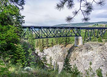
On day one we head to Summerland’s Ornamental Gardens followed in the afternoon by a scheduled steam train ride. While at the gardens we are teased by a glimpse of the seventy-three-metre high Trout Creek Trestle Railway Bridge. Touted as an engineering triumph when it was built in 1913, it’s B.C.’s highest railway trestle and the third highest in North America.

Regrettably, the steam train no longer crosses that trestle. But thanks to an active heritage society and to multi-level government funding, it chugs along a preserved ten-kilometre track from the Prairie Valley Railway Station through to Canyon View Siding. And we learned later that the train does back onto the bridge for viewing and photography.

After lunch we press on towards the Kettle Valley Steam Railway to make our 1:30 reservation.

movie castDeparture time will be slightly delayed we’re told. But the reason for the delay–a movie crew filming a period piece with actors dressed in early 20th century attire, delivers photo ops. That, and the chronicled history and features inside and out the train station, keep us reading and keep our cameras clicking.

Uncovering the raison-d’etre for this little railway south of the CPR mainline, becomes a pursuit. Why was Andrew McCulloch, chief engineer for the Canadian Pacific Railway, (CPR) tasked with building the Coast-to-Kootenay Railway? Canada’s most westerly province, British Columbia, had already been enticed to join Canadian Confederation in 1871 by Prime Minister John A. MacDonald’s promise to build a railway from Montreal to the west. However, the CPR mainline completed in 1885, was too far north to transport the Okanagan’s fruit and the Southwest’s newly discovered silver. Canada’s western ports of New Westminster and Vancouver were being left out of the ‘silver’ loop. No cross border protections existed at that time, so Americans were seizing the mineral wealth and transporting it south to connect with the United States’ Great Northern Railway. All this factored in to the CPR directors’ sanctioning the construction of this new line.

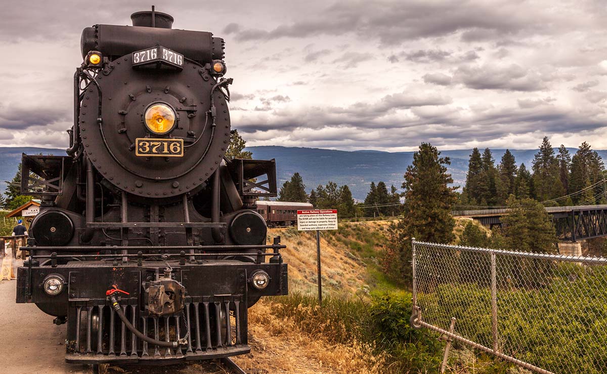
“All aboard!” Our reading is interrupted by a robust-voiced conductor. The movie crew concluded their shoot and we now eagerly line up to board. Authentic period-costumed folks––conductor, engineer, and Felix, a charismatic banjo player, along with a team of friendly volunteers, welcome you as you set foot onto the train. For photo enthusiasts, it’s an easy choice between two seating options–open-sided wagons or 1950’s vintage closed coaches. Our eager group scurries to the last open car. After achieving the best viewing spots, we agree to switch sides for the return ride. Once settled in, our journey powered by 2-8-0 steam locomotive 3716, ‘The Spirit of Summerland’ commences.

Built in 1912, the N2 B Class locomotive was said to be “under boilered” as its two engines could consume steam faster than the fireman could make it! The two engines designation came about as each set of cylinders and rods in this cleverly designed locomotive could work independently should there be a malfunction. Locomotive 3716 has a back-up diesel engine–the 1956 S6, 115-ton, 6 cylinder 2S1B Prime Mover. While our group chose the more modern open air coach, the enclosed, restored 1940’s vintage coaches, would be a better choice for cooler, inclement weather, especially the seasonal Christmas Train Ride.

musicians in rail car
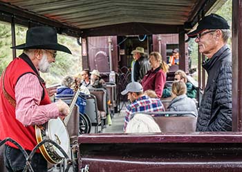
Dressed to match the times, Felix, a delightful banjo-playing songster, kicks off in our section with some classic favourites, ‘I’ve Been Working on the Railroad’ and ‘You are my Sunshine’. Requests are welcomed as he wanders through the cars. And he can pretty much play any tune asked for. Conductor Ron, provides educational and humourous commentary as we snake along the route.

We weave around pine forests opening onto the fertile Prairie Valley. There unfold views of vineyards, wineries, and orchards. The proximity of carved slabs of colossal rock remind us of the challenges faced by McCulloch’s crew. A repetitive metal on metal cadence of the wheels on tracks blend with the engine’s din. Billowing smoke from the stack emits an acrid odour, completing the retro sensory experience.

on steam railwayShrill whistle sequences signal the stop at Trout Creek Canyon. Here we disembark for the grand view, a leg stretch and more photos, of course. Accommodating, patient crew pose with passengers while other folks dart around the train snapping images of the locomotive and valley from different angles. Again, the whistle signals, this time for us to board for the return trip. We change sides, relax as veteran passengers now, and take in the landscape.

Having served a timely purpose, the little rail line that could, five hundred kilometres traversing three mountain ranges, came to an end due to air and vehicle transportation advancements and to unforgiving winters taking their toll.

The Kettle Valley Steam Railway experience not only has regular trips, but also offers the ‘Great Train Robbery and BBQ’, an Easter and Mother’s Day train. Regular season starts the third week of May.

Leaving Prairie Valley Station at the journeys end, we feel thankful that the folks in the heritage society took on the initiative to preserve this gem of Canadian railway history.

If You Go:

To plan your trip and book your tickets, visit the comprehensive Kettle Valley Railway website.


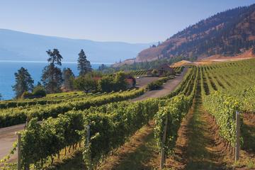
Beat the Bottleneck: Summerland Full-Day Wine Tour

About the author:
Karen is an award-winning photographer, CAPA (Canadian Association for Photographic Art) District Representative, and past president of the Delta Photo Club. When her thirty-year career as an educator ended, she was able to focus more time on her passions of photography, travel and writing.

All photos by Karen Pacheco

Tagged With: British Columbia travel, canada travel, Okanagan attractions Filed Under: North America Travel

George Berkeley in Middletown, Rhode Island

George Berkeley's Whitehall

by Elisabeth Herschbach

To the casual passerby, it doesn’t look like anything out of the ordinary: just a simple, wooden house on a quiet, tree-lined street in Middletown, Rhode Island. But from 1729 to 1731, the house at 311 Berkeley Avenue — a sturdy, rust-red farmhouse, two stories high — was the residence of one of the most prominent philosophers of the 18th century, the great Irish philosopher and Anglican clergyman George Berkeley.

Whitehall, as Berkeley called his Rhode Island home, was built from an existing structure on a plot of farmland a few miles from Newport. Berkeley himself oversaw the design, incorporating architectural details uncommon in New England at the time, including a hipped roof and double front door in Palladian style. After Berkeley’s departure, Whitehall underwent various transformations, from tavern to teahouse to family farmstead. During the American Revolution, British officers headquartered in the house; by the 1890s, Whitehall was being used as a storage facility for hay, fast falling into disrepair until rescued by three historically minded Newport women. Since 1900, Whitehall has been maintained by the National Society of the Colonial Dames, whose members renovated the house, furnished it in 18th century style, and opened it as a museum dedicated to preserving Berkeley’s legacy.

If a tree falls in Middletown, and nobody is there to hear it…

Born in 1685 in southeast Ireland and educated at Trinity College, Dublin, Berkeley was a wide-ranging thinker who wrote not only on philosophy, but also on mathematics, optics, economics, and even medicine. (During his own day, the most popular of Berkeley’s works was a tract extolling the medicinal virtues of tar-water.) Today, Berkeley is most famous for his view that material objects exist only as perceptions or ideas in people’s minds, a philosophical position known as “immaterialism” or “idealism.”


George Berkeley
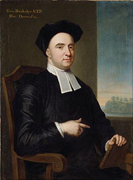
Counterintuitive as the view may be, it was endorsed by Berkeley as an answer to skeptical doubts about the possibility of knowledge. How do we know that the world actually resembles our ideas and perceptions of it? Worse yet, how do we know that the things we perceive really exist? (We are all familiar with hallucinations; can we be sure that all perception is not like that?) For Berkeley, the solution was to deny that matter exists independently of the mind. We can be sure that things in the world really are as they appear to us, he reasoned, only if material objects just are ideas in our minds. Hence Berkeley’s famous slogan “to be is to be perceived.”

So, to put a twist on the old riddle about the tree in the forest, if a tree falls and nobody is around to perceive it, does Berkeley’s view entail that the tree itself doesn’t exist? Fortunately, Berkeley had an explanation for why trees don’t disappear when nobody is looking and tables and chairs don’t pop out of existence every time we blink: God’s always watching.

Off to Bermuda— via Rhode Island

By the time Berkeley set sail across the Atlantic in 1729, his reputation as a philosopher was long-established; his most important works had been written almost two decades earlier when he was in his 20s. What brought Berkeley to Rhode Island was not his philosophical theory of idealism, but idealism in the ordinary sense. Berkeley was on his way to Bermuda, where he hoped to found a college for English colonists and American Indians that would be “a fountain or reservoir of learning and religion” in the New World, as he explained in a proposal published in 1725. His proposal won the approval of King George I, and Berkeley was promised a grant of £20,000 to put his utopian scheme into practice.

Newly married, Berkeley arrived in Newport in January 1729, planning to use Rhode Island as a base while waiting for the promised funds to be disbursed. “I was never more agreeably surprised than at the first sight of the town and its harbour,” he wrote a few months later to a friend in Dublin. The topography is “pleasantly laid out in hills and vales and rising grounds,” he observed enthusiastically, and “hath plenty of excellent springs and fine rivulets, and many delightful landscapes of rocks and promontories and adjacent islands.”

Details of these “delightful landscapes” made their way into Berkeley’s Alciphron, or the Minute Philosopher, a work in philosophical theology written in dialogue form and composed during Berkeley’s residence at Whitehall. The setting for the second dialogue, for example, is a hollow between two rocks overlooking a sandy beach, thought to refer to Hanging Rock, now part of Norman Bird Sanctuary, near Sachuest Beach, Middletown. Indeed, some still call the spot “Berkeley’s Seat,” in keeping with local legend that says that Berkeley penned much of Alciphron at Hanging Rock, a favorite haunt not far from Whitehall.

During Berkeley’s time, Whitehall was situated on a 96-acre farm managed in large part by his wife, Anne, and intended as a source of provisions for the college in Bermuda. Unsurprisingly, Whitehall also became a center for lively philosophical discussions. The Redwood Library and Athenaeum in Newport, America’s oldest lending library, traces its origins to a literary and philosophical society first formed under Berkeley’s guidance.

A failed plan, but a lasting legacy

Berkeley spent almost three years in Middletown waiting for his Bermuda grant. Eventually, it became clear that the funds would not materialize, and Berkeley and his family returned to London in 1731, never having set foot in Bermuda. Unfortunately, the Berkeleys’ infant daughter, Lucia, died a few days before their departure and was buried at Trinity Church in Queen Anne Square, Newport, a church where Berkeley himself had occasionally preached. Shortly after his return, Berkeley was appointed Bishop of Cloyne, Ireland, where he served for almost 20 years, until his death in 1753.

Although Berkeley never realized his dream of establishing a “fountain of learning” in Bermuda, his sojourn in Rhode Island did succeed in advancing the cause of education in the New World. Upon his departure, Berkeley donated his library and Whitehall estate to Yale University— a contribution Yale commemorated by naming both its Divinity School and one of its 12 residential colleges after the esteemed philosopher. King’s College in New York, the precursor to Columbia University, was designed following a model recommended by Berkeley to its first president, Samuel Johnson, a frequent visitor to Whitehall. And Whitehall itself now functions not just as a museum but also as a research library stocked with scholarly literature on Berkeley and many early editions of his work.

Every summer, Berkeley’s former home opens its doors to a number of scholars selected by the International Berkeley Society to be Scholars in Residence. In addition to pursuing their own research, the resident scholars give tours to visitors who wish to explore the museum, stroll through the adjoining18th century herb garden, and celebrate the legacy of a great philosopher who, for a short time, was also a great Rhode Islander.

If You Go:

Whitehall Museum House (311 Berkeley Avenue, Middletown, RI 02842) is open to visitors for guided tours in July and August (Tuesday through Sunday, 10:00 a.m. to 4:00 p.m.) and by appointment during the rest of the year. Admission is by donation.

For information, call (401) 846-3116, or email info@whitehallmuseumhouse.org.

George Berkeley in Internet Encyclopedia of Philosophy

18th-century Irish philosopher George Berkeley lived at Whitehall from 1729 to 1731.

About the author:
Elisabeth Herschbach lives in Maryland with her husband and son. She works as an editor, and in her spare time she likes to travel, write, and translate. Her translation of the novel Eroica by Kosmas Politis was awarded the Constantinides Memorial Translation Prize by the Modern Greek Studies Association in 2009.

Photo credits:
Whitehall by JERRYE & ROY KLOTZ MD / CC BY-SA
George Berkeley portrait by John Smibert / Public domain

Tagged With: Middletown attractions, Rhode Island Travel, USA travel Filed Under: North America Travel

Exploring Trading Sites in Mayan Mexico

Jaguar Temple

by Marsha Mildon

Standing alone, face to face with a mural depicting the Mayan diving god is one of those Indiana Jones moments that delight me when traveling. My first experience of this rare event happened in March of 2013 in the Xel Ha Architectural Zone. Now I admit up front that when wandering through pre-Hispanic cities in the Americas, I feel a real sense of communication with the original people. So I had been touring Mayan sites for years, but I had only seen murals in museums, never before on the original wall.

Maya diving god muralThis first solo excursion resulted from seeing the small ruin on the beach at the Grand Sirenis resort in Xaac Bay. “That building looks like Tulum,” I thought.

To check my memory, I returned to Tulum. Sure enough, the majority of buildings used a design like Xaac Bay: square, double rows of decorated stones around the top, and windows in the seaward side.

Some quick Internet research introduced me to the world of an extensive Mayan maritime trading network. From 900 AD to the Spanish conquest, trade was conducted in large Mayan canoes along the east coast from northern Yucatan as far south as Honduras.

As the large city states indulged in destructive wars, survivors moved to the coast and built, or adapted, simpler sites, in what is now called the East Coast Style, like Tulum. These sites had access to ocean fish and shellfish; were set on or near coastal harbors for their trading activities, and had one or more cenotes nearby for fresh water during a long drought.

Trade goods included everyday things such as salt for drying food and obsidian for knives, arrow points, tools, and weapons of war. Luxury items such as jade, turquoise, and quetzal feathers to show high rank were traded for the upper classes along with items like cotton and vanilla. And their trade currency was positively delightful: Cacao (chocolate) beans.

The map below is my rough sketch of the Yucatan Peninsula with several of the major Mayan trading centers marked. So far I have managed to visit El Rey, Ixchel, Xaman Ha, Xel Ha, Tancah, Tulum, and Muyil, viewing without meeting other tourists except for Tulum and Muyil. While there are interesting features for Maya-philes at all sties, my favorites are Xel Ha and Muyil.

Xel Ha

The author at Xel HaI chose Xel Ha for my first exploration. There was a driveway, a modern building where people took an entry fee, and a map on a sign. In I went.

The Group I found first was Group B which showed typical East Coast style features: squared buildings, some with pillars, and evidence of the typical Maya practice of erecting new buildings over old. I was elated to be wandering through possible rooms of Mayan traders.

Maya bird muralFrom Group B, I followed a path north toward buildings close to the highway, arriving at the Group of Birds. And there I saw my first mural on its original wall, the Bird Mural. The Temple of the Birds sits on several platforms so the murals are well above eye level, but easy to climb with care for building and one’s ankles. The Bird mural in red, green, and yellow shows a local long-tailed, short-beaked bird. It is an early Classic period around 300-600 AD when the site was first inhabited.

Following the building around to the south side, I found my personal favorite mural on the site, the three-panel mural with the diving god shown at the beginning of this article. The diving god — probably associated with the Mayan bees and Venus — stares down at the solo visitor from 1500 ago, an inspiring and somewhat solemn sight. This god was important to the Mayans, with murals and sculptures in many sites. Honey and astronomy, food and a world view —those were crucial to the ancient Mayans as their civilization struggled for survival, just as they are to us today.

cenote at jaguar groupFrom there, I walked east along the hot and sunny Sacbe, the Mayan white road built up with white rocks and shells, I arrived at the Jaguar Group and its beautiful — cooling— cenote.

After a quick dip, I examined the 3-columned palace of the Jaguar. Alas, the diving god mural that had been on the outer wall overlooking the cenote was severely damaged by Hurricane Wilma in 2005. However, peering in through a mesh barrier gave me a clear view of the large Jaguar mural in red ochre, black and the remarkable Mayan blue. Again, the black eyes of the Jaguar stared back at me, delivering their message from the Mayan culture. Those eyes look out from the milennium-old Mayan blue made of añil leaves traded from Guatemala and local clay, as brilliant as those at any larger site.

A small site, usually empty of other tourists, and now with good signage, Xel Ha is probably the best self-guided tour available to have a close-up encounter with ancient Mayans. It fairly glows with images of what was important to them.

Muyil or Chanyaché

To go to Muyil, on the other hand, I would choose one of the Mayan tour groups, both for the information their guides have and for the opportunity to enjoy a complete Mayan experience. Set in the Sian Ka’an United Nations Biosphere, the pyramids of Muyil rise out of jungle wetlands.

First settled around 300 BC, Muyil is one of the oldest continually inhabited trading sites, thus including classic pyramids similar to Tikal, round temples perhaps performance buildings or observatories, and the post classic East Coast building.

Unlike other trading centers, Muyil is not right at the ocean. Instead it is at the end of one natural canal, two freshwater lagoons, and a canal built by the Maya between 1000 and 2000 years ago. When I travelled there in 2016, nine of us took two boats through the first fresh water lagoon, the Mayan canal, the second lagoon and into the natural canal that flows to the sea.

Part way along this canal, there is a dock beside the boardwalk into the ruins. On my 2014 tour, we followed the boardwalk to the ruins. In 2016, we left our boat and floated down the canalsitting in life preservers. With a good current, because of the movement of fresh to salt water, this is a safe activity with lots of waterbirds around. And it’s fun; I laughed through the whole 40 minute float.

Back in the Mayan village, we had the option of choosing fish, Mayan style, (Tikin Xic),with a sauce made of gourd seeds, mild seasoning, tomatoes,onions, grilled in banana leaves by the villagers. My only regret is that I can’t find banana leaves for cooking it in Canada.


Combo Tour in Coba and Xel-Ha in Cancun

If You Go:

Xel Ha

In 2016, the Xel Ha Archeological Zone is now well signed so you can ask a collectivo driver or taxi driver to let you off near the entrance, on the east side of Hwy 307 about 300 yards south of the Xel Ha theme park. Cost is now 65 pesos. There is no food or water for sale and a lot of mosquitos, so bring your own snacks and some biodegradable insect repellent.

Muyil

It is possible to get to Muyil by car driving south of Tulum. However, this is a place that I prefer to visit with a local tour company, for both the information and the fun.

I have gone with both Community Tours Sian Kaan and Mayans Explorers and would recommend either. Both provide canal floats, boat rides, ruin tours as well as other activities. Whatever way you see Muyil, try to make sure it includes some genuine Mayan food. And take an extra T-shirt to wear while you float because even in hot weather, the water will cool you eventually.

Mayans Explorers is a family-owned tour company, with knowledgeable guides, many with appropriate PhDs. It has offices in Playa del Carmen but picks people up at their hotels.

Community Tours is a community organization started by Mayans from Sian Ka’an villages and hires local Mayans as guides, boat captains, bus drivers, cooks, and servers. It also gives monthly funds to the Mayan villages from the business. In addition to economic development they are also dedicated to environmental preservation. For these reasons, I personally choose them. They have offices in Tulum and also picks people up at hotels.

About the author:
The first time Marsh Mildon saw a photo of Machu Picchu was on her 40th birthday and her life changed. Since then, she has spent all my vacations and several months of volunteering in Central and South America, visiting ruins of many peoples and many ages. She is fascinated by the cultures of the ancient Americans. In between trips south, she works as a freelance writer/photographer with two published novels, several stage plays, and hundreds of non-fiction articles published (all in print not online).www.marshadelsol-mildon.artistwebsites.com.

All photos are by Marsha Mildon:
The jaguar temple
The Diving god at Xel Ha stares down at the visitor with its clear red ochre, green, and yellow colors.
Pillars, platforms, and new walls built over old are typical Mayan architectural styles that we can touch in Group B.
The bird mural is a three panel mural with images of birds on two sides with a somewhat indistinct Mayan symbol for ‘lord’ in the center.
The cenote can be seen from the Temple of the Jaguar and is lovely for a quick dip or foot paddle after walking the jungle-shrouded sacbe.


Tagged With: Mayan sites, mexico travel, yucatan attractions Filed Under: North America Travel

Louisiana: New Orleans French Quarter

new orleans paddle wheel boat

Reconnecting With The Past

by John Goodrow

Surrounding the banks of the Mississippi River are aspects of both the past and the present. Looking out into the river, the steamboats Creole Queen and Natchez take visitors from the French Quarter up the river and transport them into the distant past when the river was the highway of exploration. These steamboats use a paddle wheel to propel themselves along the river. Imagine a time in the past when similar ships steamed upstream loaded with bails of cotton and passengers of many types. You might meet a southern belle, or even a riverboat gambler. Jean-Baptiste Le Moyne de Bienville founded New Orleans in 1718. By 1860, the city had over 185 million dollars in commerce using the Mississippi River and a variety of ships from paddlewheel boats to flat-bottomed boats. The French Quarter exudes French and Spanish influences.

Andrew Jackson statueWalking inland from the river port, looking just ahead is an imposing figure of General Andrew Jackson on a reeling horse and surrounded by iron gated fences and palm trees with a backdrop of the three spires of Cathedral of St. Louis, King of France. The square was originally named Place d’Armes during the French period and Plaza de Armas during the Spanish period, or Weapons Square. This grassy plaza commonly known as Jackson Square (700 Decatur Street) is named for Andrew Jackson. He had a critical role in the history of the New Orleans.

France controlled Louisiana from 1718 until 1763. At the end of the French and Indian War, Spain gained control but returned Louisiana to French rule in 1800. The raising of the American flag in 1803, in this square ended colonial rule in Louisiana. In the War of 1812 only nine years later, it fell upon General Andrew Jackson to prevent the British from capturing New Orleans. With only a small group of soldiers, militiamen, Indians, and a few pirates, he was able to defeat the powerful British army.

Cabildo museum interiorBeyond the statue of Andrew Jackson are the trio of the Cabildo, Cathedral of St. Louis King of France, and the Presbytere. The Cabildo (700 Chartres Street) is a museum that commemorates the seat of colonial power under the Spanish. It was the center of municipal government in New Orleans until 1853. The final transfer of Louisiana to the United States occurred here. Do not miss this museum. It has many artifacts throughout the early history of Louisiana and has an exhibit on the third floor with more extensive coverage of New Orleans through the present time.

St. Louis CathedralAfter leaving the Cabildo, enter the St. Louis Cathedral (615 Pere Antoine Alley). Towering above the surrounding buildings with its three steeples, it is the oldest active cathedral in the United States. The cathedral is the seat of the Roman Catholic Archdiocese of New Orleans. There have been three churches built on these grounds. The first church was built here in 1718 and designed by Adrien De Pauger during the initial period of French control.

A significant portion of the French Quarter including the cathedral was destroyed by a massive fire in 1788. The Cathedral of St. Louis completed its reconstruction in 1794, during a period of Spanish colonial possession. During the construction of the new church, Louisiana and Florida were included as a diocese by Pope Pius VI with the new church as a cathedral with Luis Pefialver y Cardenas of Havana as its first bishop.

After Louisiana became part of the United States, the population of New Orleans grew rapidly. In the period of fewer than fifty years, the St. Louis Cathedral needed additional room leading to the construction of the third church in 1850. The enlargement required many improvements to the structural walls of the church. The reconstruction reused the bell tower, but nothing else. The church has many notable residents buried under its floors, including the designer Adrien De Pauger as well as members of the French clergy of colonial Louisiana.

Musician statue at Cafe BeignetAfter all of your adventures reliving the past, enjoy some refreshments and entertainment. The French Quarter has plenty of places that will satisfy these requirements and is the oldest part of New Orleans. It was founded in 1718 and was known as Vieux Carré. The rest of the city developed around this area and received its current name as English-speaking residents arrived in New Orleans.

For a quick bite to eat and some light jazz head over to Music Legends Park (311 Bourbon Street). Their menu features everything ranging from beignets to sandwiches while jazz musicians play for your entertainment. You will have statues of music legends such as Irma Thomas, Fats Domino and Allen Toussaint welcoming you to the park.

As the afternoon gives way to early evening, head down to Pat O’Brien’s (718 St. Peter Street). This bar has been in business since before 1933 when it transitioned from being an illegal speakeasy to a legal drinking establishment.

The building that they use began its life as the French Theater Company in 1791. They introduced their signature hurricane drink during World War II. At the time, O’Brien’s had too much rum on hand but not enough whiskey, so they came up with an unusually bright red drink made of rum, fruit juice, and syrup. The drink gets its name from the shape of its glass container. The drink is usually served in a plastic glass, although you can get it in a hurricane glass for a nominal fee. The plastic glass makes it easy to carry your drink during your exploration of the French Quarter. It is legal in New Orleans to drink in public as long as you are not using a glass container. Their menu also offers a variety of other alcoholic and non-alcoholic beverages. The staff will serve you light food items ranging from sandwiches to soups and gumbo.

If You Go:


Taste of New Orleans Private Walking and Food Tour

The climate in the summer tends to be very humid, and an umbrella will help for both pop up showers and protection from the sun.

For history and general knowledge:
Visitors Center
Cabildo
Cathedral of St. Louis, King of France
Jackson Square

For dining and entertainment:
New Orleans Musical Legends Park
Pat O’Brien’s Bar

About the author:
John Goodrow is a seasoned traveler, having visited every continent except Antarctica during his career in the United States Navy. Currently living and working in Mississippi, he enjoys traveling to historic and lesser-known areas throughout the world. He shares his knowledge of early American and Military history through travel writing.

All photos by John Goodrow

Tagged With: Louisiana travel, New Orleans attractions Filed Under: North America Travel

Las Vegas: Fascinating Neon Boneyard

Welcome to Las Vegas sign

Signs of the Time

by Noreen Kompanik

Las Vegas has always oozed glitz and glamour with its multitude of casinos, top entertainers and high rollers. But, no more than in the days of the Rat Pack, Liberace and Elvis, when millions of visitors flocked to a booming Las Vegas – often referred to as “Glitter Gulch” in its heyday. Even today, as people close their eyes and think of Las Vegas, nothing comes to mind more often than those magnificent, pulsing multi-colored neon signs in the middle of the desert that beckoned travelers and guests to fabulous Las Vegas.

Las Vegas wasn’t always just desert. At its founding, Las Vegas was more of an oasis. The city traces its name and its roots to a Mexican scout, Raphael Rivera. A member of the Antonio Armijo trading party traveling to Los Angeles along the Old Spanish Trail from New Mexico, Rivera and his compatriots were looking for a watering hole. At the future site of Nevada’s largest city, Rivera discovered fresh water artesian wells surrounded by verdant green valleys. The flows from these wells fed the Las Vegas Wash which runs to the Colorado River. In Spanish, Las Vegas translates to “the meadows”.

By the early 20th century, water from these artesian wells was being piped into town. As a result, Las Vegas became a well-known water stop, first for wagon trains and later railroads along the trail between Los Angeles, California, and points east such as Albuquerque, New Mexico.

And it was in Los Angeles in 1923 that neon was introduced to the United States by Earl Anthony at his Packard Dealership. Soon after, brightly lit neon signs were capturing the nation’s imagination. From the very start these amazingly colorful signs literally stopped Los Angeles traffic in its tracks lighting up the night much to the delight of awestruck drivers and pedestrians alike.

In 1931, construction started on the Boulder Dam, later renamed Hoover Dam during President Truman’s administration. Las Vegas’ population swelled from 5,000 to 25,000, primarily workers hired to build the dam.

Gambling was legalized in Nevada in 1931, and it didn’t take long for word to get out that Vegas’ greatest asset was not its artesian wells, but its casinos. Freedoms of the Old West like gambling and prostitution drew visitors and travelers from far and near. The allure of profits in these vices soon attracted East Coast organized crime.

Money from drugs and racketeering built the first of many casinos. Mafia bosses like Bugsy Siegel helped transform Las Vegas into one of the world’s top tourist destinations. The transition of Vegas from western watering hole and construction worker bedroom community to its “Sin City” moniker of today was complete. Visitors flocked to the city to partake in the offerings of low-cost luxury and fantasies fulfilled.

In 1941, the El Rancho Vegas resort opened just outside the city’s jurisdiction. Other hotel-casinos soon followed, and the section of highway became known as “The Strip.”

Small gaming parlors began lining Fremont Street, setting the stage for a revolution in entertainment. Influenced by the neon-lit theaters of Broadway, Las Vegas harnessed electricity generated by nearby Hoover Dam to power Glitter Gulch, the arcade of hotel-casinos that followed the Golden Nugget’s opening in 1946.

Sands "Rat Pack"
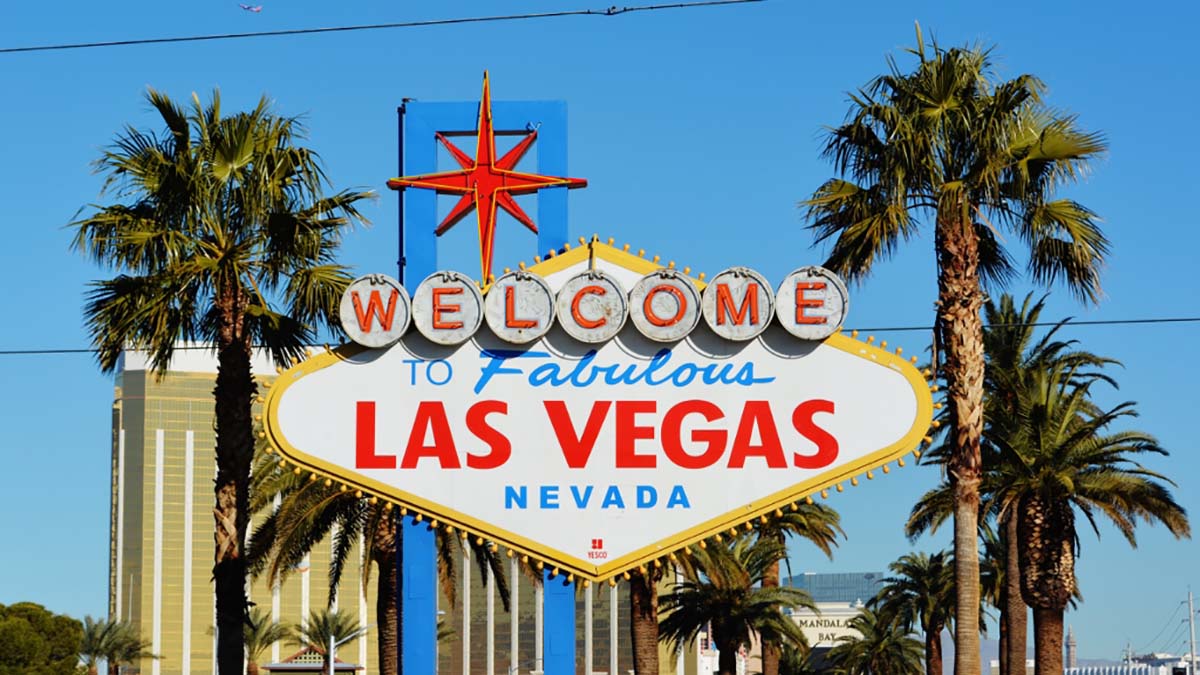
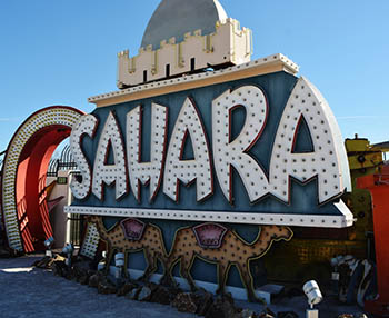
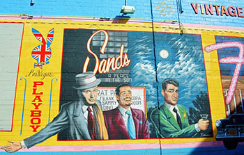
Neon put the “fabulous” in “Welcome to Fabulous Las Vegas.” And Vegas was surely at its fabulous peak in the 1950s, 1960s, and 1970s. The “Rat Pack”- Frank Sinatra, Dean Martin, Joey Bishop and Sammy Davis, Jr. and other big name entertainers along with the casinos lured visitors by the thousands to the desert. Light it up and they will come. And light it they did. Vegas became a super nova of light – a dazzling showcase of the entertainment world with its iconic signs like the Vegas Vic, the waving, smoking cowboy, the exotic camels of the Sahara, and the classy star-studded Riviera.

In the 1960s, the tall high-rise emerged as the new building type in Las Vegas. Expanding along with the soaring stories, neon signs grew larger and more detailed. Massive signs began to feature items such as Aladdin’s lamp, the Dunes Arab sheik, or the studded high heeled shoe of the Silver Slipper.

Though Vegas will always be famous for its gaudy glitz and glamour, it has not been known for its preservation efforts to keep its vintage history alive. Casinos have come and gone and in the wake of constant refurbishment or rebuilding, many of the old neon signs were replaced or even lost. As buildings were demolished for newer, more modern, gigantic edifices with their new colorful (and more economic) LED lighting, many of the old glittering marquees of Vegas’ yesteryear have disappeared forever from the Vegas landscape.

Neon Boneyard Park signLas Vegas Neon Museum

Interest in rescuing these retired signs, however, began in the 1970s with local historic preservation groups. In the 1980s, a committee of the Allied Arts Council began actively saving neon signs. Out of their efforts, the Neon “Boneyard Park” Museum was born.

Located in downtown Las Vegas, the museum is renowned for rescuing these famous architectural landmarks from the graveyard of oblivion and displaying them so the public can once more relive the memories of old Vegas.

The Neon Museum’s tour begins in the visitor’s center that occupies the historic lobby of the now defunct La Concha Hotel. A brilliantly salvaged Vegas icon of the past, this distinctively shell-shaped building was designed by acclaimed architect Paul Revere Williams. Its fascinatingly curvaceous mid-century modern design is distinctively reminiscent of the era’s atomic and UFO Space Age culture.

Originally constructed in 1961 on Las Vegas Boulevard South (next to the Riviera Hotel), the La Concha lobby was saved from demolition in 2005 and moved in 2006 to its current location to serve as the museum’s Visitor’s Center.

Guides possess extensive knowledge of the neon signs. They relate the history of neon sign production in Las Vegas, tell tales relating to many of the signs on display and stories of the talented people who designed them. Their delightfully informative tour through the artful two-acre outdoor Neon Boneyard is a heart-moving stroll down memory lane. The boneyard is home to some of the most historically treasured and world-famous signs of Las Vegas – from Caesar’s Palace, Binion’s Horseshoe, Golden Nugget, and the Stardust.

Even before our tour started, the docent described the boneyard tour as “part history, part art, and completely awesome”. Once a dying art, the museum has created a new renaissance for neon signs in Las Vegas, and they are regaining popularity. Even the city has gotten involved with an ordinance requiring a small section of historic downtown to keep and maintain their neon signs in order to forever capture and restore traces of a rapidly disappearing Las Vegas with the nostalgic charm of neon. And, according to our guide, the preservation effort continues to gain momentum.

150 vintage neon signs, seven which have been completely restored to date, are located in rows from ground level and higher and can all be viewed up close. The museum’s impressive collection of vintage signs represent some of the most celebrated Las Vegas properties and casinos dating from the 1920s to the present.

Sahara neon sign
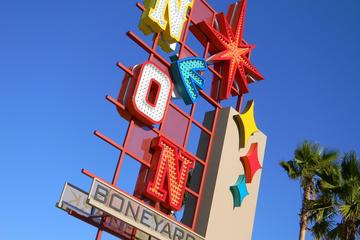
But other historical neon signs have also found their way to the neon boneyard, with their own fascinating stories to tell like El Portal, the first theater and luxury movie palace established in the city of Las Vegas in 1928 on downtown’s Fremont Street. The Green Shack was Vegas’ longest operating restaurant built in the early thirties, catering to Hoover Dam’s construction workers and suppliers. The restaurant was famous for its chicken, steaks and bootleg whisky during Prohibition.

Walking through the outdoor museum, it became increasingly clear that the signs aren’t just physical evidence of the once spectacular icons of Vegas- they are the magic moments imprinted on the memories of the several generations who visited the Stardust, Moulin Rouge, Riviera, Sahara and others. Each sign has its own unique story to tell. And in all the razzle dazzle of what is now a newer, bigger, flashier Vegas, it’s easy to forget that these iconic places were the ones that literally put Vegas on the map.

As Elvis Presley once said about Vegas “if you see it once, you’ll never be the same again.” Perhaps this is one reason the Neon Museum is such an important part of keeping the Vegas memory alive. Its visitors and patrons long to “remember when.”

If You Go:

Las Vegas Neon Museum is located at
770 Las Vegas Boulevard North, Las Vegas, NV 89101


Las Vegas Museum Tour

About the author:
Noreen Kompanik is a published freelance travel writer and photographer based in San Diego, California. She is a member of the International Travel Writers and Photographers Alliance and International Food, Wine & Travel Writers Association. She shares her adventures, published stories and photos on her www.facebook.com/Whats-In-Your-Suitcase-322531634589666/Facebook site.

All photos are by Noreen Kompanik
Welcome to Las Vegas neon sign
Rat Pack painting on downtown Las Vegas wall
Original Sahara casino neon sign
Neon Museum Boneyard neon sign.
Original Stardust neon sign

Tagged With: LasVegas attractions, neon museum, Nevada travel Filed Under: North America Travel

  • « Previous Page
  • 1
  • …
  • 40
  • 41
  • 42
  • 43
  • 44
  • …
  • 72
  • Next Page »

MORE TRAVEL STORIES:

Voodoo, Zombies and an Over-Active Imagination

A Tryst With Royal Gujarat

What Parents Should Know About Traveling Long Distance with Newborns

Trips to Morocco: Unveiling the Wonders with Tilila Travel

Sapa, Vietnam: The Heavenly Gates

Why Arizona Became America’s Wild West Movie Set

Beyond the Price: Why Cancun Offers Superior Dental Care Compared to the U.S.

From LaGuardia to the Heart of New York: Embark on an Exquisite Journey of Elegance and Comfort


SEARCH

DESTINATIONS

  • Africa Travel
  • Antarctica travel
  • Asia Travel
  • Australia travel
  • Caribbean Travel
  • Central America Travel
  • Europe Travel
  • Middle East Travel
  • North America Travel
  • Oceania Travel
  • South America Travel
  • Travel History
  • Travel News
  • UK Travel
  • Uncategorized
  • World Travel
facebook
Best Travel Blogs - OnToplist.com

Copyright © 2026 Cedar Cottage Marketing | About Us | Contact | Privacy Policy | Terms & Conditions | Copyright Notice | Log in