by Matthew Adams
During one summer, I took a holiday in the seaside town of Paignton. Paignton is one of three towns in Torbay alongside Brixham and Torquay. It is part of a supposed English Riviera that has miles of sandy beaches along its coastline, and some great coastal landscapes.
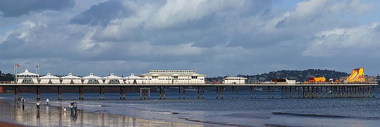
When visiting in late August I expected sunshine, but it rained for much of the week. It was not great weather for a trip to the seaside. Paignton has a number of beaches along its coastline such as Goodrington Sands, Broadsands Beach and Hollicombe Beach. Paignton Sands is the stretch of beach that includes Paignton Pier which I visited during a wet day in August. The pier includes an arcade, bingo hall, café, seafood and ice cream takeaways.
Dartmouth Steam Railway
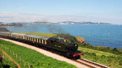 The Dartmouth Steam Railway is a preserved steam railway line that runs from Paignton through to Dartmouth. This is one of the few remaining U.K. steam railway lines which has a variety of rolling stock locomotives. Locomotives such as the 4277 Hercules, 7827 Lydham Manor and 75014 Braveheart run the 6.7 mile railway from Paignton to Kingswear.
This was something I couldn’t miss in Paignton. From Paignton station I boarded one of the steam locomotives which passed Goodrington Sands Halt and Churston en route to Kingswear. The train passed the Saltern Cove and Armchair Rock, and then crossed over the Broadsands Viaduct. After crossing the Greenway Viaduct, the River Dart came into view on the just before the train stopped at Kingswear Station.
When I arrived, the station was packed out. This largely due to the annual Dartmouth Regatta. Consequently, I did not cross the River Dart into Dartmouth. One of the highlights of the Dartmouth Regatta is the Red Arrow displays. During one such display the Red Arrows flew over Paignton, and I spotted some fairly low flying aircraft from my hotel.
Oldway Mansion
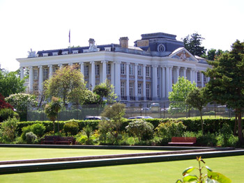 Among the more notable buildings in a Paignton is Oldway Mansion. This is a large 19th century building built in the same style of the Palace of Versailles. I visited the intriguing building in Paignton, which is something of an architectural landmark.
At the building’s entrance is the grand staircase. Ornate paintings, partly based on the original design of the Versailles Palace, decorate the ceiling above the marble and bronze grand staircase. Also above the staircase hangs a reproduction of the Crowning of Josephine by Napoleon painting. The original is, as you probably guessed, on display in Versailles.
There are 17 acres of landscaped gardens around Oldway. The gardens strike upon an Italian theme, and contain various subtropical plants and shrubs. In addition, the grotto gardens include a waterfall that passes over a rocky cave into a pool below.
Torquay and Brixham
 On the final couple days of my holiday the weather was a little better, and I went into two of the neighbouring towns. The first I visited was Torquay. Torquay is a town that includes exotic gardens along its seafront, Living Coasts, Kents Cavern, Babbacombe Model Village and Cockington Court which is about a mile away.
The historic building of Torre Abbey is also in Torquay. This restored building now includes painting and sculpture art exhibitions. Instead of going inside, I went into the Torre Abbey gardens. Outside Torre Abbey there is also Abbey Park. This is a picturesque seaside location that includes tennis courts and pitch & putt golf course.
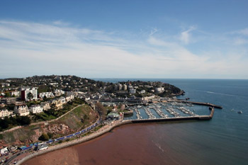
Finally, I made the trip to Brixham aboard one of the regular boat crossings that run from Paignton to other towns in Torbay. Brixham is primarily a fishing port in Torbay with a rich maritime history. There you can board a replica of Drake’s Golden Hind, and the Brixham Museum displays a variety of boat models within its galleries.
In Brixham I headed for the Royal Estate, otherwise Berry Head, which is a coastal headland nature reserve. Guillemots, Razorbills and Black-legged Kittiwakes seabirds flock to the coastal cliffs of Berry Head. At Berry Head there is also a promontory Napoleonic fortress which guarded the Torbay naval anchorage. The former artillery house now includes a display which provides further details on the fort.

After visiting Brixham, my holiday had finished. A week in Torbay certainly made for an interesting vacation. Aside from soaking up the sun on Paignton’s beaches, soak up the history at Torbay’s museums, steam railway, Oldway Mansion and Berry Head.
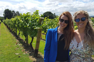
English Wine Tasting Tour to Sussex from London
If You Go:
♦ Dartmouth Steam Railway
♦ Berry Head
♦ Paignton Pier
♦ Paignton
♦ Brixham
Photo credits:
Paignton Beach and pier by Herbythyme / CC BY-SA
The Dartmouth Steam Railway by Geof Sheppard / CC BY-SA
Oldway Mansion by Ianmacm at English Wikipedia / Public domain
Torquay Harbour by averoxus / CC BY
About the author:
Matthew Adams is a freelancer that has produced a variety of articles for various publications and websites such as Swing Golf Magazine,TripAdvisor, Captured Snapshot, Coed Magazine the Washington Post and Vagabundo Travel. Matthew also has his own golf blog at: amateurgolfer.blogspot.co.uk

 We walked on to the waterside. I had no idea it was so close to the city centre. During the troubles it was a forgotten wasteland. By the Lagan, we gazed up at the Ring of Thanksgiving, a monument to peace and reconciliation. The locals prefer to call it ‘The Thing with the Ring,’ ‘Nuala with the Hula’ or ‘The Doll on the Ball’. They have a way with words here. Just a stone’s throw away is the handsome Customs House and the Albert Tower, Belfast’s very own Leaning Tower of Pisa. Once again, that infamous Belfast humour kicks in, with the locals describing it as having the time and the inclination.
 The bus took us along familiar streets: Donegal Square with its handsome Baroque-styled City Hall and Donegal place, the main shopping drag, now lined with 16 metre high sculptural masts, homage to 8 ambitious ships (including the Titanic) built by Harland and Wolff in its heyday. We skirted the Lagan again and the newly regenerated waterside and along city streets that were so familiar and yet so different. Gone were the grey police jeeps, the wary soldiers, the turnpikes and terrapins, and the beefy security guards on each and every shop door. Gone was the smell of subdued fear. And in its place there was art and sculpture and new innovative architecture. There was vitality and a joie de vivre in Belfast.
 We continued on past the remaining infamous Divis Flat, once an IRA stronghold. During the Troubles, the army had occupied the top two floors and could only access the building from the air. The flat occupants were subjected to searches night and day, their homes torn apart. Most, if not all of them, were involved in terrorist activity- or at least supported it. The residents hated the army occupation. The animosity was mutual. A nine year old child was killed by the RUC (the police) who claimed they had been under sniper attack at the time.
 The bus continued on to the Titanic Quarter past the Samson and Goliath cranes that are monuments to a once wealthy and successful Belfast. The old ship-building and linen industries had faded away and unemployment and poverty had taken its place – and with it the seeds of discontent started to sprout.
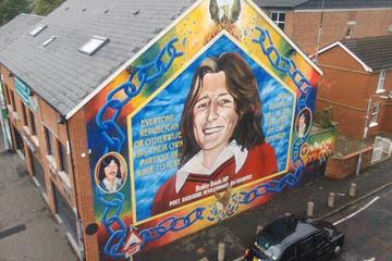


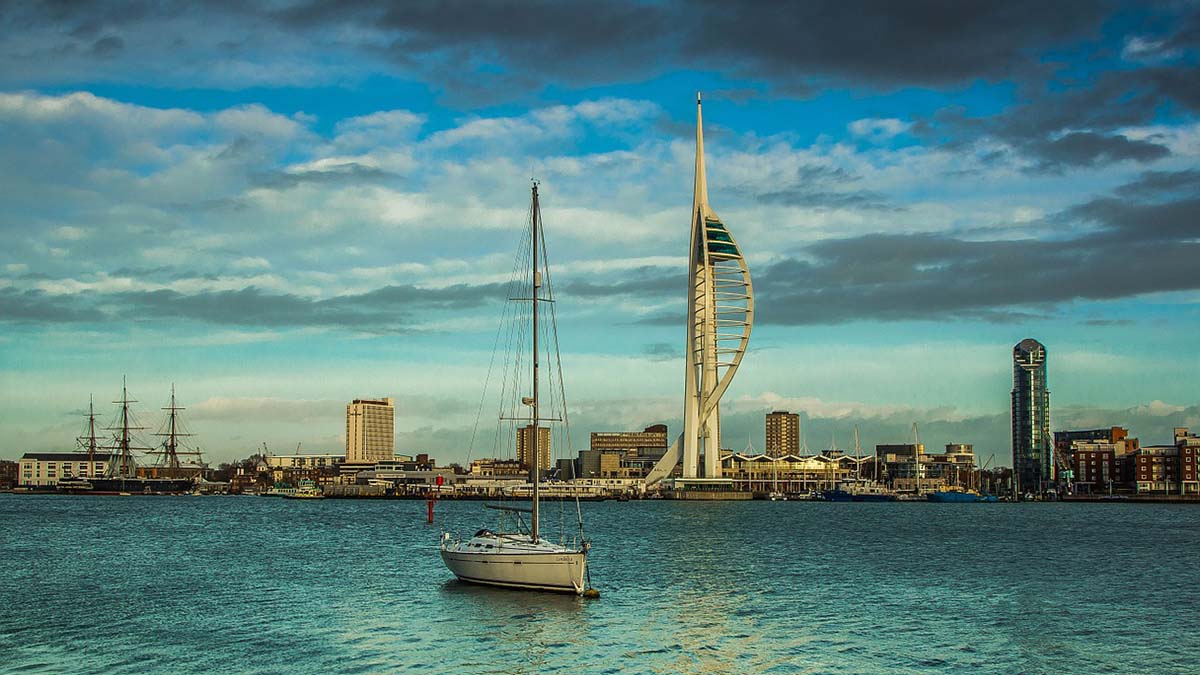
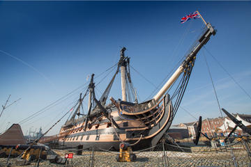
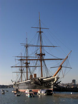 However, first I just had to drop in at the Historic Dockyard. It is here that a variety of naval museums are located such as the Royal Naval Museum and Mary Rose Museum. As mentioned the Historic Dockyard includes the HMS Warrior, which can also be considered a museum. Whilst you’ll need tickets for the ships, you can still enter the dockyard without tickets.
 After exiting the Historic Dockyard, the Millennium Promenade will take you to Gunwharf Quay right next to the train station. The Gunwharf shopping precinct is a more recent addition to Portsmouth that opened in 2001. It includes a bowlplex, cinema, Grosvenor Casino and a Holiday Inn Express hotel at the Gunwharf Quays Plaza which is ideal for any longer stay in Portsmouth.
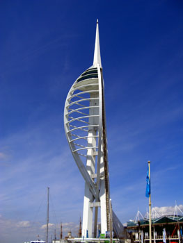 Modern Portsmouth soon gives way to Old Portsmouth along the Millennium Promenade which links Gunwharf with Portsmouth Old Town. This is where the trail gets interesting! After leaving Gunwharf, I reached the Renaissance Trail section of the Millennium Promenade. The Renaissance Trail passes through Portsmouth Old Town and ends at Clarence Pier.
 Southsea Seafront begins at Clarence Esplanade, and the Victorian seafront continues for about four miles. At the esplanade I reached Clarence Pier and its fair that includes the small Skyward roller coaster, dodgems as well as miniature golf. However, the fair remains closed until March. Although the adjacent arcades are open, and they also include the Coffee Cup café and Wimpy Bar. The Premier Inn and Holiday Inn are two nearby hotels next to Clarence Pier which could be suitable accommodation for visitors.
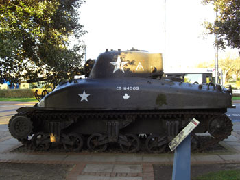 One of the highlights of the Southsea Seafront is perhaps the D-Day Museum at Castle Field. This is a museum that documents the 1944 D-Day landings in France. It includes the Operation Overlord embroidery which is an 83 meters long D-Day textile. Outside the museum an American Sherman tank and a British Churchill tank are also displayed.
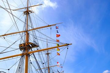
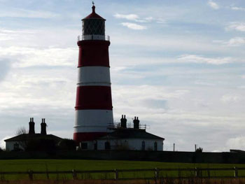 Up until the Middle Ages large tracts of East Anglia lay under water. Only the higher land was free from flooding. I could never understand why the cathedral town of Ely is referred to as an ‘isle.’ A hilly place surrounded by land and no water in sight, it certainly isn’t an island. But once you know the historical geography of East Anglia, it becomes clear. Slowly, slowly the wetlands, the lakes and water systems were drained and reclaimed from the sea. Since then, man and nature have been at war. In the main, man has won. Clever, he’s built dykes, installed pumps and constructed defences. But nature is a force to be reckoned with. Man has fought the sea, and the sea has, on occasion, won.
 Recently, I returned to East Anglia for an autumn break with my family. All the time I had lived there, I’d never visited the Norfolk Broads. The Broads are made up of rivers and lakes and wetlands. The area, rich in wildlife, is popular with visitors for boating, kayaking and canoeing as well as cycling. Between the wetlands, there are pretty villages wrapped in the folds of gently undulating countryside: thatched cottages, dwellings of flint or warm brick, traditional pubs and duck ponds.
 And so it was when we visited Aldeburgh on a cold, bright day in November. Fishing boats had been shored up on the pebbled beach; guest houses were winding down and closing up for winter; the beach was a place for a brisk walk, head down against the icy wind, coats pulled close around the neck. Dogs were allowed on the stony beach again.
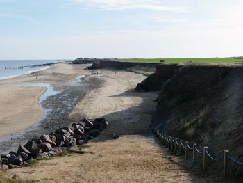 We stopped off at Sea Palling, another seaside resort devastated by the storm of 1953. The sea had breached and ripped through a section of the protecting sand dunes and carried away the Longshore Café. Several other homes, a bakery and a general store were smashed up too. Villagers clung to the roofs of their homes as the ocean engulfed them, waiting to be rescued. Seven people died and thousands of acres of land were destroyed. We sat in the café-cum-amusement arcade, drinking bitter coffee and reading the faded newspaper cuttings adorning the wall. It made for sobering reading among the duke-box pop and random slot machine sounds.

