by Ana Astri-O’Reilly
The seagulls circle above the cliff, their cawing muffled by the wind. That same wind that irritates my eyes and makes us to walk slightly bent forward at some stretches of the coastal path at Les Landes headland. Down below, the Pinnacle Rock and the remains of prehistoric settlements are clearly visible. To the untrained eye like mine, it looks like a bunch of rocks thrown haphazardly. I’m glad I brought my guide book so I could tell what is what. It’s not the first time I’ve encountered traces of the Neolithic man in Jersey but it still fascinates me to think that all those millennia ago people were living here, going about their business like us do today.
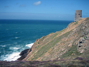
 On top of the cliff, the concrete observation tower built during the German occupation of the Channel Islands stands at attention and fixes its martial gaze into the distance. Below, at the bottom of the cliff, covered by the high tide, is the graveyard of the guns. These are heavy artillery weapons captured by the Germans during World War II and thrown over the cliff by British forces after the liberation of the islands. This is within living memory. There are still people who remember those terrible times.
The German occupation has left indelible scars on the landscape, like hideous observation towers or gun emplacements, and in the history of the islands. I’ve seen many plaques and memorials marking events from that time scattered around Jersey. Especially poignant were those that marked spots from where groups of youngsters tried to flee the island and go across to Britain in row boats and were either captured and imprisoned or drowned.
Germany’s capture of the Channel Islands (Jersey, Guernsey, Alderney, Herm and Sark) in 1940 not only had strategic importance for Hitler’s plans; it was an emotional triumph for him in that he had finally invaded a portion of his enemy Britain. The islands became thus part of the Atlantic Wall, the line of coastal defence stretching from Norway to the Pyrenees.

 Manpower was needed in order to build trenches, anti-tank walls, bunkers, gun emplacements, observation towers and tunnels. The Organisation Todt was in charge of providing workers. Its primary source were prisoners of war in mainland Europe, political prisoners and even men rounded up on the Continent. These poor men were treated worse than slaves. The Russians bore the brunt of Nazi cruelty as they were considered sub-humans. Many tried to escape the labour camps in search of food and some locals, running enormous risks, gave them food and shelter.
One of the structures that these slave workers built is he Jersey War Tunnels, which are part of a planned network of defensive tunnels also known as Höhlgangsanlage 8 (Ho8), the Underground Hospital. The Germans never used it or even have time to finish the tunnels before the end of the war. The liberation of the Channel Islands took place two days after the unconditional surrender of the German High Command on 7 May, 1945. The underground hospital is now a museum showing what life during the Occupation was like. Harsh, for sure.
 Visitors can see the original operating theatre, the boiler room and telephone exchange. There also other exhibits, like the clandestine crystal radios people used to listen to news from the outside world at the risk of imprisonment or even death. There’s even an Enigma machine on display, which reminded me of World War II movies and made me smile.
When we visited the Jersey War Tunnels, I learned that among those slave workers were Spanish Republicans. My guess is that they were transported from the concentration camps on the coast of occupied France where they had been sent after the end of the Spanish Civil War. The Republicans, a mix of anarchists, Marxists, moderate socialists and communists supported by the Soviet Union and International Brigades had lost the bloody civil war against the Nationalist forces of General Franco in 1939 and had been harshly punished thus.
 It occurred to me that my own grandfather could have been among those labourers in Jersey had he not been rescued by the Argentinean government just in the nick of time. He was in the concentration camp at Argelès-Sur-Mer, close to the Spanish border. He is an Argentinean national but he was living in Spain when the war broke out and since his parents were Spanish, he was considered a Spaniard and recruited by the Republican side without further ado.
At one point during our visit, I was overcome by angst and despair and my chest felt tight, I needed to get out and breathe. It could have been the fact that I was underground in what felt like a tomb, and probably was for some, and made me feel claustrophobic. Or it could have been that I was feeling the angst and despair labours felt then and still linger in the tunnels.

If You Go:
♦ There are daily flights from London (Gatwick and London City), Manchester, Southampton, Amsterdam, Zurich, Exeter, Bristol.
♦ Ferry crossings from Portsmouth, Weymouth, Cherbourg (France), St.-Malo (France) (Please note that some routes are seasonal.)
♦ Jersey War Tunnels: Address: Les Charrières Malorey, St Lawrence, Jersey, JE3 1FU (March to November)
About the author:
Ana Astri-O’Reilly is originally from Argentina and now lives in Texas. She worked as a translator and foreign language instructor in her native Buenos Aires. Now she is a contributing editor at PocketCultures.com and writes about travel on the blog Ana Travels anatravels.com She speaks fluent Spanish, English and some Portuguese.
All photos by Ana Astri-O’Reilly:
Observation tower at Les Landes
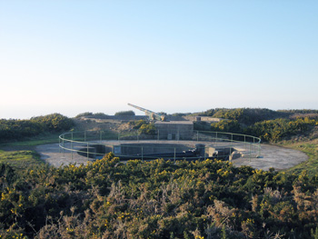
Battery Moltke, St. Ouen Parish
Bunker in St, Ouen Parish
The boat in which a young Jerseyman managed to row to Britain on display at the Jersey War Tunnels
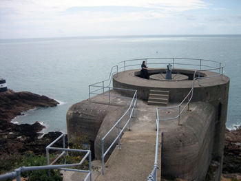
A view of the naval coastal artillery battery Lothringen command bunker (Leitstand) Noirmont
 Hinterland was the first network television series (a combined Fiction Factory production for Welsh language channel S4C and the BBC) filmed in Ceredigion; probably because its lack of motorways makes it difficult to reach for film crews. Its stark location was part of the appeal though, according to series producer Ed Talfan on the BBC Hinterland blog page:
 I wrote an article about the Cambrian line railway journey still available on what was Suite 101 years ago, and this year wrote a poem about a possible railway journey from Scarborough on Britain’s east coast to Aberystwyth on the west.
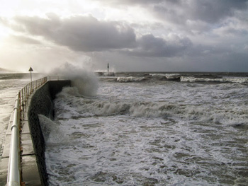 Circling the headland again, I saw the waves looked even higher as they crashed onto the south beach and defensive walls between the sea and harbour. So I walked down as far as I could, and was rewarded with excellent views and photos of the sun setting over the highest southern peak; between swirling grey clouds and above seawater flying high into the air after battering the promenade.
 A Welsh uprising against the rule of Henry IV under Owain Glyndwr captured the castle in 1404. He crowned himself Prince of Wales, and held a parliament at Machynlleth. Mach is a few stops on the trainline east of Aber, where the train can divide into two: one continuing east-west, and the other riding the south-north coast line to Pwllheli. The rebellion lost the castle in 1408, and order was restored under Henry V by 1415.
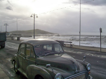 Aber town centre is quite small and easy to navigate. Walking out from the station the north beach is straight ahead past a pub sarcastically named after Lord Beechings. Lord Beeching’s report closed down the fifty-miles long Aberystwyth to Carmarthen train line linking mid and south Wales in 1965.
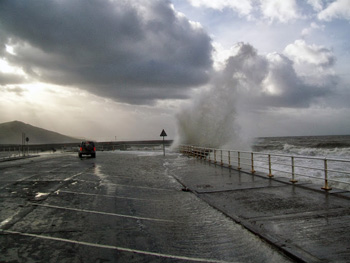 Under the bridges, the Mynach falls 300 feet in five steps to the Rheidol. The Devil’s Bridge name was inspired by a local legend that thought the original bridge was too difficult to build, so the Devil must have built it in exchange for the first soul that crossed. An old woman tricked the Devil by sending her dog onto the bridge. It’s a nice story, but a shame for her dog!
 From London to York
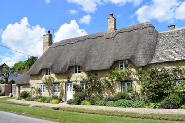
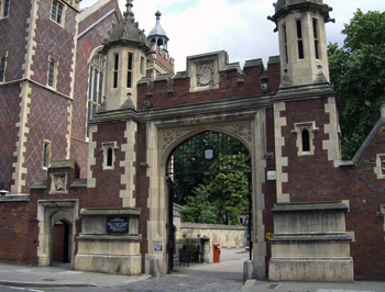 Rising the next morning to very un-English like weather ( read “sunny” ) the three of us headed for Petersfield, south of London. During our stay this would be our home away from home. Founded in the 12th century by William Fitz Robert the second Earl of Gloucester as a market town, Petersfield grew in importance because of its location on a direct route north to London and south to the coast. Like those travelers before us we took advantage of the locale returning most days to a late meal and a pint at the pub. Albeit we had the benefit of modern travel and Brit Rail passes purchased before leaving Canada which offered us sizeable fare savings.
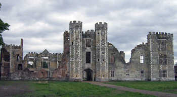 A short visit can’t do justice to all that York offers but the highlights of our visit include Jorvik on the site of a Viking village complete with its workshops to latrines. The Shambles, a medieval street were butchers dressed and displayed their wares. Thomas Herbert House on the site of a Lord Mayor of London Christopher Herbert’s house of 1620. Could I be related? Of course the Ghost Walk, an entertaining stroll through after hours York and a great way to learn the town’s darker history followed by a glass of the local bitters and Cornish pasties at the Golden Fleece Pub. Do you sense a bedtime ritual? To quickly our stay in York is over and we board the return train to Petersfield. Our next excursion, Windsor.
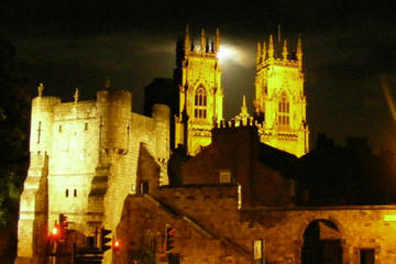
 During my walk-about I meandered down narrow roads, past Market Cross House which is said to have a secret passage way used by King Charles II for private trysts. Continuing through public and some private gardens. After a lengthy stroll along the Thames I found myself at Eton College where since 1440 A.D. Olde Blighty’s future leaders have been educated. A quick check of my watch and I realize that I have barely enough time for a fly-by sandwich and an Ale at the Bel and The Dragon before I am to meet up with the women.
 Over that ale we decided that London should be next on our agenda even if we could not agree on what to do once there. Fortunately by the time we had arrived at Waterloo Station a compromise had been reached. We spent the day doing the tourist things. Crossing the Thames by the Waterloo Bridge we continued along Victoria Embankment, through the gardens of the same name finding our way to Covent Gardens. There we stopped at Pips Dish before moving on to Trafalgar Square where we took the Tube to Harrods for a little shopping. I vowed that my next time in London would be spent in exploration.
 Being a fan of Dan Brown‘s The DaVinci Code, locating the Knights of the Templar Church was a must do. As my time in England was rapidly passing I needed to get to it. Some say that the Temple Church is so named for Knights Templar, 12th century pious noblemen who set out to protect pilgrims travelling to the holy land. Others insist the Temple Church was a medieval bribe designed to silence the Knights Templar as they knew a little to much of the Catholic Church’s looting and pillaging of which they played a major role. Likely there is some truth in either version. After following a circuitous route in an effort to find the Temple Church and about to give up I spotted it nestled between much larger buildings in a back alley between London’s Fleet St. and Pump Ct. around the corner from Ye Olde Cock Tavern, fittingly in the centre of a district rife with solicitor’s chambers. Unfortunately, this day the church was closed.
 For the anniversary a new state-of-the-art SeaCity Museum was opened at Havelock Road, within the Cultural Quarter of Southampton. This museum has now replaced the former, and smaller, Maritime Museum which was closer to the seafront. As the SeaCity Museum is located within a former court building it does not win any prizes for innovative architecture!
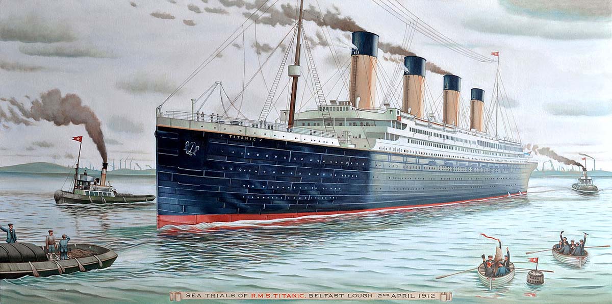
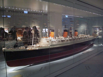
 Southampton’s Titanic Story is the exhibition that covers the brief history of the Titanic. A large diagram of the Titanic is drawn out on one wall which displays the ship’s layout and various compartments such as kitchens, boiler rooms, cafés, the Grand Staircase, cabins, lifts etc. Behind this there are glass cases which display Titanic documents and artefacts such as the captain’s sword. Various bits and pieces from other similar ships are also included in the exhibition like the Olympic’s Honour and Glory Panel, which was very similar to the panel included at the Grand Staircase of the Titanic.
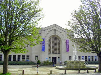 Beyond the SeaCity Museum, the Cultural Quarter also includes the City Art Gallery which displays a variety of paintings. Although not exactly the Louvre, it is still renowned for its collections. For the Titanic anniversary this gallery is dominated by hundreds of Titanic paintings. These probably won’t always be included in the City Art Gallery, but there are always a variety of paintings displayed at the gallery.
 However, Southampton is not just famous for ships. Famous aircraft have also ‘taken off’ at this site in the UK. Among them, the first Spitfire was constructed at Southampton’s assembly lines during the 1930s. Unlike the Titanic, this plane did not go down so easily as it was an influential RAF aircraft during World War Two.
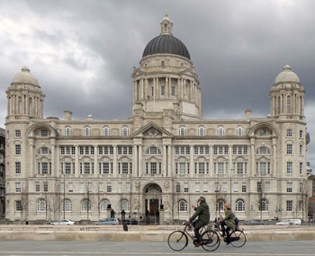 It’s Liverpool’s architecture that grabs you first of all, even before you begin to explore the history behind it. Liverpool’s history is tied up in its past as a great Atlantic port and the buildings on the waterfront, known locally as the Three Graces, symbolize the wealth that international trade once brought to Liverpool. The most iconic building of all, the Liver Building, sits proudly looking over the River Mersey and local legend has it that if the Liver Bird sat on top of the building ever flies away, the city will crumble. The Waterfront is a part of Liverpool’s World Heritage Site which winds through the docklands and across the Ropewalks area up to the St. George’s Quarter which also includes the Walker Art Gallery and the recently re-furbished Central Library.
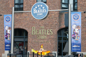 There are a number of fascinating museums down at the Pier Head and in the Albert Dock area. The Merseyside Maritime Museum is located near to historical sites such as the Piermaster’s House and the Canning Docks. It also houses exhibitions highlighting Liverpool’s involvement with the Titanic and the Battle of the Atlantic. The International Slavery Museum helps visitors and locals understand how Liverpool’s past is rooted in the slave trade. Over 5000 slave ships left Liverpool docks between 1695 and 1807, undoubtedly contributing to the growth and success of the city during this period. The museum includes exhibitions about life in West Africa and the Legacies of Slavery. Liverpool’s Chinatown is also well worth a visit. It was the first established Chinatown in Europe and you can wander into the area through a huge ceremonial Chinese arch. The area is mainly a home to restaurant and grocery shops these days but there is a range of cultural events held throughout the year with Chinese New Year seen as a major event in the city.


